|
|
|||||||||||||||||||||||||||||||||||||||||||||||||||||||||||||||||||||||||||||||||||||||||||||||||||||||||||||||||||||||||||||||||||||||||||||||||||||||||||
|
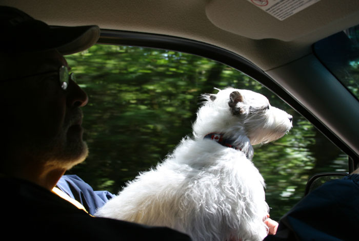
We finally got a rental car which is hard to get around here. We had made a reservation two weeks prior, well before we left to head south with Fran and Joe. Today we were going to take the ferry across to Graham Island and drive north to the very top of the Queen Charlottes and then start sight seeing on the way back. It was quite a distance and a lot to see so we wanted to get an early start. There was no getting an early start here though because first of all we had to wait until 9:00 AM to get the car (and that’s because we were told that’s when the morning airplane comes in). Once we got the car we then had to wait until 10:00 AM for the ferry to cross from Moresby Island to Queen Charlotte City located on Graham Island. We packed some energy bars, apples, bottled water, our rubber boots, jackets, cameras, towels (to clean off Ziggy if he got dirty and us too if we go hiking and get muddy or sandy), plastic bags to bring back shells, some maps, and guide books, and off we went. In retrospect we should’ve packed a couple sandwiches too as there are not many eateries around here.
NICE COUPLE Its about 10 miles from the marina to Alliford Bay, where the ferry lands. We were there 15 minutes early along with some other cars and took advantage of the time to let Zig out for a bit. A very friendly nice looking young woman, with piercing blue eyes, came over to the car and asked about Ziggy. She said she and her husband used to have a Jack Russell and she missed him so much. She was asking about Ziggy and telling us funny stories about hers. Her husband came over. He was very tall, dark and strikingly handsome. He seemed a little shy but very nice and slowly warmed up to us. They didn’t look like island people as they had new citified haircuts as most people up here are a little rough around the edges. They soon began chattering like kids about their recent trip to the big city of Vancouver. They said they went to get haircuts and also to get their eyes lazered so they didn’t have to wear glasses anymore. They told us that the whole week they were there they watched the fireworks each night. Apparently Vancouver was having a multi-country event and each night a different country would put on a wonderful fireworks display obviously trying to out do the others. We learned he was pure Haida and she obviously was not, with her northern European light complexion. She said he’s a carver and was the head carver for Bill Reid and Tao Loos, the canoe commissioned for the Vancouver 1989 Expo. Unfortunately his main income is from logging. She told us she has a garden shop in Skidegate and that’s where they live. I asked her how she likes living here as she’s not from the island and she said she loves it. She told us all their favorite places to go hiking and said if we have time we should stop by as her husband would love to take us to the Indian cemetery and tell us the history. Sue Brown was her name. Too soon our short conversation had to end as the ferry was approaching its landing and we said our goodbyes, but not without her running back to our car to give me the name of the hairdresser they found in Vancouver. What a neat couple and they are so beautiful together though so different. He reminded me of descriptions I’d read about, impressions the first Europeans had of the Haida people when they arrived in the late 1700’s. In their ship’s logs they wrote that they described them as a handsome group of people, more so than any other along the Pacific Northwest Coast, and much taller than any others, many at least 6 feet tall. She, who was so beautiful and blond, and would be a head turner anywhere, was here in this remote place, married to this handsome Haida man, a striking couple in this rustic wilderness and happy as could be.
SKIDEGATE We crossed on the ferry and once across headed up the road towards Skidegate. There’s only one road on the island and it’s called the Yellow Highway, HWY 16…well, except for all the logging roads which are rough dirt roads and tiring to drive on and sometimes quite dangerous if you happen to meet a logging truck that is barreling around a corner really fast. We drove through the Indian village of Skidegate. This place and Masset are the two places where the few remaining Haida that survived the small pox epidemic went for shelter with the missionaries. It’s a small village, clustered in the recessed palm of a beautiful crescent shaped beach that recesses within the channel and overlooks the cut between the islands and off to Hecate Strait. It’s a beautiful setting and very near the new Haida Museum that will be complete in 2007. We passed Sue’s greenhouse store. Mmm, chocolates for sale too in her cute little nursery shop. She must have a sweet tooth I think as it’s an odd combination, plants and chocolate. There’s a cheery blue house next door, which must be their house. I hope we have time to see them again as I’d love to hear his stories about the Haida history. 9 KNOTS TO 100 KILOMETERS AN HOUR No dilly dallying today though as we were on a mission and that was to get up to the top of the island. Once there we’ll take our time slowly coming back down. Larry said, that way, if we don’t get to see everything we want, we could drive back, but not have to drive all the way to the top. After being on the boat for several weeks and only going 9 knots per hour and now to get into the car and go 100 kilometers per hour it was almost too much for me. I felt like things were flying by. My neck was twisting like a head on a bobbing doll.
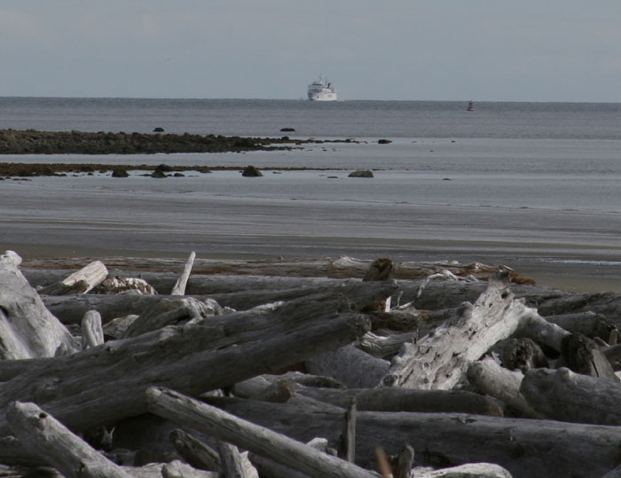
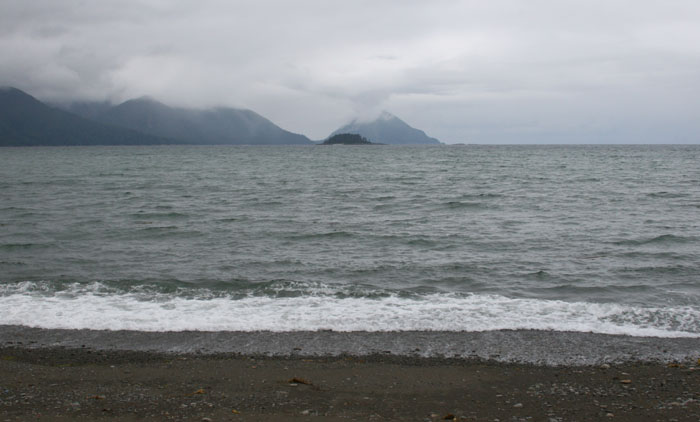
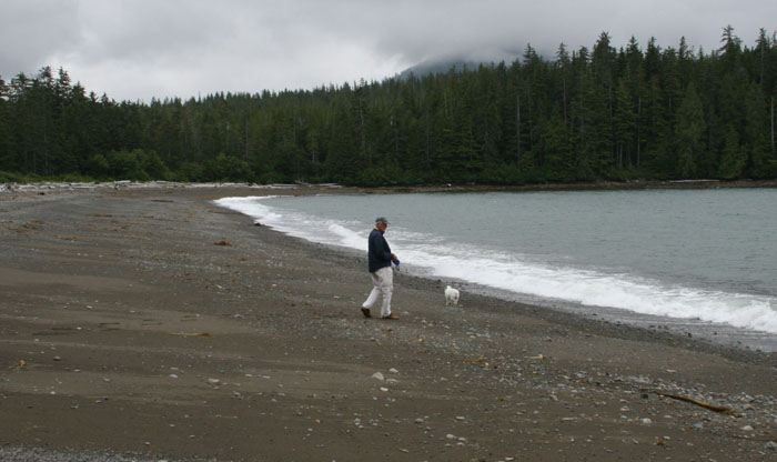
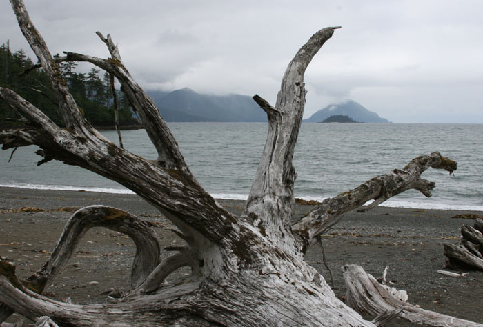
We passed the most
magnificent beach facing Hecate Strait just north of Skidegate. It was
the beach we saw when we came across from Prince Rupert on the boat. We
had followed it as we headed in the long channel into Sandspit. The shore
is covered with dark charcoal colored sand and strewn with huge silver
weathered logs and driftwood. Again the scale is misleading as the beach
was just so huge that a couple we saw walking on the beach with their dog
were dwarfed by the expanse. They looked the size of mere insects from
the road. We stopped alongside the road for a moment and watched as the
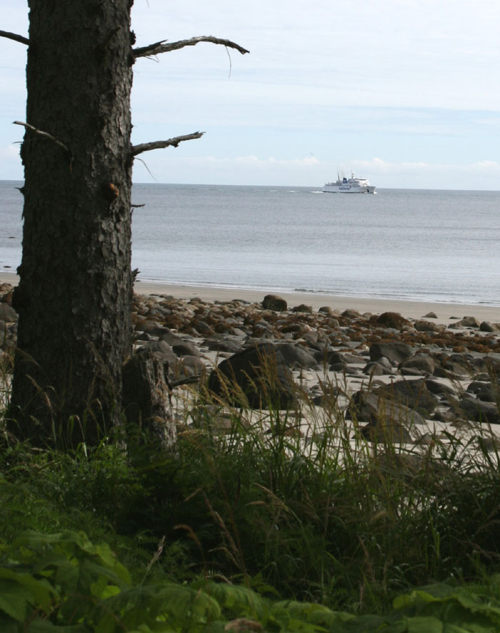
BC ferry was just coming in from Prince Rupert and heading around the same
markers that we marked our course. They crossed the shallow spit at the
proper place, like we did, and it looks like they had a very calm crossing
from Prince Rupert on Hecate Strait like we did.
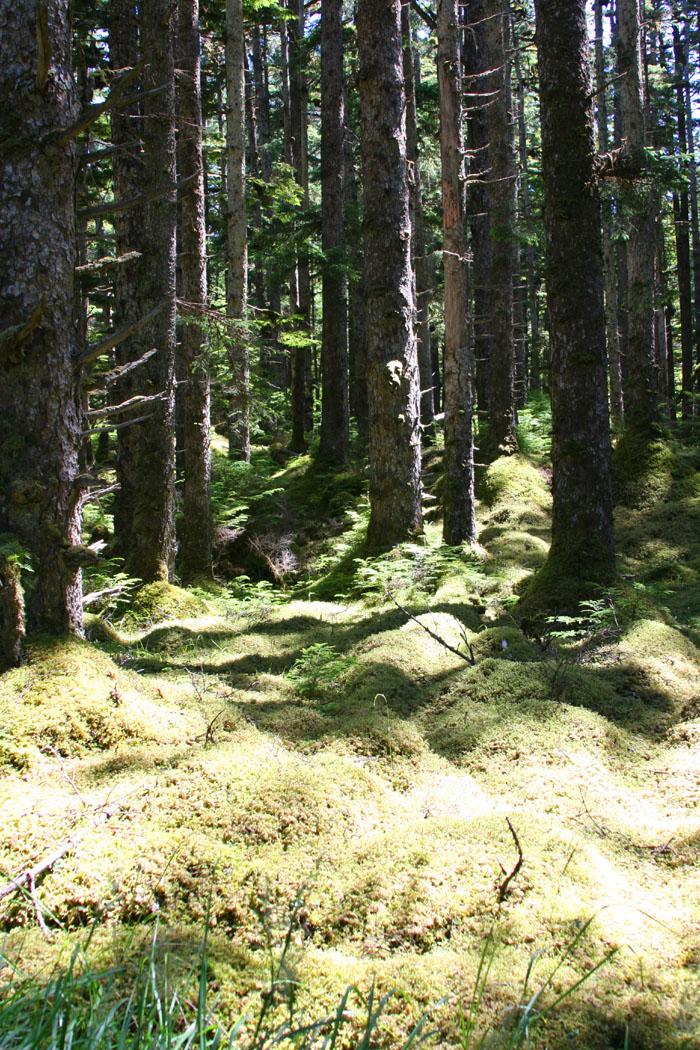
HEADING INLAND Soon we were passing the little village of Tlell which we read was an artist’s colony. We told Sue we wanted to go there and she said, “There’s not much there.” At that point, this amazing consistently well paved two lane road heads west going inland, leaving the shore line and views of Hecate Strait behind us. The scenery is beautiful, much like Big Sur in a way but no cliffs dropping down to the ocean of course, just flat road, a great road for bicycling with good scenery. Once we headed inland we were surprised to see meadows opening up through patches of tress and then eventually the trees disappeared to a landscape of cattle grazing land and ranches. The fields are scattered with blooming wild flowers of yarrow, foxgloves, yellow dandy lions, and others with a mix of magenta and purple colors. We passed a mixture of landscapes, from boggy swamps, to dry cattle grazing grassy meadows, to beautifully forested areas, and glimpsed in through tall trees into mossy covered forested floors, and then marshlands with meandering glassy smooth tea colored streams cutting zig zagging channels through the tall green grassed landscape. We surprisingly had the place to ourselves and unbelievably didn’t pass a car almost all the way to Port Clements.
MASSET INLET We continue heading straight north now from Port Clements and begin to see ocean water on our left, the west. We realize we’re seeing the lower part of Masset Inlet. This is the body of water that you would enter if you came to Queen Charlottes straight from Alaska, crossing the Dixon entrance. The wind is blowing strongly, funneling strongly down in the inlet creating white caps.
We finally reach Masset. We cross over a small bridge that takes us over a marsh land leading to the village. We see the small old marina of Masset, filled with small fishing boats mostly. We don’t see any cruising boats. This would be the place we would dock if we came up here. I’m not sure if there would be room for us. Masset is small an unimpressive at first with just a couple B&BS, some rustic cafes, a hardware store, a co-op for groceries, the post office, one BC bank, a recreation center and a couple small gift shops selling Haida souvenirs. It’s a small Indian village. There’s nothing fancy here. It’s a hodge podge of insignificant architecture, mostly box like buildings with no frills. There’s a wide street in center of town, much like an old pioneer town. Sadly the center of town is filled with loiterers, several drunken Indians, lounging around on park benches just staring at you and muttering things to you that you don’t understand. It’s a shame but true that Indians, of all geographical locations, seem to have a genetically low tolerance for alcohol, another introduction of white man’s nasty habits. We’re looking for a place
to have lunch and nothing looked too appetizing. We checked out the pub
that was advertised in visitor’s guide as having the best hamburger on the
“golden highway”. I poked my nose inside and it was dark and smoky and
was really just a big open bar with pool tables. I see another place at
the top of the road. It’s got some picnic tables out front, and seating
inside.
We continue on Hwy 16 again, a lonely highway but beautiful, on up to Tow Hill. It’s a good road even when it changed to a dirt road as it’s well cut and smooth. We passed forests and bogs and shorelines strewn with logs, agate rocks and boulders.
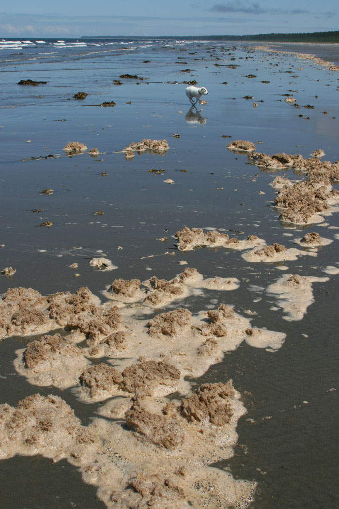
We finally reached the end of the road at Tow Hill, and drove the car out on the massive flat hard dark grey sand of the beach that stretches as far as you can see, all the way they say to Rose Spit the very rugged tip of the Queen Charlotte Islands. The tide was just starting to come in so were wary of going too far with the car on the beach. There are plenty of warnings about getting your car caught as the tide comes in. If we had timed it right we could have driven all the way out to Rose Spit and back but must be sure to time it right to safely get back and not be swallowed up by the sea.
BIRTHPLACE OF MAN Wow, what a place. I can fully understand now why many Haida legends believe Rose Spit to be the place where mankind was created. It’s like no other place on earth, surrounded by wild oceans on each side, meeting at the point, crashing and upwelling up as they meet, a place feared and respected by mariners because of its terrible turbulence. We drove out on the beach for awhile but knowing we couldn’t reach the end today, we stopped and walked along the shore to beach comb.
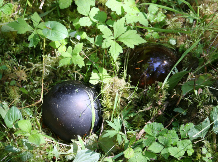
The shore was endlessly littered with dead Dungeness crabs. We didn’t understand why. During the last couple weeks at Sandspit marina, we watched the fisherman, prepping hundreds of crab traps across the road from the marina, and then when we got back from Haida Gwaii, they were non stop, night and day, coming and going, loading their boats sky high with traps, going out and dropping them only to come right back and load up with another load, over and over again. So we knew it obviously was the opening of crab season. We wondered how’d there’d be a crab left out there in the ocean with so many fishing boats and so many traps.
RAZOR CLAMS We looked for shells but really it was crab carcasses that were in abundance. We found lots of razor clam shells. This stretch of beach is known for an abundance of delicious razor clams, the only mollusk now that you can safely dig up and eat. They are clever, fast and hard to catch. They very quickly sense the first sign that you are digging for them and they quickly dig themselves very deep in the sand so you have to move and dig fast to catch them.
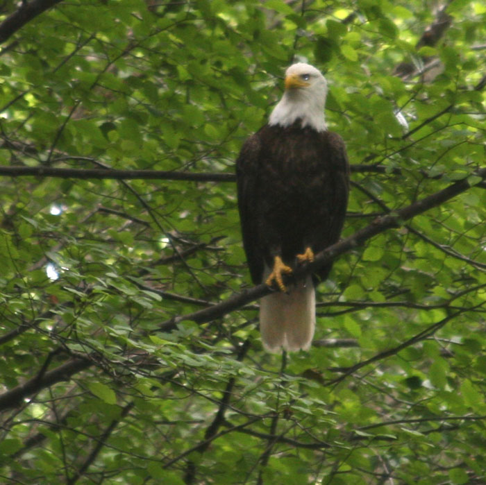
The fine dark grey firm sandy beach was also covered in strange puffy clumps of pinkish dirty sea foam which is a sure indication sign of lots of razor clams. I guess this dark grey black sand has evolved over million of years of force from these stormy seas that have been pounding and rolling these dark volcanic boulders along the shore, having worn them down to a beautiful stretch of dark fine grained sand. We found all sorts of feathers on the shore, that of ravens, eagles, seagulls and other shore birds.
VIEW OF ALASKA The seas were amazingly calm today and would be a perfect day for crossing over from Alaska. Imagine the Haida in these canoes, paddling across these seas north to Alaska. I would love to be here to see this place on a stormy day. We looked out across to the north and in the haze could make out the southern islands of Alaska. The sun was out and it was warm. We heard from folks at home and they say they are miserable with an unbearable heat wave and I guess that’s why we have had such uncharacteristically warm weather.
NO BLOW AT TOW HILL
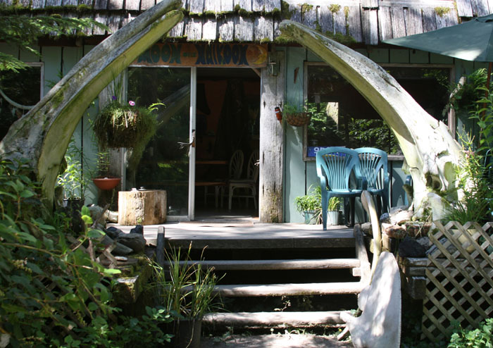
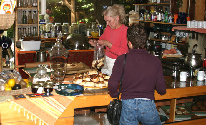
We stopped at the one and only small cottage we see nestled in the woods along side the dirt road near Tow Hill. It says “Fresh Bread”. We park and walk up the rustic wood steps to their deck and front door, and under an arbor created by huge whale ribs that have been salvaged off the beach. The aroma of fresh bread, cinnamon rolls, and homemade soup fill the forest. Surprisingly there are several people inside, like us, stopping in the wilderness to see what’s here. A white haired lady is behind the rustic resin covered wood counter, pouring cups of fresh brewed coffee, herbal teas, and loading up plates with rich dark nutty cinnamon rolls. The lid on a big stainless steel pot is vibrating on her old fashioned gas stove, emitting fragrant steam from a stewing soup and a large fresh homemade pizza loaded with veggies and cheese is on the counter ready to pop in the oven. We get a couple coffees and didn’t have the will power to resist the cinnamon rolls and sat down on one of the wooden tables made out of a fallen tree. It’s like we dropped back in time to the hippy days of the 60’s, with resin hobbit tables, and lots for sale, hand crafted items like hand bags, jewelry and pottery but what was the most interesting was their collection of found fossils, bones, rocks and shells from the nearby beaches. They had them casually sitting here and there on whatever ledge was available. I’m so glad we stopped as it was really interesting.
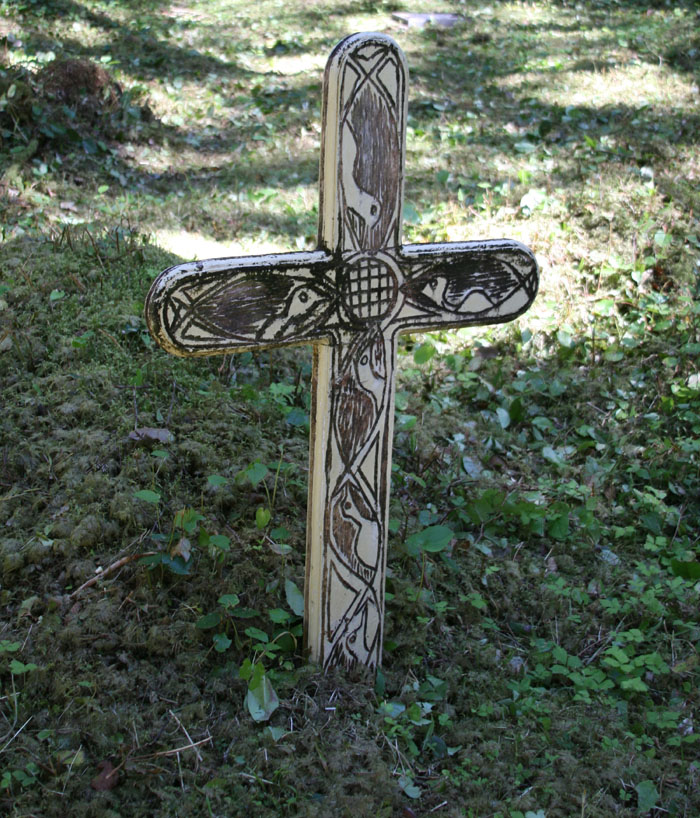
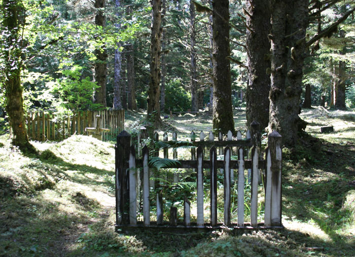
We drank our coffee and ate the delicious cinnamon buns and off we went again. Just before we reached Masset we saw a sign pointing down a road leading to the bird sanctuary. Oddly, the road name was Cemetery Road. I had read that there was an old cemetery in Masset and that it was interesting for its Mariner history. I couldn’t tell from any maps where it was but we took a chance and decided to take the road to see where it led us. The road took us quite a ways through the forest and past the wet lands. We starting to get a little discouraged as it just didn’t make sense that a cemetery would be way out here so far from town but sure enough and just by chance we found it, though not marked. It was near the end of the dirt road.
It was a lonely isolated place, not within walking distance of town or anything for that matter. It was fenced but the gate was not locked so I took a walk inside. I love to look at old grave sites in remote out of the way places. Not all the grave sites though were very old as some had recent dates on them, but even though some were recent, it was rapidly being taken over by the forest as trees were growing up everywhere and roots were pushing things up. Many of the graves were marked by handmade wooden crosses with simple painted names and dates and sometimes even in felt tip marker. It was all very primitive and simple. Some of the crosses were hand carved and one was definitely a native grave with what resembled a watchman figure on it but even that was in poor shape as the head was knocked off and laid to the side. Another grave had Japanese floats picked up off the shore and were scattered on top of the grave mound for decoration or other meaning. It was an interesting walk through the cemetery, not like anything I’ve ever seen.
MASSET AGAIN We headed back to HWY 16
and into Masset again. It looks like there are a couple B&BS that are
decent to stay in. At first glance there’s not much here but I’m sure
there is more to discover here like anywhere if you had more time. Just
driving through doesn’t’ give a good impression like many places.
We gazed at the small new marina and wondered what it would be like to come into this little place by boat. The docks don’t really look big enough for boats our size but people do it, we’ve heard of them doing it. I wonder, would we have to raft up to another boat or anchor somewhere? We headed out to the far
side of town, to Old Masset, where the First Nations live. This place of
course was the other town where the Haida migrated to after they lost most
of their population to small pox. Many of the simple houses look run
down, some abandoned and most with windows broken, or no doors and pretty
well trashed. Other houses look lived in but a lot of junk lying around.
It was a sad sight really to see this. I felt sad to see how their life
was now, compared to the visions and remains of their old culture that we
had seen and learned about the last weeks. There was not much trace of
what used to be their old culture here.
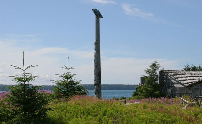
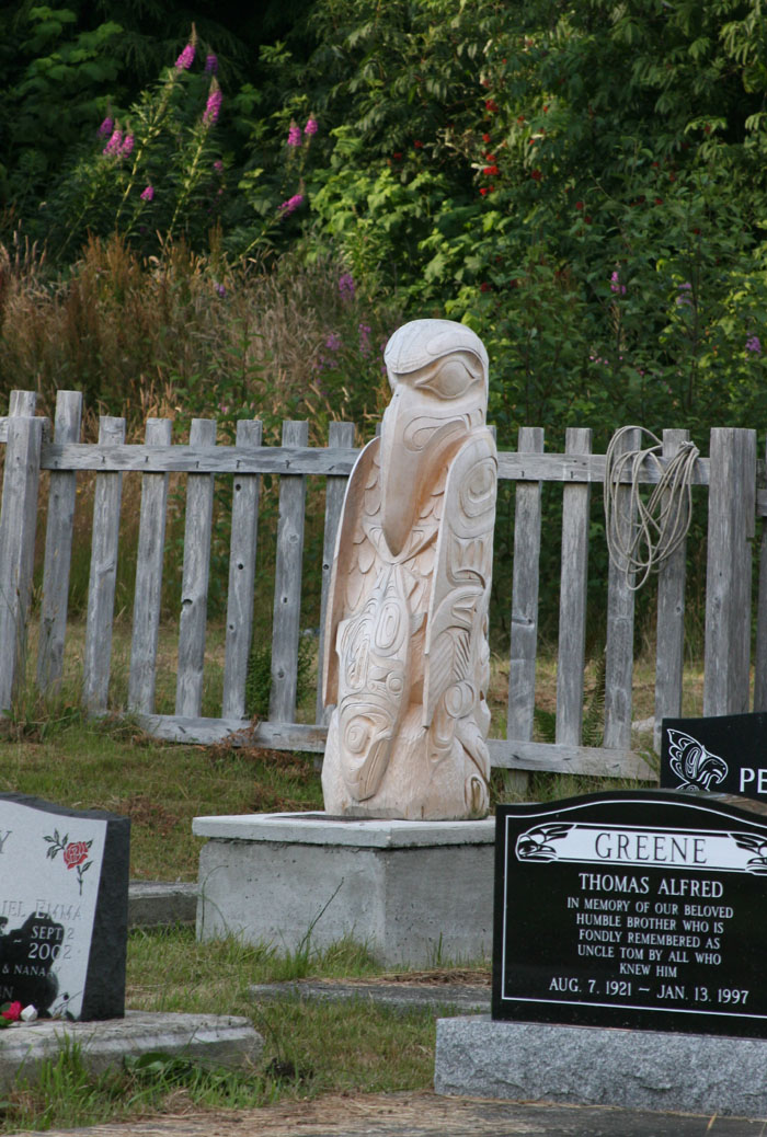
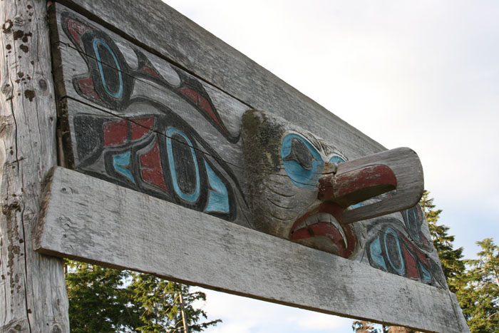
Suddenly as we’re feeling so solemn driving through this place, we saw a totem on the point. It was beautiful and majestic. It was strong and bold and staring off across the waters of Masset Inlet, a beacon for the village. It was magnificent. Its Jim Hart’s totem, a contemporary Haida, who is restoring pride and hope for his people much like Bill Reid has done in recent years. His house and studio was standing nearby, a simple house but beautiful and well built. It was a modern version or take off of the beautiful Haida architecture, a taste of the paste but hope and strength and a new outlook for the future. It gave me hope for the people just looking at it and what he has created.
We stopped in the nearby store. They were selling Haida souvenirs and art. We were shocked when we saw the price tag of a simple bracelet priced at $3000 in this little rustic place. Unless you were a serious collector and knew more about the Haida artist, that was a bit over the top for us. We headed back down the HWY as already it’s getting late, around 4:30, and we still have a long way to go. Larry says it doesn’t get dark until 10:00 so we can still see a lot.
PORT CLEMENTS By the time we reached Port Clements, it was after six. We turned off the highway to see the place and hopefully find a place to eat. It’s a lonely stop that looks out over a wide stretch of the lower part of Masset Inlet, the end of it really. The wind is blowing a good clip across the water and perhaps that combined with the conflicting direction of the tide has built up a strong chop with visible white caps. We see a very small public dock with less than a hand full of local boats tied to it. There is a long pier that juts out into the Inlet but with this wind blowing I wouldn’t want to be there. Nothing is open in town but a small rustic looking lodge which looks more like a run down bar with pool tables and dart boards inside and a nice view out over the lonely inlet. We think how bad could it be? There’s nothing else so in we go.
There are about 5 people at the bar, they look like locals and I’m thinking could be right out of Cannery Row, some real characters they were. They looked a little worn around the edges, haven’t seen a hair cut in a long time, scruffy beards, holey clothing and a few with some teeth missing but a friendly group. We say “hello” and ask if they are serving dinner but felt more like asking if they had some grub. The bar tender woman says “yeah sure” and we take a table by the window. As we pass two guys sitting at a table, dirty from a day of obviously hard work, one guy asks “Are you in that sailboat?” I say “Ah no”. Larry answers, “We came here by car.” I ask him “Why?” and he says “Ah nothing’, there’s just a sailboat at the dock that took our place.” I immediately can’t believe there are some other cruisers that have made it all the way down here at this God forsaken lonely place. They have one “special” on the board and its rib eye steak. The other choices for dinner are posted on a lighted plastic sign hung on the wall with removable letters (and a few missing to complete words and many hung crooked), just like you would see at an old fashioned To Go joint. Most of the offerings were like fast food, like fish and chips, chicken wings, etc. I did manage to find a halibut filet on the menu and we ordered. A few minutes later the waitress comes back out of the kitchen and says there’s no fish. So, OK, I order the rib eye with Larry. We ask what it comes with and the waitress didn’t seem to know so she went back in the kitchen to find out. I think they were figuring out what they had in the kitchen and making it up as they went along. When she came back, she said a potato. We said fine and then asked what kind of salad dressing they had for the salad and off she started to go again but we stopped her and said, “What ever you bring will be fine, don’t worry about it.” We were happily surprised
that the meal though the size of a logging dinner was good and the salad
crisp and fresh and all worked out fine. We each had a huge rib eye steak
covered in sautéed mushrooms, more than you could ever eat and a salad,
baked potato with sour cream and butter and a glass of some kind of red
wine and a view across the inlet. We were just fine.
WE STILL HAVE LIGHT It’s a good thing the sun goes down late around here. We headed back down the only lonely HWY never seeing a car pass us and though it was the same scenery it looked different as we reached the shore again on the Western side of Graham Island. The tide was out and the sun was setting low in the sky and beginning to fill the sky with unbelievable with color. The magnificence of the islands was on display in their full glory.
We couldn’t go by Balance Rock again without making a stop to test Larry’s strength, to see if he had Goliath’s strength, enough to push it over, as I imagine people for centuries have been unsuccessfully trying to do. Will he be like King Arthur pulling the sword from the stone and pushing the boulder over? No such luck, so still having some daylight left we rushed off hoping to get a glimpse of the old Haida cemetery in Skidegate before dark.
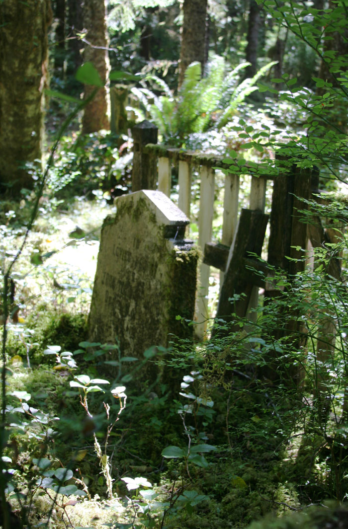
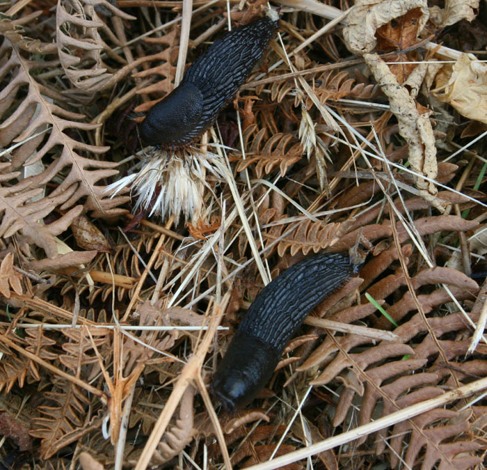
SKIDEGATE CEMETERY Fortunately, we have
perfect late afternoon sun light, you know, those long shadows and what
the sun lights up is intense and golden. It spotlighted the cemetery
dramatically. It was quite a sight to see. I walked around the cemetery
following its perimeter guarded by a decorative rod iron fence. There was
a sign posted at the entry gate requesting others to respect their grave
yard by viewing and taking photographs from outside. It was so quiet in
the nearby village and I didn’t want to draw attention to ourselves as I
felt a bit like an intruder but was so interested. The typical ravens
that seem to guard all Indian sites began squawking at us echoing their
warning all across the valley. The ground on the outside of the fence was
covered in these strange jet black slugs in the grass.
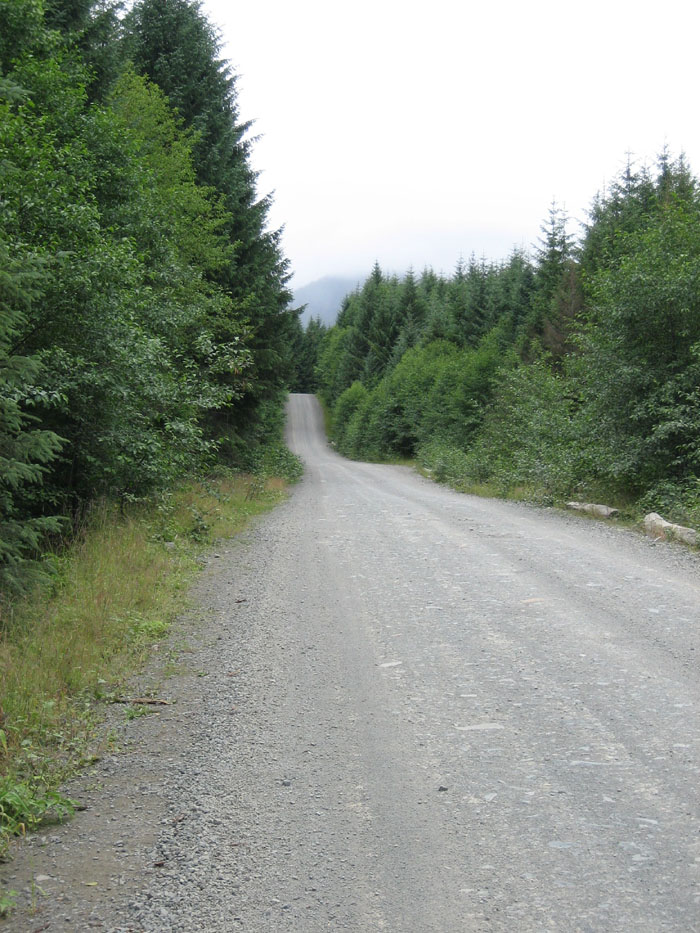
RENELL SOUND, QUEEN CHARLOTTES Well, it’s finally time to get a little peek at the west side of this beautiful archipelago. And that of course would be the wild side (as if the rest of it wasn’t wild enough). We read somewhere that we could take one of the logging roads to drive there. How grand I thought as I have no desire to take Knotty Dog over there. We can take a logging road from Queen Charlotte City to Renell Sound which meant driving up and over the mountains to the first big protected sound as you round the top of Langara and Graham Island by sea on the northern half of the Queen Charlotte Islands. We had our trusty little rental car to get us there, not a four wheel drive, but it will do…BUT, I have to say, that we had to sign a waver with the car rental agency agreeing to NEVER, never, take the rental car on any logging roads. The agent makes it very clear as she points to the line where you sign your life away agreeing to the terms of the contract, all the while giving you a little wink, because everyone knows that everyone eventually can’t resist exploring the logging roads no matter what you agree to. You can’t avoid the written warnings everywhere though, about the dangers of driving on the logging roads. They brought images to me of that first movie Steven Spielberg made in 1971, called The Duel starring a hen pecked salesman, played by Dennis Weaver, driving his company car through remote rural areas all the while being viciously harassed and followed by a 4 ton truck driven by an unseen demon trying to run him off the road. That movie was kind of the fore runner to the well known phase we now refer to as “road rage”. Well, this is the image of fear they put into your head about the multi-ton logging trucks that barrel down these dirt mountain roads at crazy and unsafe speeds of 60 miles an hour with long extended loads. They are impossible to stop in a life saving amount of time with that much weight and speed behind them, and their length can literally knock you and your little rental car, at a blind curve, right into the outfield of the next valley over in a nanosecond. Well, with that thought in mind we headed out.
VISIONS OF SALTY SUGAR PLUMS I was sooo looking forward to getting a glimpse of the dark side, the wild and wooly side of the islands and to do some beach combing for whatever flotsam or shells may have washed their way on shore over there. I was salivating at the possibility of finding a rare Japanese glass float or a mammoth moon snail the size of a bowling ball or well anything would be great, really. I love any kind of beachcombing, period, as it’s always a mystery as to where it came. I imagine it came from far off exotic places, or maybe it washed ashore from a fallen container off a ship in a storm. Regardless of the image that comes to mind or what it is as it doesn’t matter and I just feel pure glee at finding any shells, small, large, ugly, beautiful, it doesn’t matter, and this area on the west side was supposed to be the Rolls Royce of beachcombing. I thought, maybe we’d find a whale or shark bone, or maybe even a whale’s tooth the size of a banana! Dead whales, mostly in days gone past, have been known to wash ashore here, their carcasses devoured and cleaned by bears and eagles, and then left to be scattered and spread along the shores by storm waves. Or maybe we would find some dentalia shells, those rare and hard to find pencil shaped shells, used and prized by the early native people as currency and icons of status, or maybe, I could find just a simple little red or blue trading bead. Now that would be dandy. I have been looking for one of those for so long. Would this be the place that I might get lucky? It was like visions of sugar plums running through my head except they were the salty kind.
RUGGED WEST SIDE Besides just the titillating addictive draw of beachcombing, we also just plain wanted to see the rugged West coast, a mere glimpse to see what it was like over there. It’s not settled on that side, there are no towns or villages. There’s not much sign of human contact or existence except for the ravages of ongoing logging, and maybe a few abandoned Haida village camps, mostly now swallowed up by the forest with only a few rustic remains of more decaying totems slowly being over taken by the forest and its elements. Perhaps you’ll see a few fishermen, the adventurous kind venturing onto this rugged water for the prize salmon or halibut, and of course you may come across the curious, like us or a camper crazy enough to venture up and over these mountains with their motor home or God forbid, their rental, on these precarious roads. Only a few I think make this bumpy trek as most may not be so foolish. Most of the north coast of Graham Island is an unforgiving and unbroken coast line offering minimal shelter to the mariner. The seas and weather can be inhospitable as evidenced by the many ship wrecks, many never recovered or found and sadly long forgotten….
Many more stories, sad or brave, are yet to be told about these shores. Those are the images that draw us to this side, the edge of the earth, a place caressed and beaten by the mighty Pacific waters and stories and legends to tell of brave adventurers that dare to see it. Ah you can tell I’m a dreamer but doesn’t that make it more of a journey and adventure?
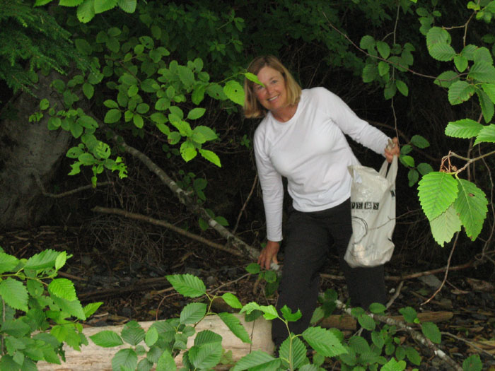
NO SERVICES, SO GO PREPARED Again, we packed some food and drinks, extra jackets and towels to clean up for whatever dirt or mud Ziggy usually gets into and the three of us headed down the road to the ferry. Another $10 fare, which is collected on the return trip, and a second double look from the ferry man, who by now is beginning to see us as a familiar face, and we were ferried across to Queen Charlotte City. It didn’t take long to find the dirt road to the west coast as it’s just at the end of the small town of Queen Charlotte City, just past the last buildings. The road immediately turns into dirt, dust and gravel and the small settlement of town and civilization is too quickly left behind. The first several miles of foliage along the road was not scenic as it was covered in thick grey dust stirred up by the many four wheelers and logging trucks that roll down this backwoods road. It was like as if the landscape had been spray painted or stucco’d over in a dreary grey. It was not the vision I had had of traveling through this beautiful wilderness.
LEARN THE TRICKS OF
THE ROAD It was slow going at first, weaving and swerving to miss the pot holes and guiltily thinking about the car agency person pointing to that line for our signature assuring that we would never traverse a dreaded logging road. It was surprising though how we soon we forgot about that and gathered a savvy sense of the road, as there was no courtesy out here from the other drivers, though there are few and rarely seen. The protocol is to go as fast as you can and I think the more dust you stir up to cloud the other’s vision, the better. Maybe it’s a strange form of amusement out here in the wilderness. We learned that trick quickly when the first four wheeler that passed us, left us engulfed in a blinding and choking cloud of dust and dirt that brought us immediately to a complete and abrupt halt for fear of blindly driving right over the ledge and down several hundred feet never to be found again. Sadly it became a crazy road race and forget that movie Duel, with Dennis Weaver, I’m now having flash backs of Mel Gibson’s Road Warrior as it comes too vividly to mind. It’s an element of survival here to be ahead of anyone you might notice gaining on you in the rear view mirror, as it was much better for you to be leaving the dust in their faces than vice versa, but then…we gradually came to our senses. We told ourselves we weren’t here to, or interested in, racing on these dangerous roads. I was having a hard time already dealing with speeds of 30 to 50 miles an hour on these scary roads after spending the whole summer going 9 knots to get here on a soft liquid base. After all we just wanted to see the scenery. So, gradually we surrendered to these crazy road warriors. If we were to pass an oncoming vehicle (noticed ahead by the nearing cloud of dust over the hill) or were soon to be passed by someone from behind (noticed by the nearing cloud of dust approaching behind us), we just quickly and sheepishly pulled over, as far out of their way as possible, rolled the windows up and let the horrendous dust cloud settle after they sped by like mad demons and disappeared in the distance. Yes, this did make for slow progress but that’s the way the travel went.
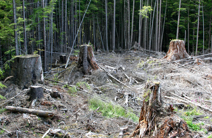
There are no services out here, though I have faith that if you had car trouble one of these demented road warriors may stop for you. We hoped the car rental agency had loaded the trunk with spare tires and tools for whatever might come up though we didn’t bother to check, we just assured each other that the stuff must be there. With no services, relief in the most natural sense of the word, was along the side of the road, and that would mean me squatted behind a bush, Ziggy lifting his leg in several places to mark his in case there was any question about his alpha dogism out here and Larry who was not as discriminating just picked the nearest spot. We stopped along the way for lunch overlooking a serene lake in the mountains, filled with weathered logs and stumps from logging. It was a bit depressing.
“HOLY SHIT HILL” As we climbed higher and higher into the mountains, the trees and landscape became more and more beautiful and green as there were no more dust or road warriors. A gentle rain began to wet the landscape. The skies became darker and more dramatic and steam emanated from the forest as the cool rain touched the warm earth. The farther we went on our journey the less road warriors we saw, in fact we didn’t see any once we made our steep climb over the mountains. We began to see forests that were old and magnificent. Streams and waterfalls were cascading down every valley and rocky crevice, lined by beautiful moss and ferns. You could here eagles screeched across the landscape maybe telling the others of our arrival. It was a rich verdant landscape. As we reached the top and began our decent finally to the west side, I suddenly remembered a warning from the nice woman and her Haida husband that we met on the ferry the other day. She said the drive over here “is a wonderful trip, but watch out for Holy Shit Hill”. She said the locals call it that because you can’t help but saying “HOLY SHIIIIITTTT!!!!” as you descended down to the West side. She was right of course, and we screamed “Holy shit” all the way down, slipping and sliding down the wet and muddy decline. It was etched with horizontal grooves all the way down, perhaps created by the big heavy logging rigs cavetating across the surface on their dicey trip all the way down. We felt like we were riding down a bumpy vibrating roller coaster, and felt the urge of a kid to make a long sound so your voice vibrated with the bumpy bike ride.
HEAD FOR HIGH GROUND IF THERE IS A TSUNAMI
We had two choices, left or right. We decided to turn right and follow the dirt road along the East side of Renell Sound. We would follow it as far as we could go in a days drive and still have time to get back. The farther we went the more signs we saw about those darn Tsunamis, and then we started coming across signs saying “This Area is Unstable, Absolutely No Stopping”. What? I’m beginning to wonder about this place but we came this far, nothing is stopping us now. Soon we just began to ignore the warning signs as the scenery was so over whelming. Too bad we didn’t have a little camper or tent to put up and stay for a day somewhere along this beautiful place. Knowing that we had that big drive back to look forward to at the end of the day before darkness set in was a bit much but we just proceeded on to see as much as we could.
A BEAUTIFUL PLACE The road weaves and wanders but mostly follows the coastline. There are off shoots of the road that lead up from the shore, all logging roads mind you, as there is no signs of civilization here, no houses, stores, nothing. We’d pass beautiful crescent shaped coves, with small sandy beaches strewn with weathered logs and then black volcanic looking rugged rocks, formed in all kinds of jagged shapes by the ocean’s force. The trees by the waters edge were stripped and crooked from the winds. And to think, we aren’t even on the real exposed coastline, we’re in the protection of the Sound. We stopped a few places to check out the shore for what treasures might be there but I have to say my hopes of finding all those salty sugar plums were sadly disintegrating though the beauty of the area was enough in itself. It wasn’t a sunny day, good for photos, but misty dark and wetish so sadly no images to take back. We went as far as we could feeling comfortable that we still had time to get back in a decent amount of day light. We actually found an RV parked on the side of the road overlooking a most beautiful cove. Their engine was running to keep them warm and they had a flat tire but no one was to be seen. I wondered how in the heck they got up and over these mountains to get here. Will they ever get back? It didn’t seem like they cared. Hope they have a spare tire.
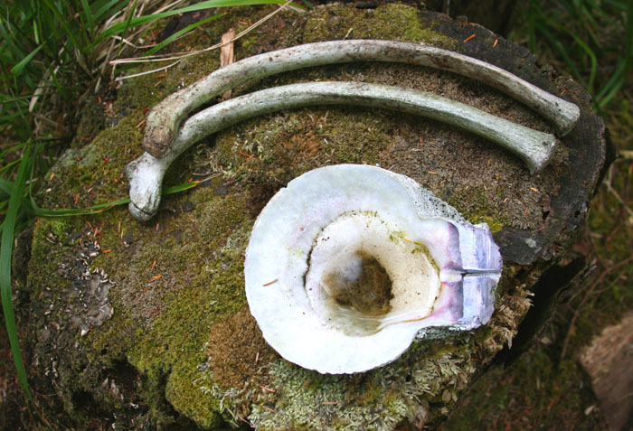
We made one final last
attempt to satisfy my gunk holing addiction and wouldn’t you know, Voila,
I was rewarded with a pile of purple hinged large sea scallop shells! It
was a little pile on a rocky area almost as if a little sea otter had left
them after having a delicious meal. I had never seen one of those until
we went to see the Ninstints at the southern tip of these islands.
The Haida watchman had set one on a moss covered tree stump and the morning
dew had filled it like a small bird bath. I was ecstatic at my find
though to others, they may have been disappointed.
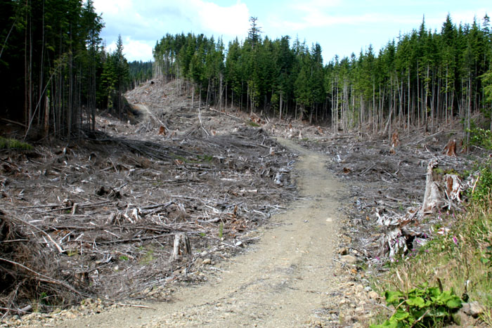
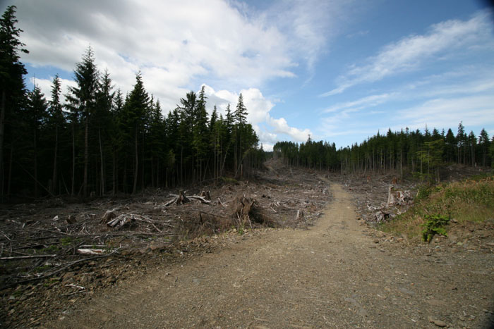
LOGGING DEVASTATION Our trip back for some reason wasn’t as beautiful as going. This time we had a different perspective, maybe it was the direction of the day light going down or the location of the logging that became too vivid going the opposite direction. Why hadn’t we noticed the logging so much on the way up? On the way back it was everywhere. It was devastating to see it in all its horror. It went on for acres and acres. Now I know why the Haida put their foot down. This place is far too beautiful to destroy. It really left a bad taste in my mouth.
SPLIT SECOND OF FEAR We were lucky on the way
over not to come across a logging truck in all it’s glory rolling down the
highway but on the return trip back down the mountains on the East side we
literally almost lost it. I was giving Larry a break and was driving.
Fortunately we were on a straightish area of the road, just past an inside
curve and I had the briefest of brief moments to be able to slightly get
the car over without going over the edge as this mad logging truck
appeared in a split second rumbling by like a freight train straight down
the hill. I’ve got to say it was one of the scariest moments of my life.
FINISHED, DONE, THAT’S ALL We made it back to the boat again after dark and again a double look from the ferry man. Enough of the driving on the logging roads for me. Though I did want to see the unfinished canoe in the forest up by Port Clements. But no thank you. I’m finished, done, that’s all. The canoe was thought to be uncompleted during the small pox out break in the 1800’s as it hit the Haida so quickly by surprise. It was left uncompleted in the forest where the timber was cut, a sad symbol of their plight. CAN’T LEAVE THIS PLACE WITHOUT SEEING THE LOGGING FESTIVAL We so enjoyed the Queen Charlottes in its entirety. I hated to leave as it is such a magical place, the people, the culture, the landscape, the nature, the storms, its remoteness, I loved it all, but we had to get going. We still had a long trip back over waters for a change that we already have traveled. It would for a strange change familiar waters, and coves and harbors and people. It would be the first time in several years of cruising that we would be familiar with our stops. But we didn’t want to leave before we saw the Queen Charlotte Logging festival. A short video
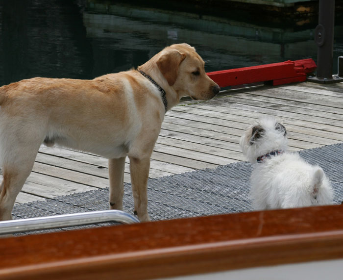
Ziggy & His pal in Sandspit Marina movie clip
|
|||||||||||||||||||||||||||||||||||||||||||||||||||||||||||||||||||||||||||||||||||||||||||||||||||||||||||||||||||||||||||||||||||||||||||||||||||||||||||


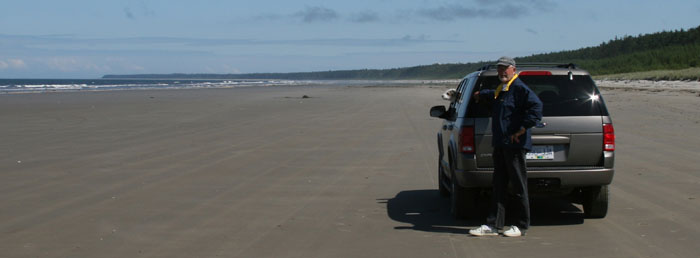
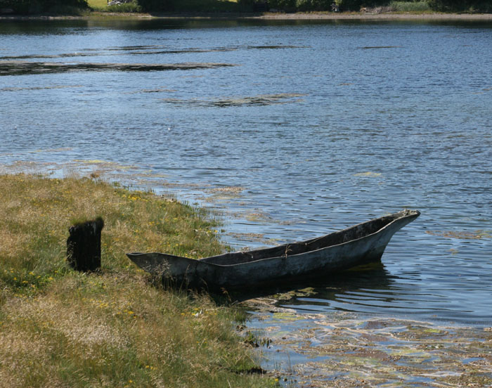
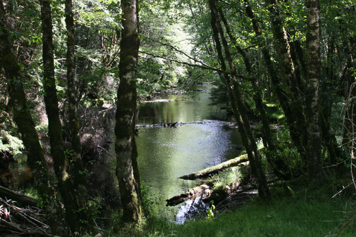
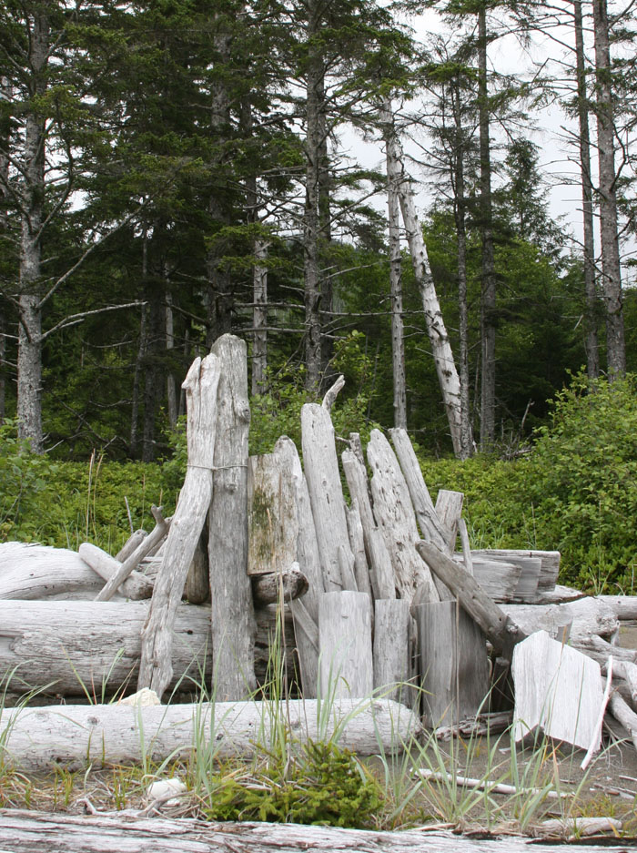
 THE
BEACH
THE
BEACH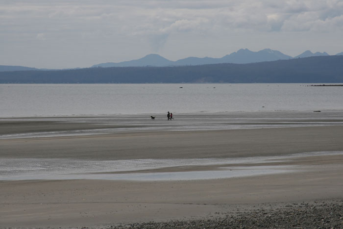
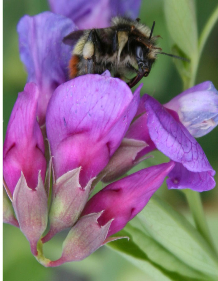
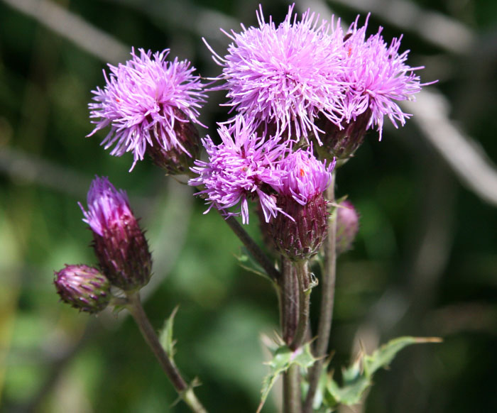
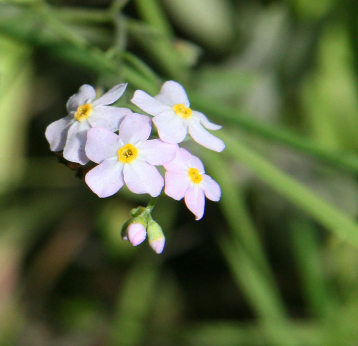
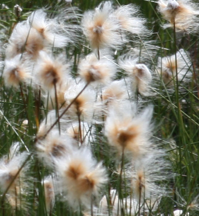 We
made one stop to examine an unusual flower alongside the road. It was
like a fur puff ball on the end of a thin reed, not like anything we’d
ever seen anywhere.
We
made one stop to examine an unusual flower alongside the road. It was
like a fur puff ball on the end of a thin reed, not like anything we’d
ever seen anywhere. 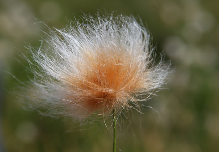
 MASSET
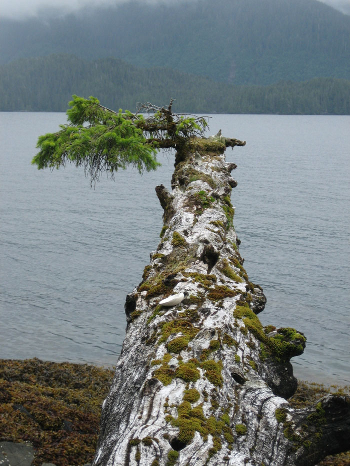
 TOW
HILL
TOW
HILL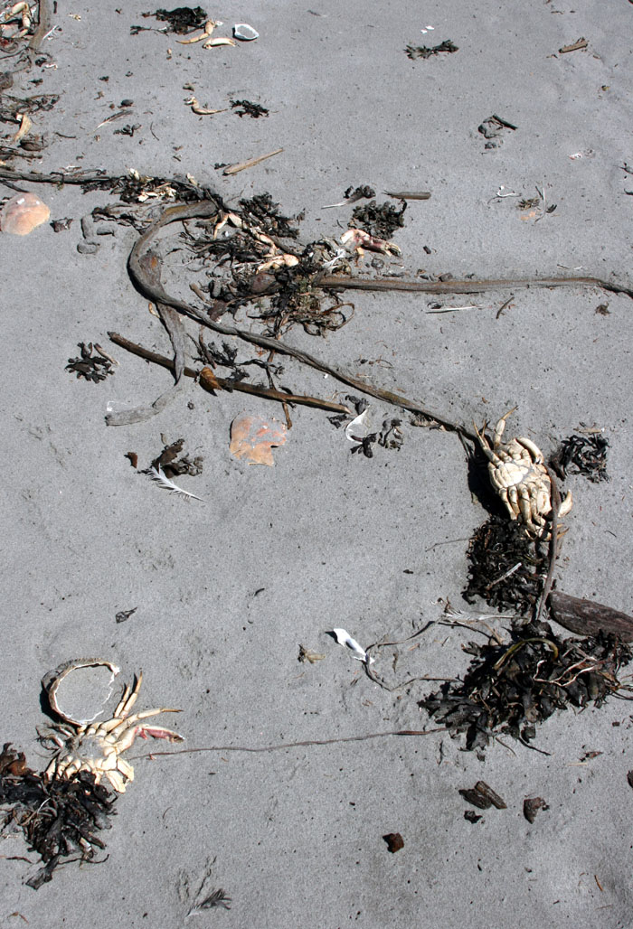
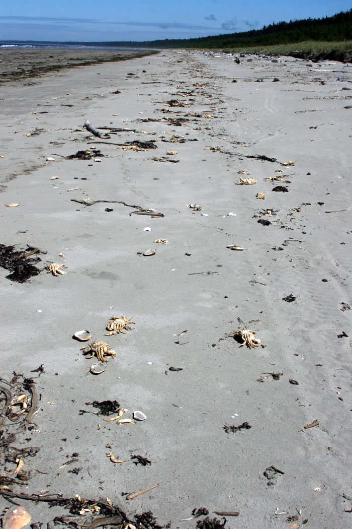 WASTED
CRABS
WASTED
CRABS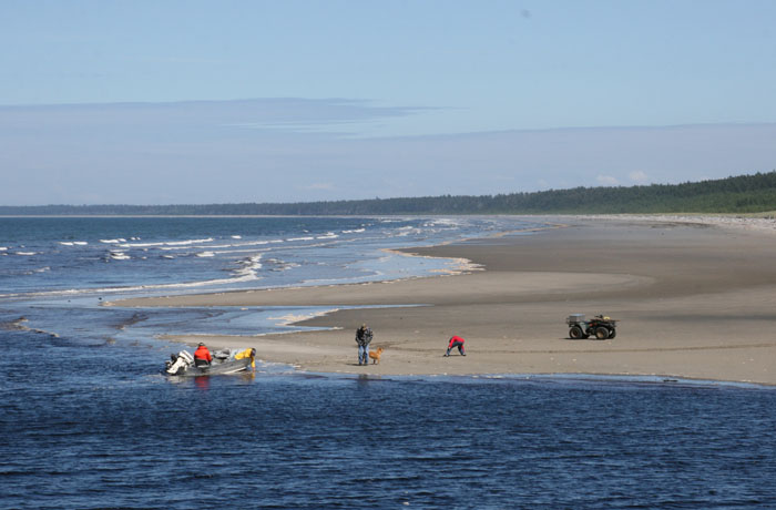
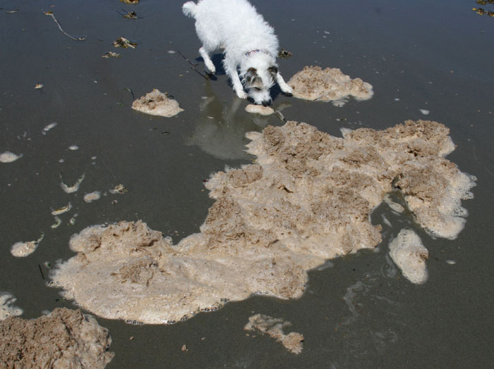
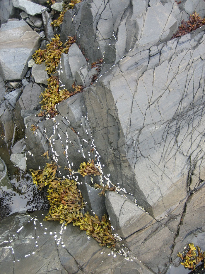
 PUFFY
CLUMPS OF PINKISH SEA FOAM
PUFFY
CLUMPS OF PINKISH SEA FOAM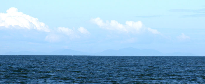
 Since
we only have so much time and knowing we can’t drive out to the end of
Rose Spit we decide to start our slow journey back.
Since
we only have so much time and knowing we can’t drive out to the end of
Rose Spit we decide to start our slow journey back.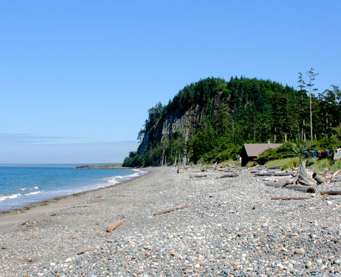


 FRESH
BREAD AND MUCH MORE
FRESH
BREAD AND MUCH MORE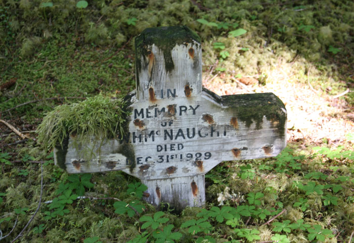 OLD
MASSET CEMETERY
OLD
MASSET CEMETERY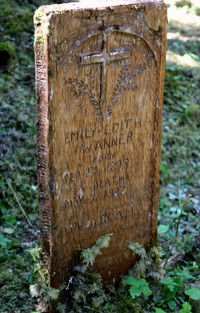
 JIM
HART’S TOTEM A BEACON OVERLOOKING MASSET INLET
JIM
HART’S TOTEM A BEACON OVERLOOKING MASSET INLET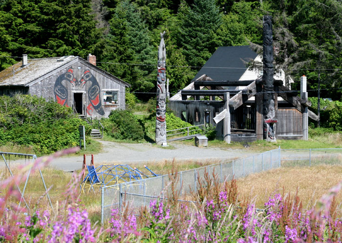 We
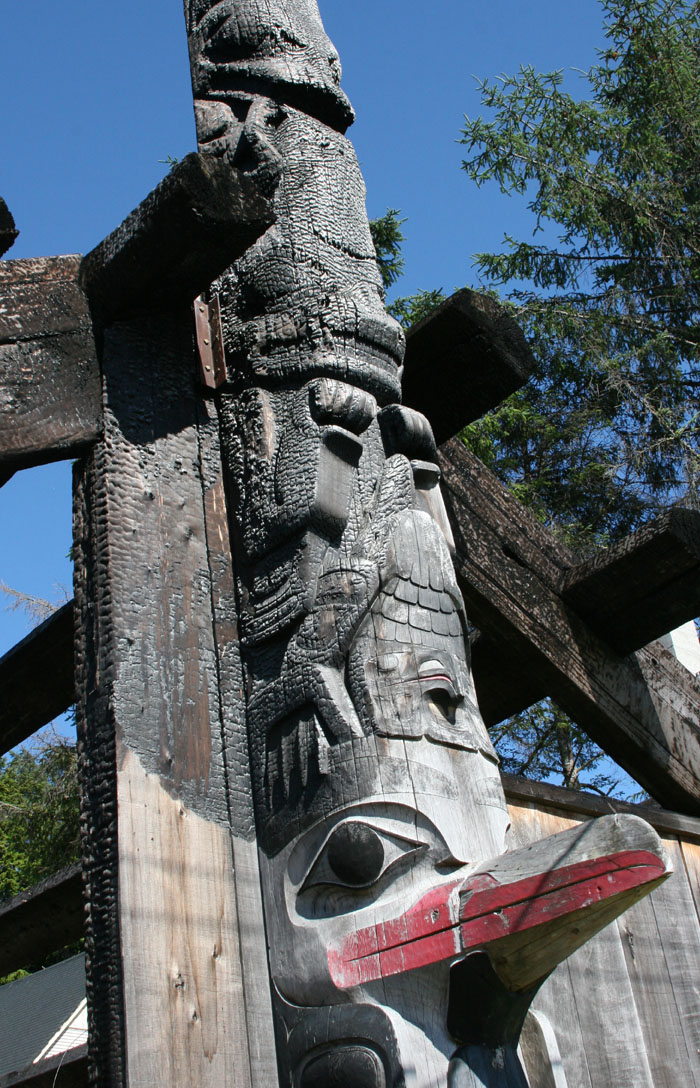
turned the corner and on the next street were more totems, and a long
house. As we approached, we couldn’t believe our eyes, as the long house
and its frontal totem were burnt to a crisp. We stopped and talked to a
woman and asked what happen to it. She said “One night some visiting
students spent an overnight inside and not knowing that their candles
would catch this place on fire, they destroyed this place.” Just when you
start to feel hope, you see something so precious destroyed.
We
turned the corner and on the next street were more totems, and a long
house. As we approached, we couldn’t believe our eyes, as the long house
and its frontal totem were burnt to a crisp. We stopped and talked to a
woman and asked what happen to it. She said “One night some visiting
students spent an overnight inside and not knowing that their candles
would catch this place on fire, they destroyed this place.” Just when you
start to feel hope, you see something so precious destroyed.
 SOME
GRUB AT THE PUB
SOME
GRUB AT THE PUB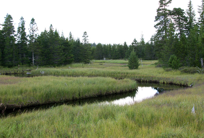 Half way through dinner what we thought was a lonely place started to fill
up with locals, many coming in to play pool and visit with friends. It
was a local hangout. We ate quickly and soon were off as we had quite a
long journey back and we were getting pretty tired. But as Larry said
again, we still had light.
Half way through dinner what we thought was a lonely place started to fill
up with locals, many coming in to play pool and visit with friends. It
was a local hangout. We ate quickly and soon were off as we had quite a
long journey back and we were getting pretty tired. But as Larry said
again, we still had light.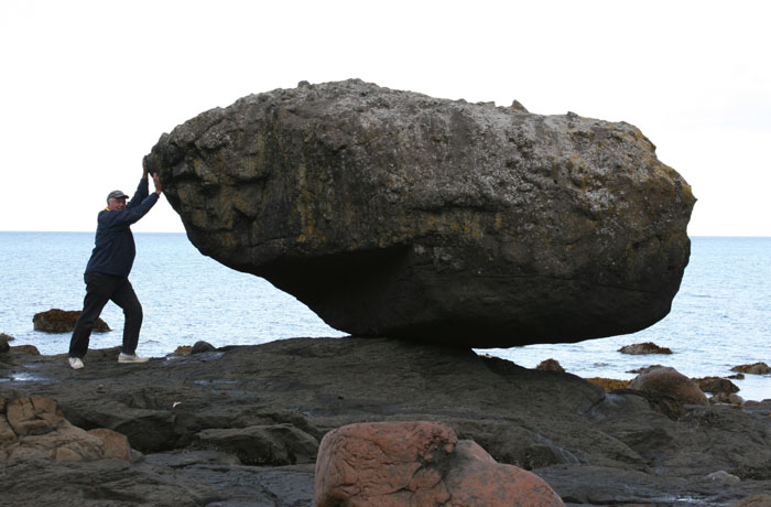 GOLIATH
AND BALANCE ROCK
GOLIATH
AND BALANCE ROCK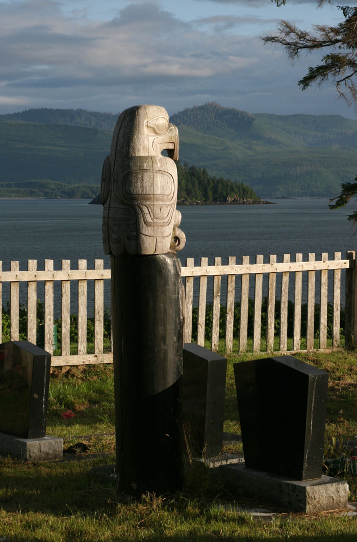

 NO
SERVICES FOR RELIEF
NO
SERVICES FOR RELIEF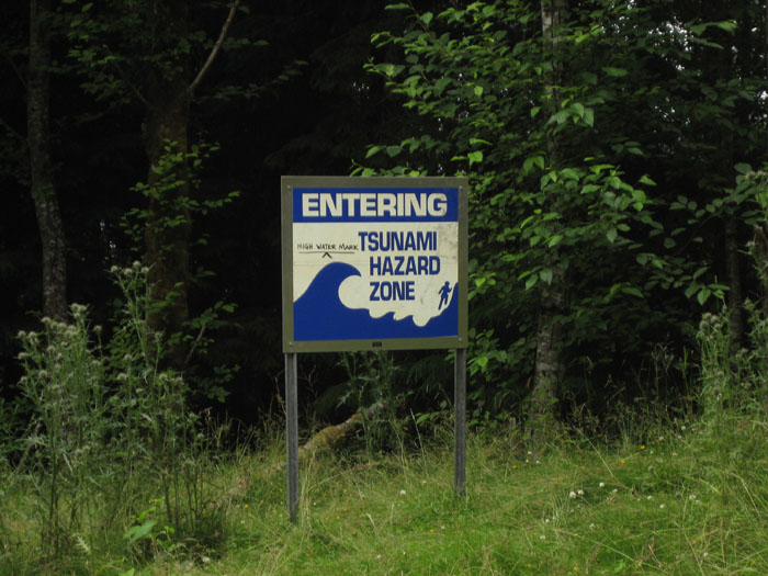 The
“Holy Shit Road” drops all the way down to a small little pad of dirt at
the bottom abruptly at the water’s edge. We looked around and couldn’t
help but notice all the warning signs for Tsunamis. What Tsunamis? I had
never ever even seen a sign warning of Tsunamis in all my travels. It was
weird. The warnings said if a Tsunami occurs head for high ground! Wait a
minute we just came down that crazy hill and I couldn’t fathom the thought
of trying to get back up it again. That is easier said than done.
The
“Holy Shit Road” drops all the way down to a small little pad of dirt at
the bottom abruptly at the water’s edge. We looked around and couldn’t
help but notice all the warning signs for Tsunamis. What Tsunamis? I had
never ever even seen a sign warning of Tsunamis in all my travels. It was
weird. The warnings said if a Tsunami occurs head for high ground! Wait a
minute we just came down that crazy hill and I couldn’t fathom the thought
of trying to get back up it again. That is easier said than done. 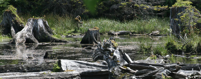


 VOILA,
MY GUNK HOLING NEEDS FULFILLED
VOILA,
MY GUNK HOLING NEEDS FULFILLED
 I
was so shaken by the experience that I couldn’t continue to drive and had
to make Larry drive again even though he was tired. We literally in a
brief moment of time saw our lives flashing before us. Thank God we were
at that particular spot in the road that we were. Now I understand the
warnings about these guys, the dangers.
I
was so shaken by the experience that I couldn’t continue to drive and had
to make Larry drive again even though he was tired. We literally in a
brief moment of time saw our lives flashing before us. Thank God we were
at that particular spot in the road that we were. Now I understand the
warnings about these guys, the dangers. 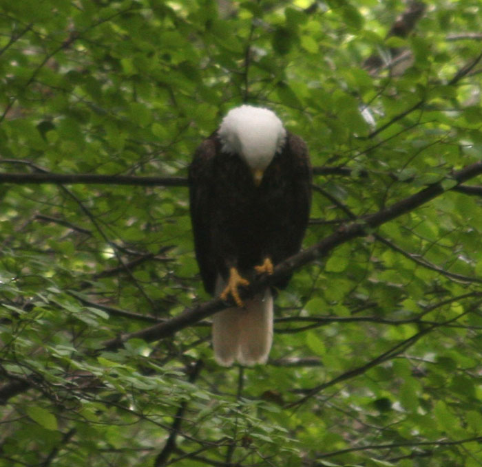