|
|
||||||||||||
|
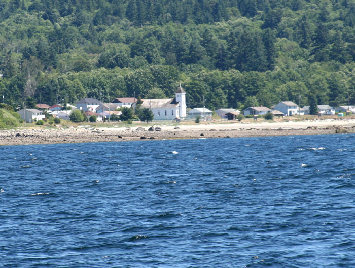
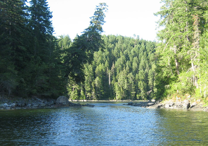
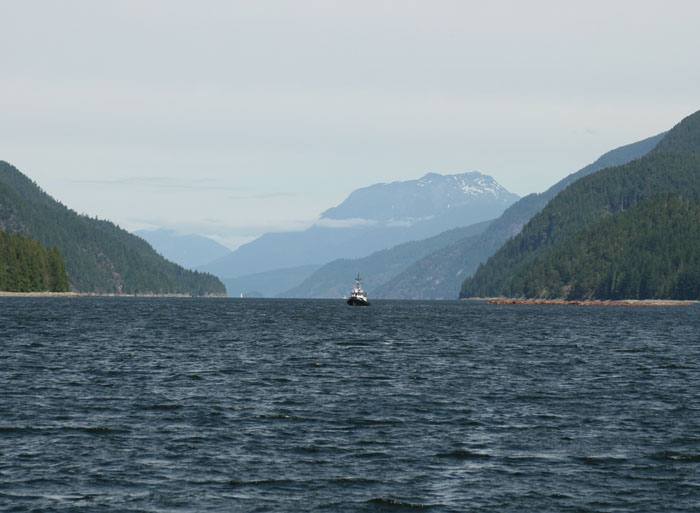
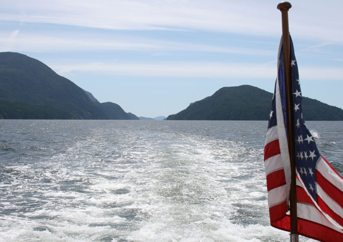
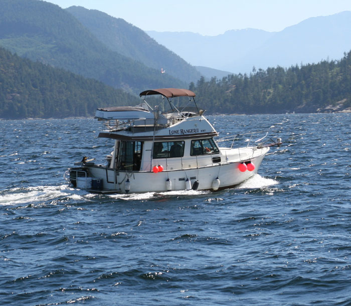
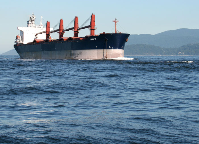
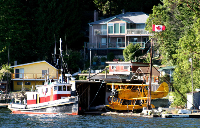
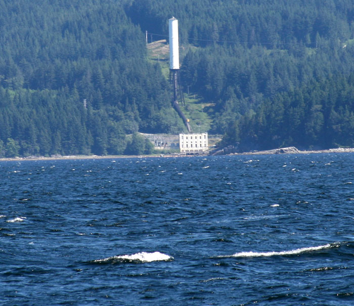
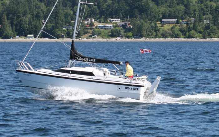
HOOCHI MA MA!!! Hoochi MaMa!!! Be careful coming out The First Narrows. Now I know why there is so much written up about The First Narrows. We’ve been through there three times before and “not a problem” so we were wondering why this one book had so many different drawings of current flows, etc. Now we know. This one guide book has about 8-10 different illustrations showing current situations going through The First Narrows under the Lion’s Gate (the bridge). I prefer to call it the Lion’s Mouth now as it almost swallowed us up!!! When we came through under the bridge we had 10 knots of wind on our nose and it was rough as all get out. We had huge 8 feet tall, very steep, standing waves, one right after the other. It was like walls of water that we had to get through. We dropped down into the first unexpected trough took one particular big fella right over the nose as it went under when it bounced back up our fore deck filled up with green water like a bath tub, actually I guess you could say we had our very own Jacuzzi up there for a couple minutes. I watched in terror as it sloshed back and forth looking for a way to drain out. I began to wonder if we had drains up there as we never ever have taken water over the bow like that, so much so in one instant. It sloshed forward and backward for about 5 more steep waves before it dissipated down the drains that later I did check and we have and they work very well. Well maybe we should’ve known better but as far as we knew we didn’t have tide and winds against each other. We had the wind and currents in our face, a bad combination but not as bad if we had wind and currents going against each other. We finally got out of that terrible area but now still have to get around Howe Sound which should have winds coming down out of the mountains and hitting head on into the winds from the Straight. Cheryl Fortier had said it can get pretty rough around Point Atkinson and I see it in sight. Ziggy is panting. Poor little guy is scared to death as the bulbulous bow is banging into the seas. I hate this kind of boating. We should have about an hour of this we think before we make a turn which hopefully it will get a little easier. There was no turning back though that’s for sure. We’ve got to figure out these currents and not take them for granted in the future. It was dead calm flat in the harbor of course and it was very misleading as to what awaited us on the outside. Even all the way until the very moment before we went under the bridge, there wasn’t a clue. The sun was out, no wind, nice weather, clear and beautiful.
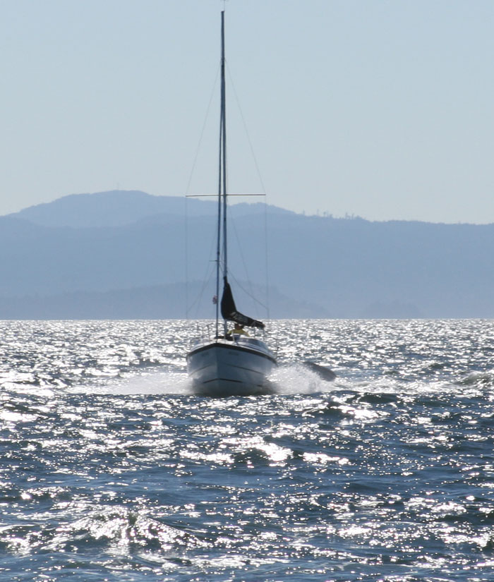
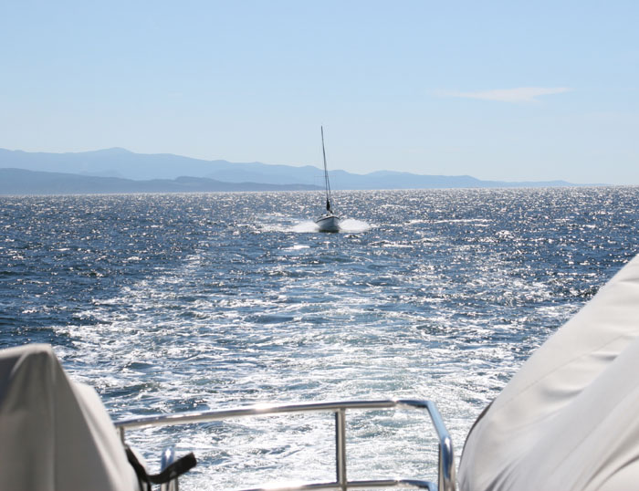
We’re crossing Howe Sound now and banging our way across. There’s a mass of white caps on the Strait and I look off to our port and watch the long rows of rollers coming in off the Strait. The bow continues to bang its way ahead throwing white spray out and up on each side of our pilot window heights. We’re about half way across Howe Sound now and we watched a tug towing a barge head into Howe Sound. It looks so calm and peaceful in there but they have a small craft warning there also. We can see a sailboat ahead coming this way, riding these huge rollers with the wind filling its sails. He’s got it easier going than us as he’s got following seas and winds.
GAVE ZIG A CALMING PILL I’ve given Ziggy a half tranquilizer to calm him but had to give him another half. The second one seems to be doing the trick. (I found out later he spit the first one out as I found it on the floor.) He was really scared and there’s no reason to put him through. Now he’s more relaxed and looks like he may be able to take a nap.
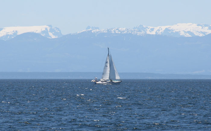
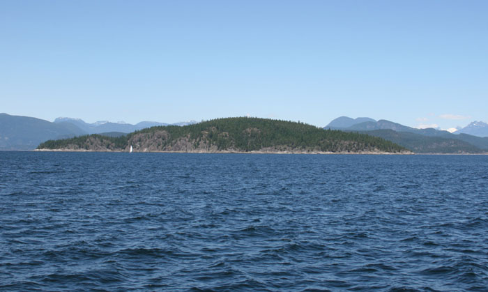
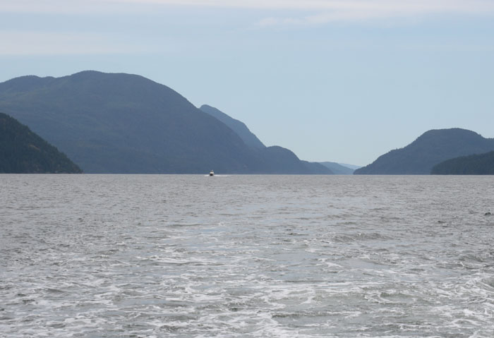
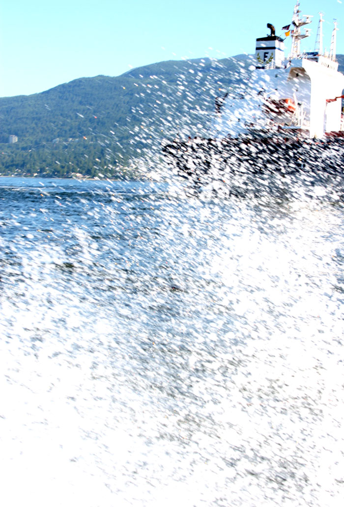
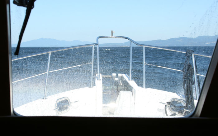
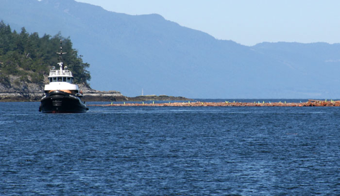
NO PICS TODAY It’s a shame it’s so rough because I’ve passed up several nice photo shots, one of Point Atkinson with the snow cover peaks in the back and another of the little island in the center of Howe Sound with some nice little cottages houses perched out on its rocky precipices. I wonder if someone inside one of those cottages is watching us and the white waves we’re throwing across the water. Are wondering what kind of kooks would be out here to day. There’s another tug pulling a barge heading into Howe Sound. Can you imagine pulling a load like that in these seas? Those guys are macho in my book. I don’t know why they don’t call this Strait of Terror. We can here a vessel in distress on the radio and the Canadian Coast Guard is trying to assist them near Sandy Point. We listen intently for any updates. That darn tug is pulling three loads heading up Howe Sound. It reminds me of the little train that can. I think I can, I think I can as he looks so tiny with those big loads. He’s doing it though. There’s nothing but white caps ahead. We’ve got 10 foot waves and short deep troughs. I was hoping it was going to get better. This is scary. We think we’re going to try to head into Gibson’s for protection and get out of this. The weather is supposed to be worse tomorrow so we may get stuck there. We can see Texada Island ahead. It’s just a grey contour in the distance and we know it will be calm there but it’s a long hard way and the seas just seem to keep getting worse. These monsters are 10 feet, short and steep with white caps rolling over the crest. There’s another sailboat motoring towards us, again with the seas with them. His mast is bobbing all over the place. It looks like a little toothpick swinging way left then way right. He’s got his jib up. We were so distracted watching this guy bouncing all over the place that we didn’t notice the huge BC Ferry who suddenly appeared on our portside. Wow that was a surprise. We didn’t even know he was coming as we figured no idiot would be out here, even the BC Ferry. It doesn’t bother him though as he plows through this mess. We’ve got winds between 33-39 knot winds on our nose. Gosh WOW we just took a wave up over the pilot house wind shield. That’s the first time I’ve seen thick green water cover the pilot house windows and I mean thick. It was solid green! The water is draining off the top of the pilot house like a sheet of water on each side!!! We never have had that before. We watch as the BC ferry leaves us in the dust or in the white caps. He just cuts through all this slosh like it was nothing. I can’t blame this decision on coming out here in this on Larry as I looked at the weather report too. I was equally involved in this decision. How can it be so rough when it is so beautiful out?
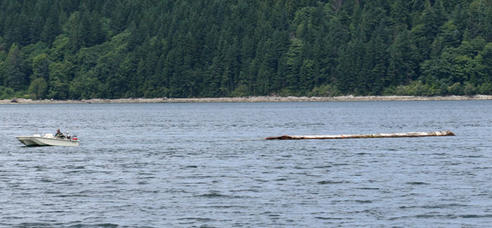
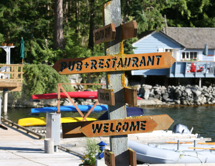
MAKE OUR WAYPOINT TURN HOPING FOR CALMER TRAVELING We finally get to our waypoint to make our turn and it seems to be a little better. I guess this was the test for Small Craft Warning. You never will get a definitive definition of what small craft is. It’s always been a point of contention for me. Some people think they know what it is but the Coast Guard will never describe it exactly nor will any cruising book. We’re two hours and 30 minutes to Welcome Channel. It sure will be welcomed today if we decided to head on. The tranquilizer is doing the trick for Ziggy. No need for the poor little guy to stress out because of our stupidness. We’re spotting some logs. Wow there are some long ones out there. They are only visible every so often because of the height of the waves as they hide in the troughs. At first we thought one was a kayak. It was kind of wide and we got worried but it was just a log thank God. The seas are so strong it looks like these long logs are actually bending in the seas. The winds are still in the mid thirties but seas are looking darker, less white caps. We watch one big log in silence as we go by it and imagine the damage that thick sucker could do. It was about 20 inches in diameter. This new direction is a little better. We are wobbling around but we’re not pounding into it like before. We’re thinking we might go on. Hope we aren’t making a mistake. At least we are cutting the waves on the forward quarter now.
LAST CHANCE TO GET OUT OF IT We’re crossing by the sound that leads to Gibson our “port of protection” and the last place to put in or go on. There are two arrows going in two different directions on the chart with a pink Triangle with an exclamation mark. We look at the chart plotter for more detail but it always say nothing, just Caution. What good is that? At least there aren’t as many white caps just little ones. Winds are still high.
THOSE CRAZY NORDHAVN PEOPLE This is the first time in a long while that I had trouble peeing and getting the pants back up. I guess we must be becoming like those crazy Nordhavn people. I always think of them as extreme going out in anything. So many people say to us on the dock, “Oh well, your boat can do anything and go in any conditions.” I hate that when they say that, because that makes you feel like you have to go but I’m really just a big chicken at heart. This boat is way more than me. I still like nice easy cruising no matter what the deal is. Some of the white caps are so large that you keep thinking you are seeing small boats or other cruisers but then they disappear into nothing, it’s just another big white foaming white cap the size of small speed boats.
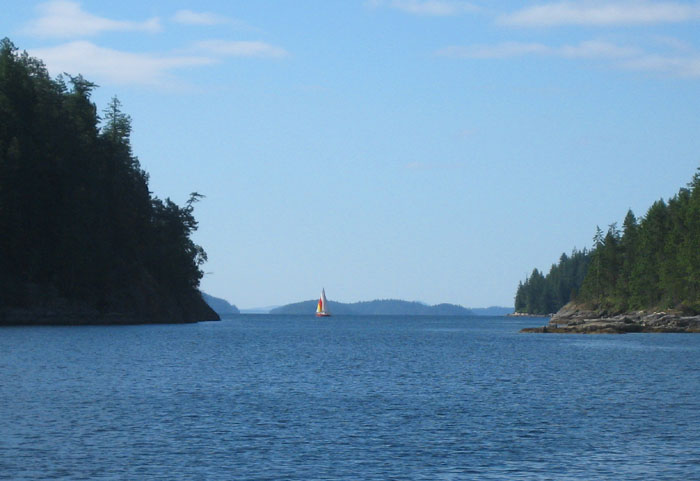
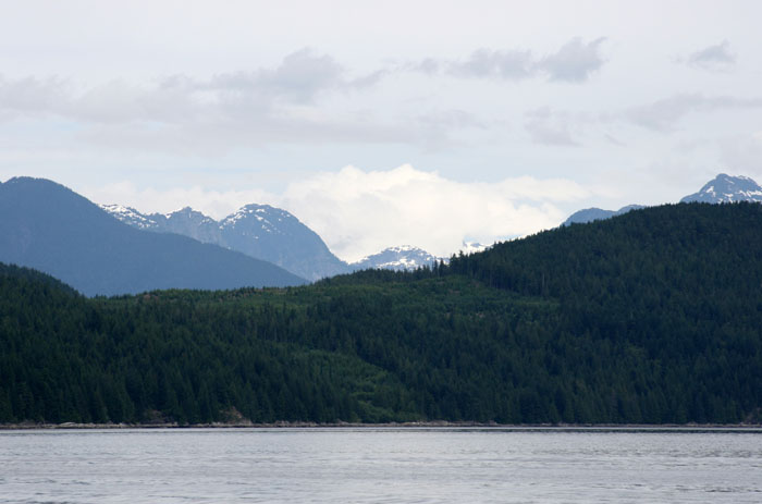
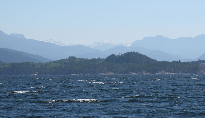
THOSE SAILBOATERS LIKE TO SUFFER Oh my gosh, there’s another sailboat. Of course they would be the only ones that would want to be out here so they could suffer. Well we’ve past Gibson so I guess we’re just as bad as we’ve made the decision to suffer also with only the idea of a small light at the end of the tunnel and that will be Welcome Passage where we know we will be welcomed and protected ahead. To me, this area is the official start of The Inside Passage. The winds are still hovering at 34 knots but the seas are much less severe. The winds are coming directly out of the west now. The weather forecast said the winds would be out of the North, if so, we would have been protected from the winds by mountainous shore as we are heading directly West. We’ve got 3 hours and 20 minutes of this to go according to Larry and the chart plotter. There’s a beautiful view up Howe Sound and towards Gibson. There are low hills by Gibson and snow capped mountains in the distance behind.
This is the first time I’ve ever typed one handed as I have one zonked out Zig in my other arm. We see another spot on the radar. It’s a tug towing thee loads behind him. We’ve seen several big mother load logs bobbing by. We hear a sail boater that just came across from Nanaimo and just entered Welcome Pass. He told his friend who is still sitting at dock in Nanaimo that there’s lots of protection in Welcome Pass and winds of only 15 knots. A small trawler is headed this way. I don’t think I’d want to be out here if I were him even though he has it behind him. It’s just going to get worse as he heads further into the direction that we came from.
THERE WENT THAT CAMERA AND CUP OF COFFEE We had another big wave and my Sony camera flew off the shelf and the lense cover broke. Hopefully the camera is OK. Larry spilled his coffee too. Luckily it didn’t get on the computers. It didn’t even faze me as it’s not the first time. I can see the light flashing at Welcome Channel! The winds have died down to about 25 knots now but it’s still bumping and wobbly. It’s certainly not been conducive to taking pictures even though we’ve seen some great sights. The camera never can capture how rough the seas are in my opinion. Today I couldn’t even stand still to try to take anything. This will not be the first time that we have been grateful for the protection of Texada Island.
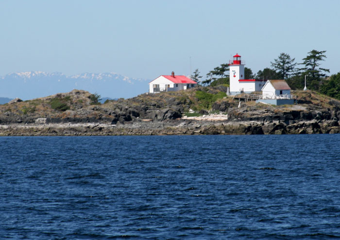
DEADHEAD AHEAD Larry points out “there’s a dangerous deadhead”. It was eerie looking thing sticking up about six inches out of the water almost too still and quiet, as if it was watching us go by waiting to catch someone who is not paying attention. Our lucky day today I guess. We’re almost to Welcome Channel. I can clearly see the little lighthouse on South Thornby Island. What a welcome sight, guess that’s why it got its name. The winds are still blowing a good 20 knots but the seas have finally calmed down. The sun is out clear and it’s a beautiful all day. I’m glad we decided to continue and get this over with. Now we can enjoy ourselves and not worry about coming up the section tomorrow in even worse weather or having to get stuck somewhere and delay our journey northward.
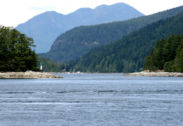
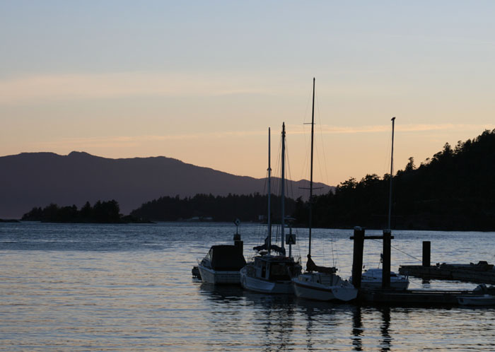
AAHH PROTECTED BY WELCOME CHANNEL We are now in Welcome Channel protected by Thornby Island. The winds are still 20 knots but it’s like there is no wind. We don’t feel it. It’s calm and flat. re’s nothing. Flat. We can see a tug up between the islands heading this way and Larry looks at him through his binoculars. He says he’s hauling one big A___ load of logs. We slow down a bit and pull over to the right. I think we may sit here in the wider area and let him go by. We hugged the shoreline and slowed down so as not to give him a wake to loosen his load and let him go by. Then we came out into the opening past the islands and turned to make our way in to the protection and dockage of Pender Harbor.
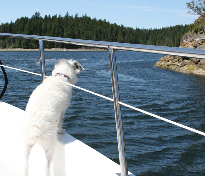
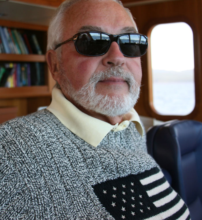
(Thank God we didn’t have the Portuguese Bridge open when we left Vancouver. Ziggy likes to ride out on the bow coming and leaving port and he would’ve been a goner for sure as it all happened so quickly.)
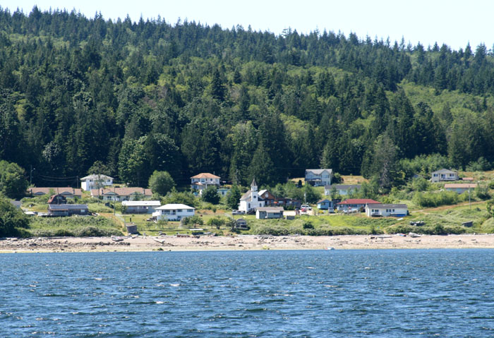
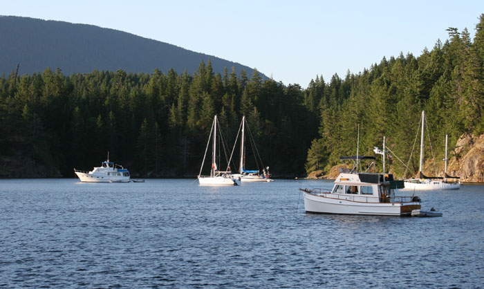
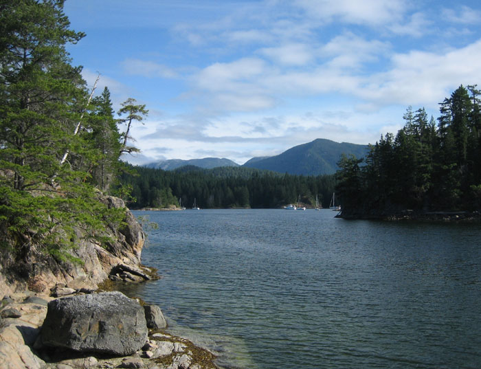
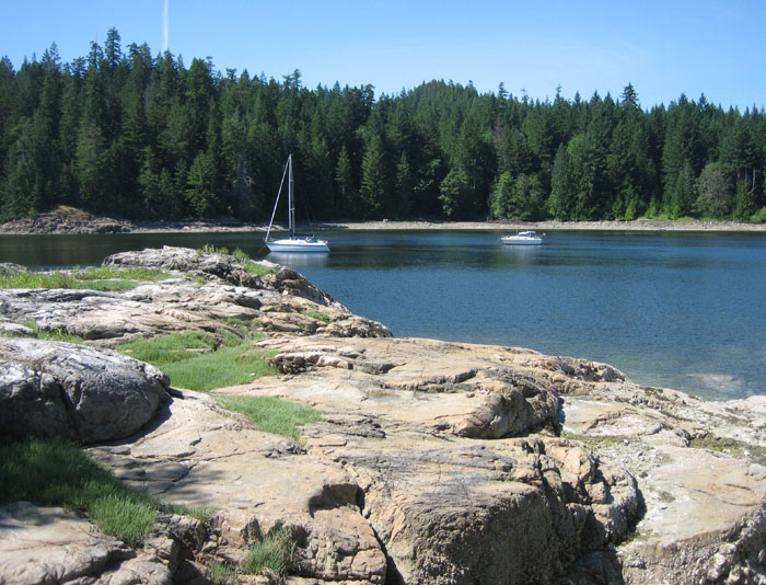
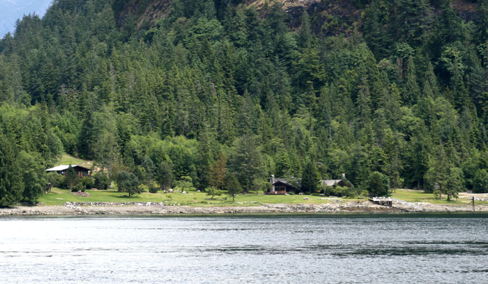
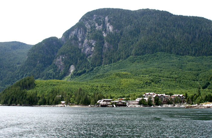
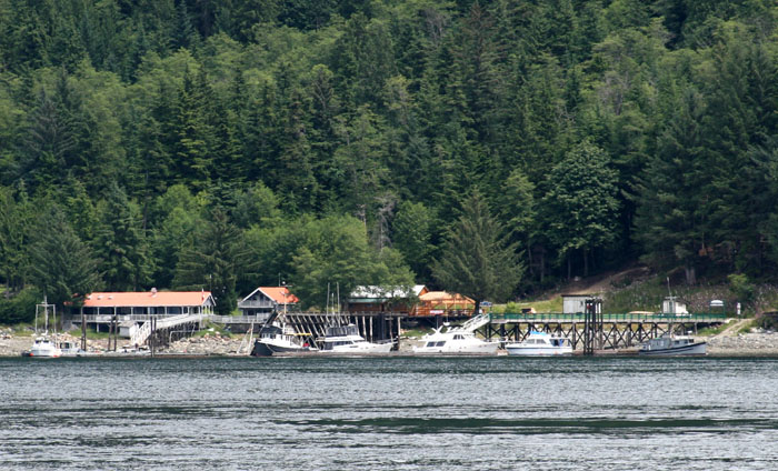
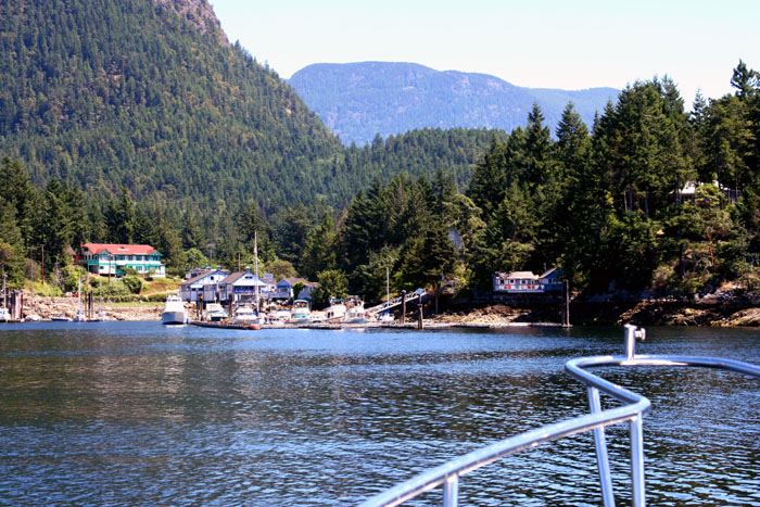
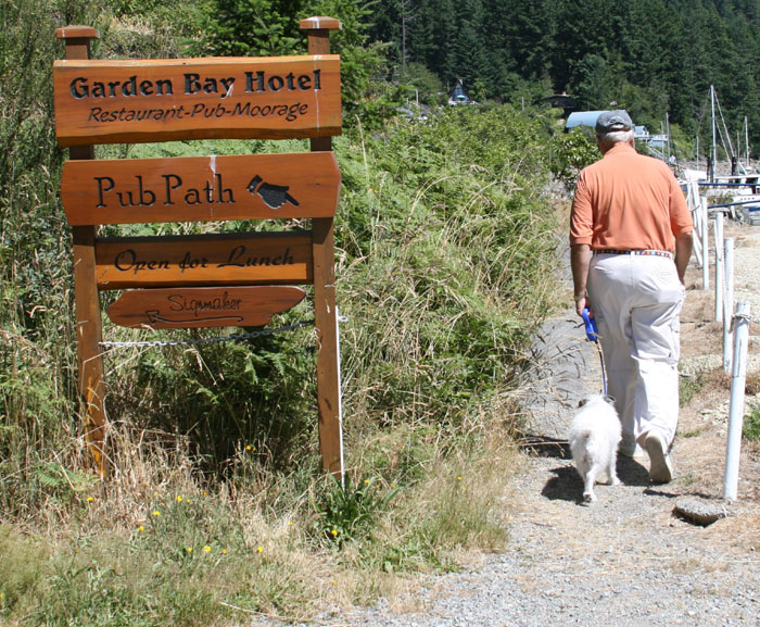
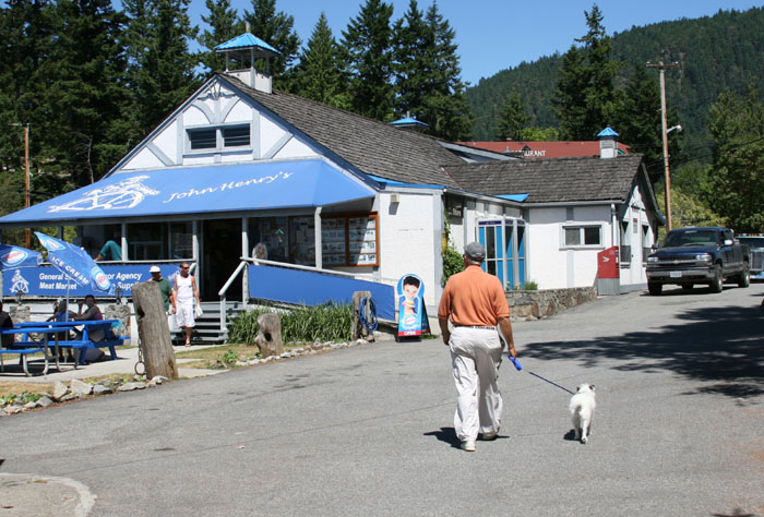
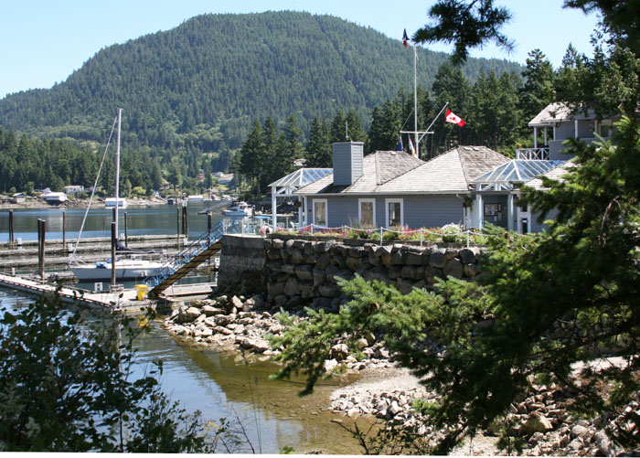
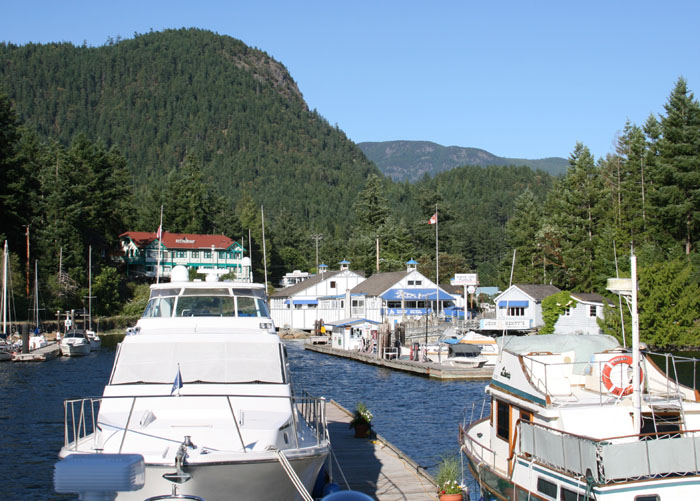
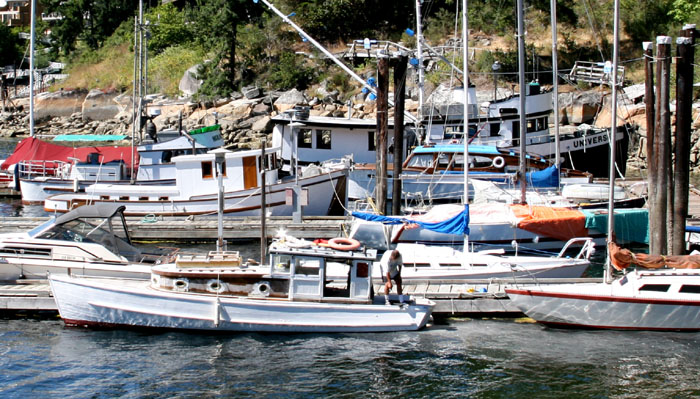
PENDER HARBOR Twice now we have come into Pender Harbor after battling the seas and we are always welcomed with a friendly hand tying us securely to their wooden docks. Once we get settled we usually seem to crash for a much needed several hour nap. Dave, the new owner seems like a very friendly chap and Bill was helping out, getting people settled and welcomed. The area is much more built up than what we remember from four years ago. There are a lot more summer cottages with little docks. I don’t get the same feeling of being in a remote place that I did when we came here before but it still is pretty remote as there is only road to get here and it’s not an easy trip.
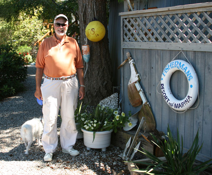
Ziggy was out of it, poor guy, we had given him half a tranquilizer when we were banging around out there on the Strait and when it didn’t seem to do a thing, we gave him another half. He was still pretty shaky on his feet and very tired. He can’t quite figure out that he can go do his business now. He just wobbles around in the grass, a little tipsy, not knowing what he’s supposed to do. (I did find the other half of the tranquilizer pill on the floor the next morning so I guess the first half was more than enough or maybe it was the second half. I’m not sure which one went down the hatch). You wonder what the strength of that pill is because one half finally knocked him for a loop. The other half would’ve put him out completely. It would have been way too much. It saves him a lot of grief though. Next time I’ll try a ¼ pill.
THE BEST HAMBURGER ON THE SUNSHINE COAST We walked over to the Pub and made
reservations for dinner. While we were there we decided to have some lunch. It
tasted fabulous. It was either really fabulous or we were just ravenous from
not having eaten all day. It was too rough at sea to make anything to eat, even
to get any snacks out so I guess anything would taste fabulous today. I think
though that it really was fabulous. It was just a hamburger, but I think
it might compare to Jimmy Buffet’s claim as “the best hamburger in paradise in
the Bahamas”. Maybe I’ll claim it’s “The best hamburger on the Sunshine Coast.”
WE ALL CRASHED FOR SOME MUCH NEEDED REST Well all three of us crashed for the rest of the afternoon and woke up just in time to go back to the restaurant again. I managed to drag myself out of my deep nap. I glanced at the clock and saw it was 5:40 PM! Wow, eat and sleep, not a healthy thing but we were that tired. Our dinner reservation was for 7:00 PM. The boat was way too quiet so I assumed Larry and Zig were still napping but when I looked out one of the port holes and saw the both of them heading up the dock ramp for a walk before dinner. That was sweet of Larry. I watched the two of them and thought such unlikely pals.
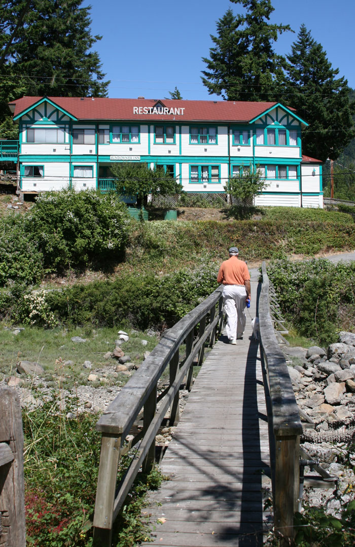
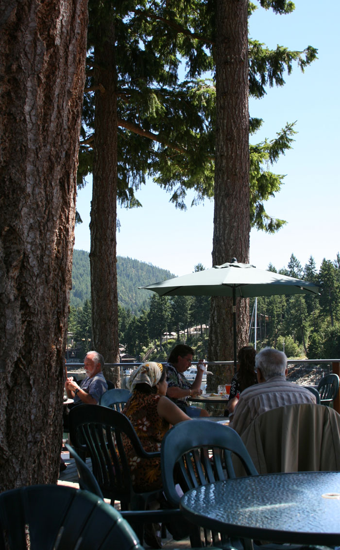
DINNER AT THE PUB We were having beautiful warm weather and decided to have dinner outside on the deck. The deck is built around two or three huge trees that fortunately were spared when they built this place. Thank God they saved them as they are beautiful and form a tall sheltered umbrella of green branches over us. It’s a beautiful setting looking out over the quiet protected little cove. The water was flat and the little summer cottages are perfectly reflected in the mirror like water below. A few boats were anchored, snuggled deep inside the cove and out of the way and a few other boats were tied up at the docks. It wasn’t nearly as full as it has been other times that we’ve been here. We can see the RVYC (Royal Vancouver Yacht Club) out base too. It has a very nice dock and building. They were empty also.
RULES OF THE PUB The restaurant was buzzing. I guess people
from the local cottages were here and of course the handful of the boaters too.
The deck is divided in two by an odd little plexi fence. The deck on one side
is for the pub and the other side is for the pub restaurant. Some folks from
England (that pulled into the docks on a sailboat) sat on the restaurant side at
a table next to us. After a few minutes they became very upset with the nice
waitress. They said something about it “not being fair” and that they felt like
they “were being discriminated against”. They finished their beer and huffed
off walking back down to the dock, onto their sailboat and left motoring out the
cove.
We couldn’t hide our curiosity and had to ask the waitress what the problem was. She said they had minors with them and minors by law can’t sit in the pub area because they serve alcohol. So they had to sit on the restaurant side but didn’t want to order from the restaurant menu but the pub menu. (The restaurant menu is a bit pricey so I guess that essentially was the root of the problem.) She said the English lady (from the sailboat) was very upset and said it was discriminating because the only thing separating the pub and the restaurant was a little divider. (And what’s confusing to me is that they also serve alcohol in the restaurant so none of this did seem logical.) It did seem silly but that’s the law I guess. The waitress was very understanding at their frustration and apologized profusely to them but they still left in a huff. (Sometimes I think you just have to go with the flow of local traditions and how they do things and not expect things to be the way you think it should be or how you are used to it at home.) We had a fine dinner and I loved my rack of lamb from Salt Spring Island. Larry had a beautiful thick piece of halibut poached in fresh strawberry sauce. It had a nice pink color from the strawberries and was delicious. We had a crème Brule for desert “infused with rosemary and tea” with fresh raspberry white chocolate ice cream with compote of pear, cranberries and local gooseberries along the side. It was so unusual and very delicious. We always enjoy coming there as the food is always so good.
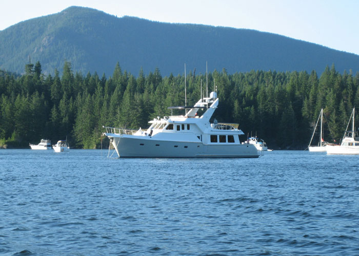
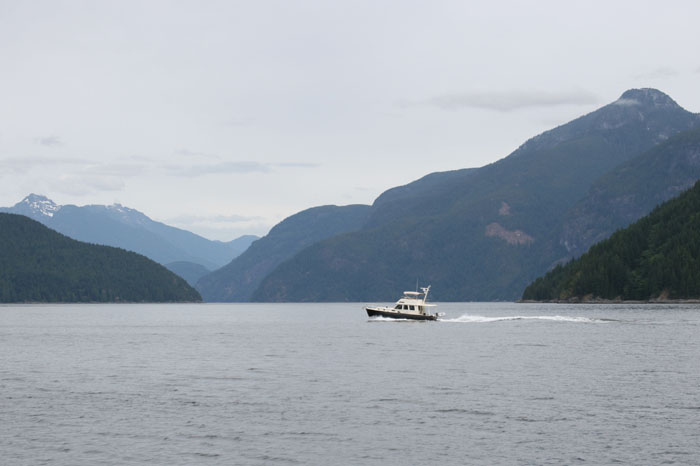
THE PREDICTABLE EXCHANGE OF INFORMATION ON THE DOCKS Well, people on the docks are talking about heading out tomorrow and all wondering and talking about what they think the weather will be like. The weather report is calling for some strong winds so all are and should be a little wary. The people on the Grand Banks that banged their way across the Strait yesterday said they are now heading back across the Strait again to Campbell river. They have friends they need to meet. I can’t believe after they just fought their way across today that they are now going to turn around a go back again. They are going to leave tomorrow morning about 5:00 AM. Another couple said they are going across but leaving much later. They have 30 foot, at the most, Camano Trawler called “Porpoise”. It’s going to be pretty rough I think but they said they are just going to stick their nose (I’d say neck) out there and see how it goes.
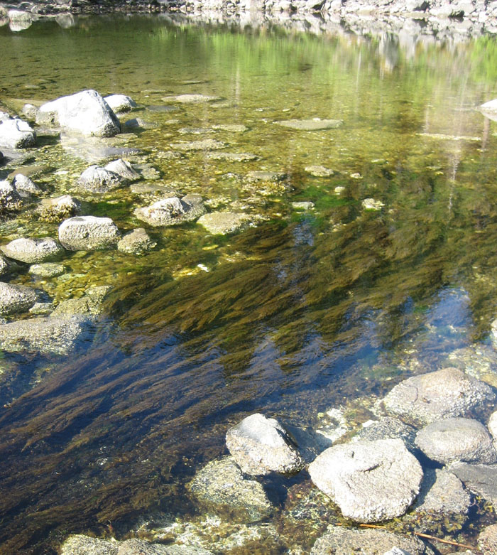
PS: WATER IS STILL NOT CLEAN UP HERE
PENDER HARBOR TO SQUIRREL COVE The next morning we head out pretty early. The Grand Banks has already gone and the people on the Camano are getting fuel getting ready to leave.
MAY DAY, MAY DAY
ANOTHER MAY DAY Then not too long later we hear the Victoria Coast Guard trying to reach another vessel. We never heard the vessel in distress but this one, they said, had given a MAY DAY reporting that they were capsizing. They didn’t have time or weren’t able to give a position or other information. The woman handling the radio on Victoria Coast Guard side is repeatedly trying to hail them or “anyone that may know of the vessel reporting that they were capsizing to come back with information”. No one comes back. It brings tears to your eyes as you hear this woman try to repeatedly hail this boat and the only response is silence. Thank God for the Coast Guard doing their best to help all these boaters. They are really on the job up here as they seem to have to deal with one problem after another today. We have a great amount of respect for this Canadian Coast Guard group. It must be a very tough and challenging job.
CONDITIONS ARE NOT TOO BAD FOR OUR PROTECTED PASSAGE We keep plodding along, the winds are 39 knots on our nose and we’re going 8.10 knots so, that means the winds are about 31 knots. We see two trawlers passing us heading south. All the conditions are doable but we don’t know what it will be like as we get up to a place where we will have a little opening between the islands and see how bad it is out there on the Strait. The spray is washing over the pilot house windows but not heavy and volumes like yesterday.
BLACK DIAMOND DAY
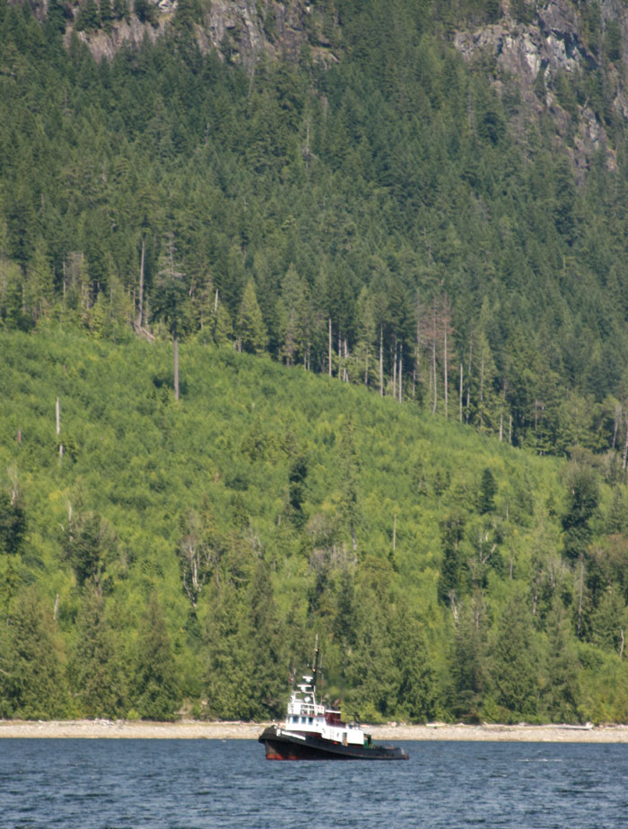
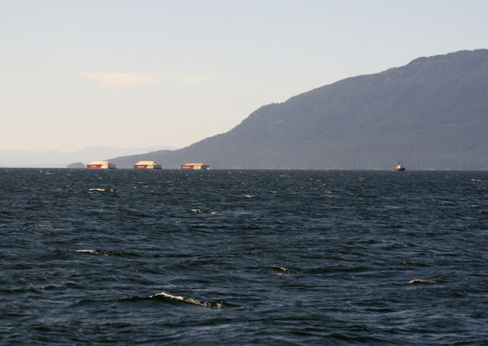
We still hear the woman at Victoria Coast Guard still trying to still get information on the capsized vessel, all the while she’s requesting a response or information on the reported missing vessel some jerk keeps breaking in on 16, looking for his fishing bodies, naming them all off. I guess his radio isn’t powerful enough to hear the emergency announcement by the Coast Guard, but it is so maddening to hear this idiot when the Coast Guard is trying to get information about a vessel down. Bernadette is the name of the Vessel. Even though we’ve got 30 knot winds and the sea is white capped, it’s a smooth ride. We see another tug pulling a big barge full of cartons, three and four levels high. Larry is making water as we go. It is so great to be able to make water now and not have to worry about rationing or filling up where the water is bad.
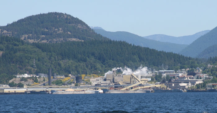
POWELL RIVER
IN THE DISTANCE, THE END OF THE ROAD
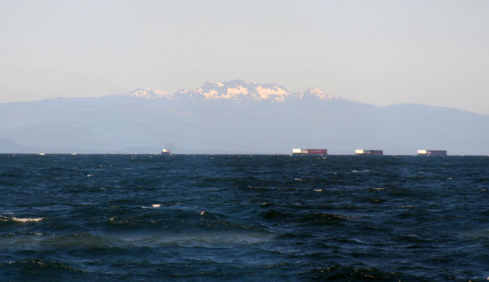
As we pass Powell River and are open to the Strait we are still good to go. The winds have dropped to about 25 knots. We’ve got white caps, short period with two foot seas and we’re plowing through like a tug, nice and strong and smooth. We look ahead as the different layers of mountain silhouettes call us on. Every so often a soft lacy spray comes over the bow leaving salt droplets and streaks so we have a veiled image, lace like of the course ahead. Gradually we feel the change in the tide as the travel is becoming harder and slower as we are fighting the current. Winds are still about 25 knots. We still haven’t reached Lund yet which is officially the end of the line but we can see it ahead on the chart plotter.
LUND
DESOLATION SOUND Now we are making our way into what they call Desolation Sound. This is the area where the tides from Juan de Fuca to the south and Queen Charlotte Sound to the north will meet and change directions on the ebb and flow. It’s an amazing natural phenomenon that I don’t understand. It doesn’t feel so desolate these days after passing all those cottages to the south of us. I don’t feel the same remote feeling as I did the first time we came up here. This time we decide to go on the outside of the Copeland Islands. I won’t be able to see if a cross is still mounted on a rock on the other side. I wondered then and now what it symbolized, a death or drowning or a burial of some early settler?
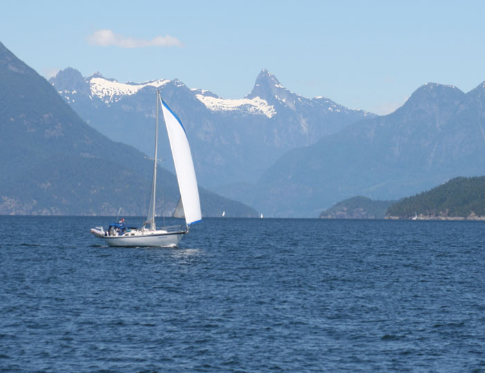
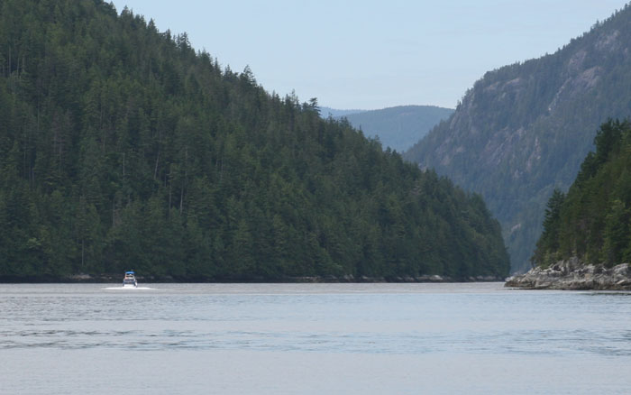
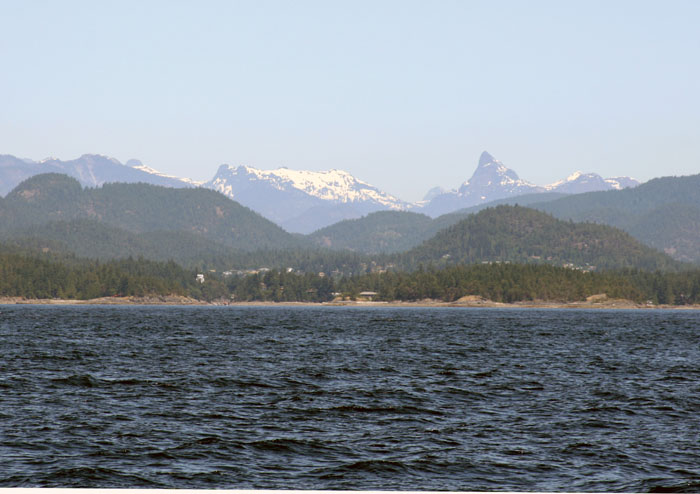
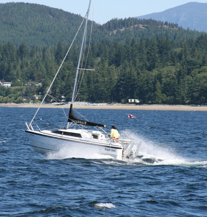
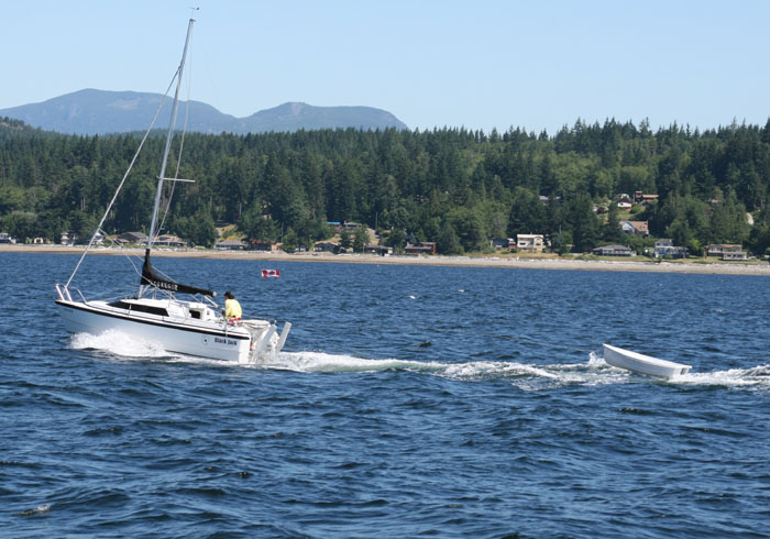
We passed Salvary Islands and I remember being at Lund four years ago on their opening day of clamming there. The dock master in Lund said they are the best clams you will ever eat anywhere. Mmmmm, I’d like to taste some of those yummy clams. It’s been a long day today. We have about another hour to go. Actually it’s only been 4 ½ hours but tiring. The seas are much calmer now. Well, you do feel something when you know you are at the end of the road. It’s just sinking in the idea that there is no more road now for hundreds of miles only boat access. I love that idea. We passed Refugio Inlet and enter the inlet to Desolation and it is spectacular. We see lots of sail boats taking advantage of the winds. They look so small against the magnificent colossal mountainsides. They are like specs as the scale immediately changes and becomes tremendous.
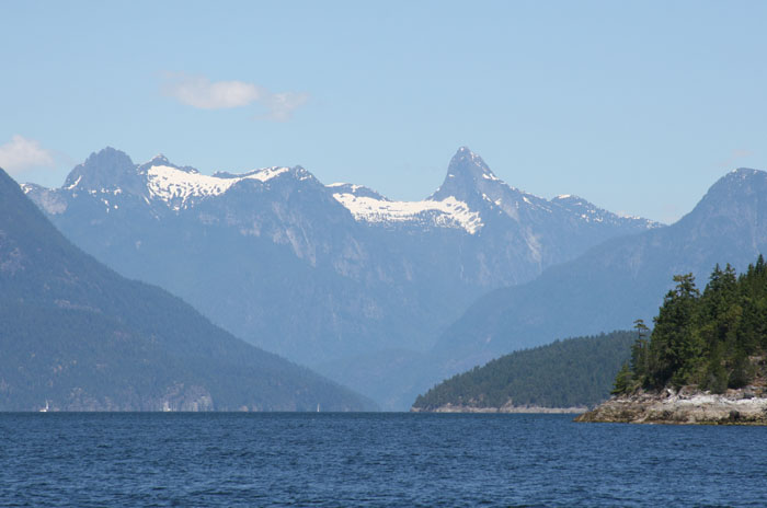
TRICKERY ISLAND “Trickery Island” I call it. It’s the first little island at the southern entrance of Lewis Channel. Twice now it has fooled us with it’s size. It’s right where the charts change scale as you enter Desolation Sound. There’s just something strange that happens once you pass that imaginary line to Desolation Sound and start heading north, the scale of things just gets huge. You never really comprehend it or grasp it the whole time you are up north of that line. You only realize it when you get anchored somewhere and think there isn’t much room between you and the shore but then realize it’s huge as someone on shore suddenly shrinks to the size of an ant. Maybe it’s because there are no buildings anywhere so the human eye doesn’t have anything to compare things to so it can adjust to the enormous space up here. But even so, if there was a shack or boat in a cove or channel the spaces are so expansive to what we are used to that our senses have a hard time picking up on it.
What a beautiful spot this is and we have a perfect spectacular view through a small cut that looks straight out to Lewis Channel.
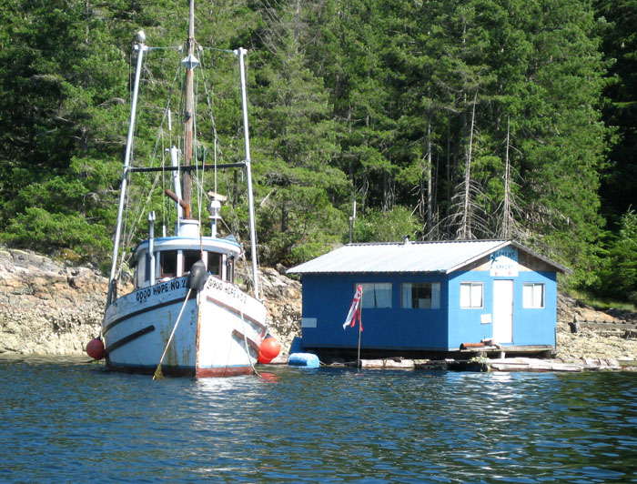
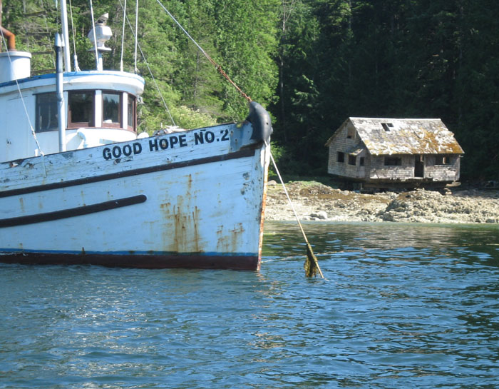
GOOD HOPE NO. 2 J In the next recess of the cove about a ¼ mile over are two more floating shacks again tied and held only by long thick ropes covered in algae and moss as they are strung across just below the water’s surface. There are a couple skiffs out front and obviously people do live there as we saw a weathered looking long gray haired woman coming home from work. (Maybe she works at the town store?) She tied up her skiff went in and that’s the last we saw of her or anyone.
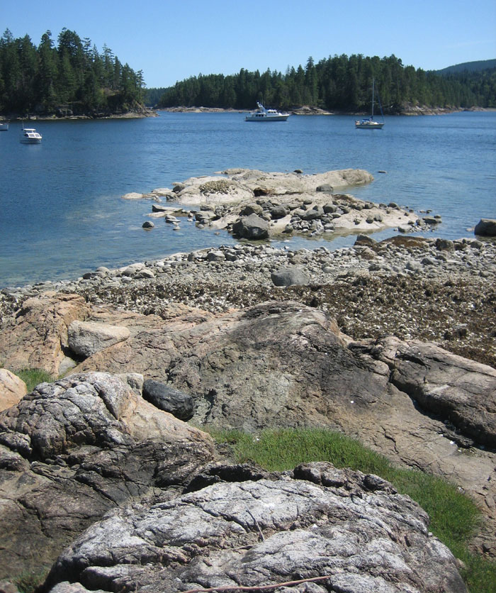
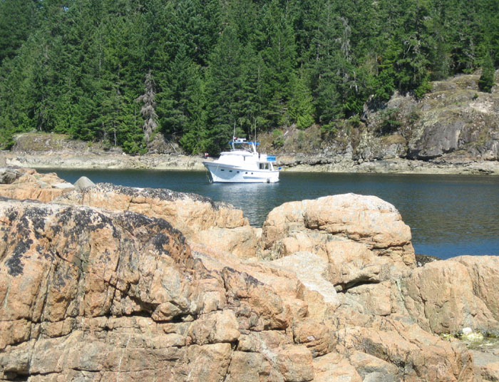
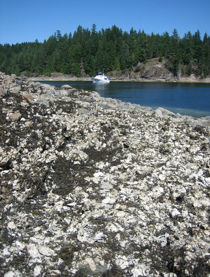
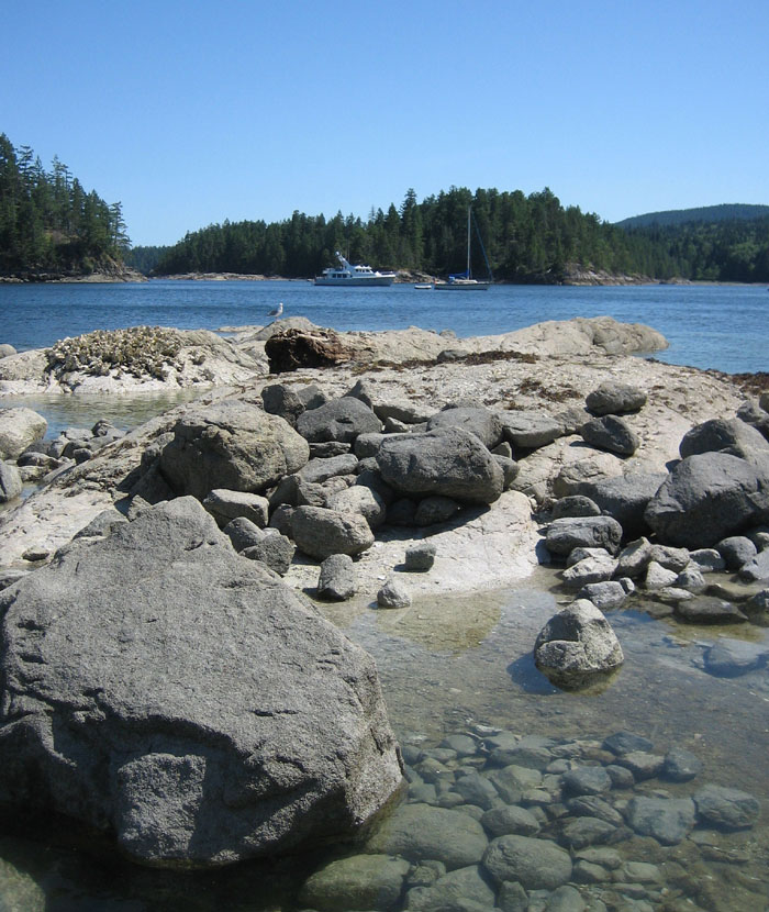
ANCHORED OVER A WRECK We have the perfect anchorage spot as it has a funnel view of the strait outside. We are parked right on the outer side of most of the boaters who are anchored here. We realized later after studying the chart in more detail that we are probably anchored just over where there is supposed to be a ship wreck. That’s just our luck. I hope we don’t have a problem getting the anchor up in the morning. Further reading tells us the bottom of this cove is said to be strewn with logs and old tangled anchors so though peaceful looking now I hope it won’t decide to snag any of us leaving in the morning.
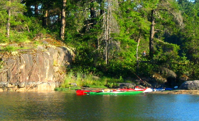
KAYAKERS SET UP CAMP
FREE LOADERS I can see a resident pod of Canadian geese going from boat to boat looking for free scraps. Now they are headed to the kayakers’ island. They’ve sure got us humans figured out as they get free snacks everywhere they go.
OBNOXIOUS GROUP There’s not one squirrel in Squirrel Cove that we can see but there sure are a lot of boats coming in. It was so quiet and peaceful until a group of sail boaters started filing in. It wasn’t long before this obnoxious group started dingying over to each other’s boats and start partying, drinking, yelling at each other, playing music and completely ruining the anchorage’s peacefulness. Then to top it off we got a cell phone call from some resort in Las Vegas wanting to sell us ome time share! I guess it’s not so desolate around here after all. So much for “desolation sounds” and listening to nature tonight as these partiers went on well past 10:30 PM when I think we finally dozed off even with all the noise. It’s more of a challenge these days to find some peace and quiet than anything I think. TOWN OF SQUIRREL COVE The town of Squirrel Cove is quite a dinghy ride away from the anchorage. As I mentioned it’s on the left as you come in the entrance leading to the opening of our protected cove. There are a few buildings perched on the side of the hill and a public dock out front. Just over the hill on the other side is the small village anchored by a church with a steeple. I would love to have explored the little village if we had stayed longer as it looks so inviting. The store we read sells fresh baked Cortes Island bread which sounds pretty good right now too.
SQUIRREL COVE TO YUCULTA RAPIDS We get everything started at 10:00 AM and leave at 10:15 AM so that we will time our arrival at Yuculta Rapids at slack. If we arrive at slack we won’t be fighting the rapids that run through the narrows. It will only by a 2 ½ hour trip today depending on how much we decid to explore along the way or if we head up Teakerne Arm to see the waterfall. Well, the rowdiest of the drunken sailors are still asleep and most of the rest of us left before they were up. We bet they are still sleeping, probably hung over. I felt like yelling a bit to wake those that ruined the peacefulness of this place last night but didn’t. That place turned out to be a crowded little anchorage. There must have been twenty boats in there by the end of the evening. We saw our first eagle last night soaring high over the anchorage.
ANCHORAGE WITH NO PROBLEMS Well, I’ve got to admit, I was a bit intimidated after reading the cruise books warning of the dangers of pulling up logs and debris or getting hooked on a wreck down below in this anchorage. We pulled the anchor up without a hitch and so did 20 other boats. Makes you wonder about those books sometimes. Not one boat pulled up a log or tangled with all those supposedly abandoned anchors. Even us, who had supposedly anchored over a wreck, didn’t get hooked to it. I was nervous all night after reading the warnings about where you could and could not anchor safely, some of the guides completely contradicting each other. Somehow, comically we all pulled up our anchors and headed out as if it was the cleanest bottom in Desolation Sound. (Better off for me not to read those books until after I have left a place. I must remember that as it happens over and over again.)
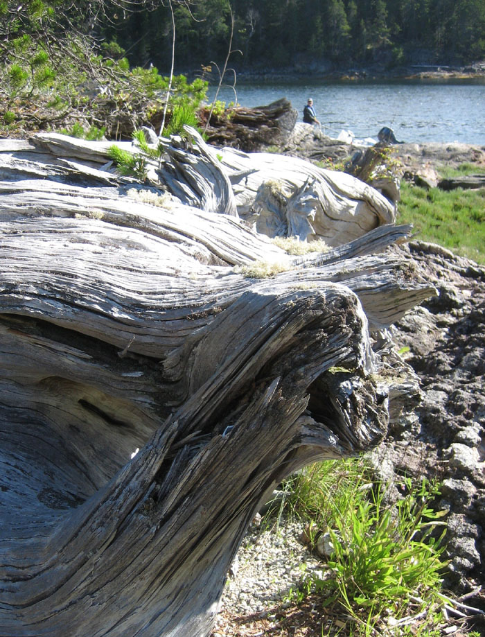
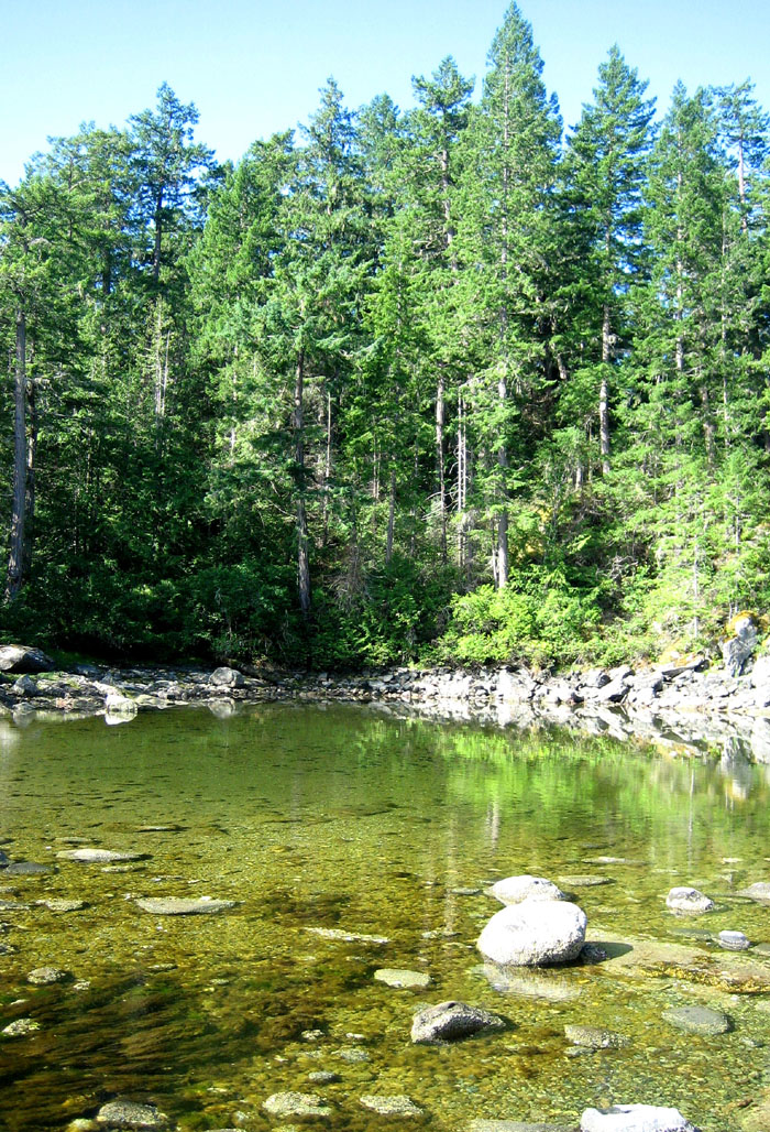
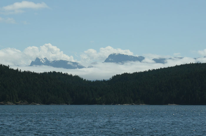
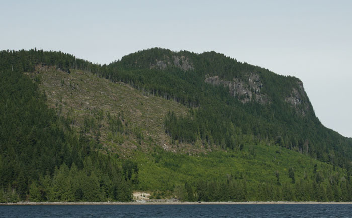
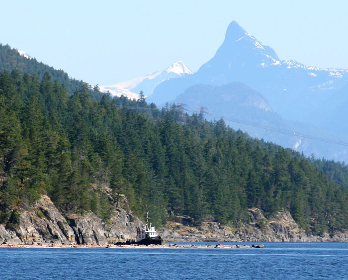
ADMIRING THE SCENERY The landscape is a multitude of hills and mountains, covered in forest interrupted only by some clear cut logging and sporadic black granite cliffs. The few rocky beaches are strewn with silver weathered driftwood logs, lots of them. The dark ragged mountain peaks are covered in snow and though it is a beautiful sunny day those mountain peaks are softly enveloped in gauzy cottony clouds. The temperature has chilled down a little as the Front has come and gone. It’s 64 degrees out, winds are about 22 knots soon to be on our nose as we make our way up Lewis Channel heading NW. The seas are just a bit choppy, though no white caps and occasionally across the expanse we see a few sailboats, those are the ones that were our sober nighttime anchorage partners. Their white triangular sails full and standing out crisply against the dark green backdrop of the forest and rocky cliffs. The drunken sailors are still asleep missing this beautiful morning. We hear a rattle and Larry tells me to go find it. It sounds like it’s at the water line by the starboard stabilizer. I tell Larry where I think the sound is coming from. Larry goes to check it out and it’s merely the side door. The handle was not turned shut completely.
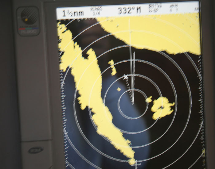
DEPTH OF PERCEPTION AND TRUSTING THE RADAR While I was watching the helm a tug and log tow appeared ahead of us up the channel. As I mentioned the spaces become huge up here and things seem to be a bit of an optical illusion as spaces are much bigger than we think they are and angles are different. We see the tug and both of us discuss which side we should pass him on. He seems to be coming down on the right side of the channel coming straight towards us. The proper thing to do would be to pass port to port but he looks like he’s on our side of the channel. Larry starts to turn the boat to the port to pass starboard to starboard. I look in the binoculars and it looks like the right decision but then I look at the radar and it’s not. The tug according to the radar is on the left side of the channel. We can see the dot of the tug and a ¼ mile back the huge mass which is the log tow. We finally agree that he must be on the left side of the channel though are eyes say differently. So we head over as if we are going to go straight at him but as he gets closer he really is on the left side. We trusted the radar rather than our own eyes and it proved correct.
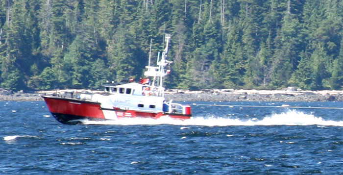
WORKING CHANNELS Before we made our move in the channel we tried to hail the tug on several working channels but he never answered back. Later we called Comox Radio (Comox Coast Guard) and asked what channels they monitor. They answered back immediately channels 6 and 10 and traffic control stuff is on 71. That just confirmed what Larry said but the tug still didn’t answer. The Canadian Coast Guard is really on the ball up here. They answer immediately to distress calls or questions and if anyone is chit chatting on 16, they get on their case immediately. When they come on the radio with an announcement, they speak clear and precisely unlike the garbled stuff we get from the US. We love the US Coast Guard also but wish that they wouldn’t put these young kids on the radio that don’t speak clearly, as we can rarely understand a word they say. God it is beautiful up here. Even a cruise ship would feel small here. I’ve forgotten what a rare and breathtaking experience this is.
The current is running down the channel with the wind and now we think we just switched where the currents switch to head north to Queen Charlottes. We’re making 9.10 knots. In fact Larry has slowed the engine down because we’re getting a little push. Otherwise we’re going to get to the rapids way too early.
NO INTERSTATE HWY UP HERE
GOODBYE TO SUNSHINE, DESOLATION AND HELLO TO THE INSIDE RAPIDS We’re now leaving Lewis Channel and coming to an area were several channels meet. We continue in the same direction to Calm Channel. Once we entered Desolation Sound we officially left what they call The Sunshine Coast. It looks like it’s true as ahead of us facing north, there is a dark cloud cover and behind us we’re leaving the sun. The clouds hover over the tops of the mountains decapitating many and some just circle them like big thick necklaces as we see the tops proudly protruding out covered in patches of snow.
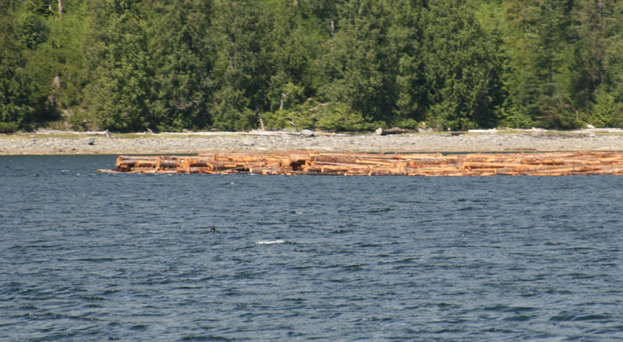
Off to my right I can see a pile of logs. The loggers have cleared the hillside and have slid the cut logs down the hillside to collect at the bottom in the water. I guess soon a tug will come by and pick them up and tow them south like the ones we’ve seen them doing along the way further south.
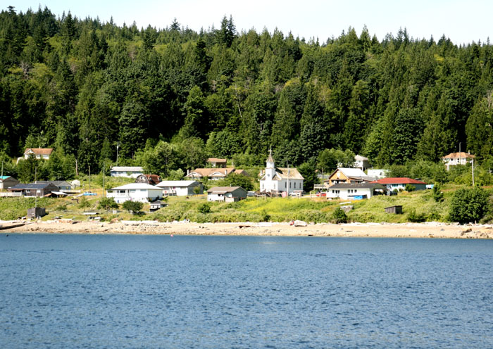
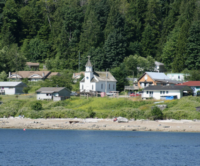
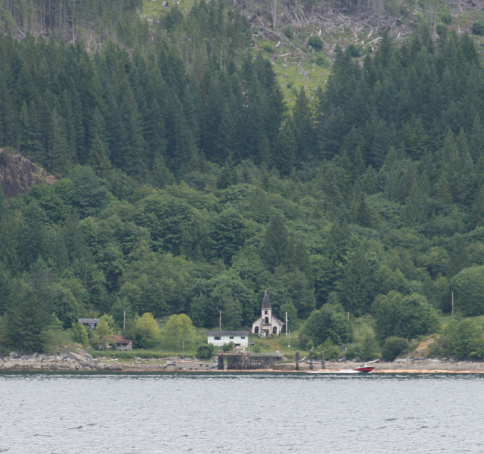
CHURCH, NOW A GHOST TOWN
We can see the pass ahead where Yuculta Rapids is. In the background is a large green mountain with a big logging road zig zagging down the face of it as they have been busy up here clear cutting the heck out of things.
BIG BAY, A SAD SIGHT As we approach the rapids, we take a quick glance off to our right to see where Big Bay Resort used to be. It was sad to see the docks gone and the place empty as we had such good times there. A lot of history lost when they closed that place. What a sad sight.
OH, HO HUM, THE RAPIIDS ARE SLACK The rapids are slack and we hardly are aware of them. It was kind of disappointing as I was looking forward to some excitement. Guess Larry timed it too perfectly.
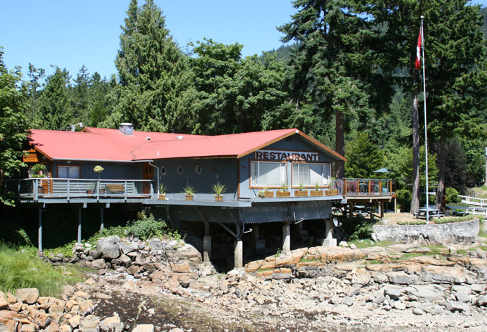
DENT LODGE We hail Dent Lodge our destination for the next couple days and make arrangements to come in to dock and end this beautiful cruise today.
|

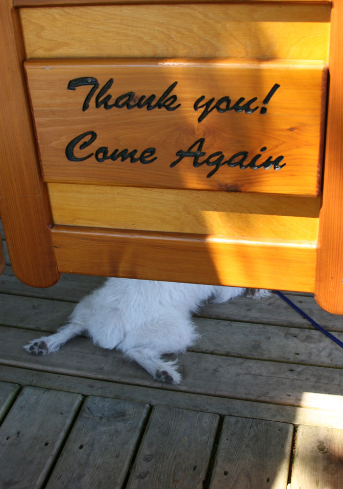
 ZIGGY’S STILL ALITTLE OUT OF IT
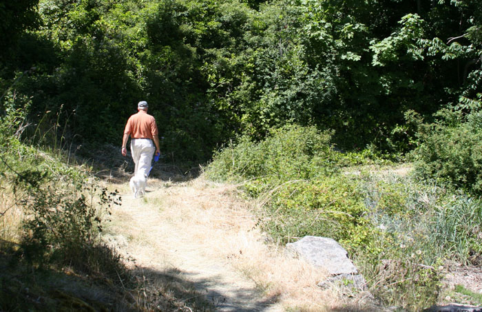

 Still ahead we see lots of cottages
populating this remote shoreline and in the distance, finally, the land at the
end of the Pan Pacific Highway. We’re lucky to have been here before it’s
become so populated even though it was only a few years ago. I envy those
before that that came here when this was truly a wilderness. That was the real
adventure. Pretty soon they are going to be putting in a #@* freeway up here so
all these people can get to their weekend cottages. What a pity that would be.
That would be the end of the romance and mystery of this area.
Still ahead we see lots of cottages
populating this remote shoreline and in the distance, finally, the land at the
end of the Pan Pacific Highway. We’re lucky to have been here before it’s
become so populated even though it was only a few years ago. I envy those
before that that came here when this was truly a wilderness. That was the real
adventure. Pretty soon they are going to be putting in a #@* freeway up here so
all these people can get to their weekend cottages. What a pity that would be.
That would be the end of the romance and mystery of this area.