|
|
|
SHEARWATER TO KHUTZE ANCHORAGE
We left Shearwater at 7:45 AM. M/V Mary One left before us. They were a little nervous leaving because the marina had them crammed in really tight. They were really packing them in yesterday. One guy in a big boat, that was planning to leave his boat here a few weeks while he flew home, wanted Mary One’s spot on the dock in the worst way because the power was better. He was getting very anxious for Mary One to move as he had a water taxi to catch to take him over to Bella Bella where he was going to catch a 60 passenger plane back to Prince Rupert and then on home to Washington. We were surprised to hear they had airport service that could take that many passengers. We were wondering if that has always been the case or because of the new popularity of all these fishing resorts has made it profitable for the air lines to provide that service.
We head out towards Seaforth Channel leaving Bella Bella on our port and stern. We took one last glance back to Old Bella Bella and the new Coast Guard Station. The day is wet and grey and lonely looking. We head out past Dryad Point light house and into Seaforth Channel which is flat as can be. We’ve got about 10 knots on our nose and we’ve got the wind shield wipers going on all the pilot house windows as it’s raining. The clouds are hanging low and off to our right they are thick and foggy.
The Mary One is in the grey distance ahead. We’re making time on them. They said they are headed to Laredo today. Not sure where that is but will look it up later when we don’t have to anticipate going through Reid Passage up ahead just before Ivory Lighthouse.
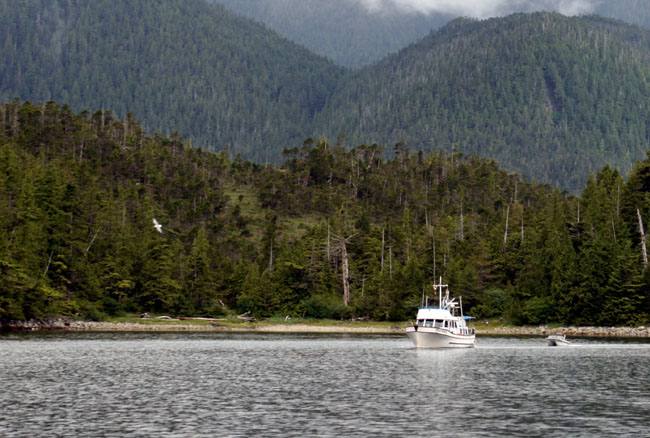
OH, THAT REID PASSAGE If you check our Alaska Trip 2002 log you’ll see we had a hair rising experience going through that rocky narrow passage when our steering locked up and we were heading strait towards the rocks with zero showing below us on our depth sounder. So we both had a lot of anxiety thinking about going through again and this time with a bigger boat. It shouldn’t be any problem though. Seaforth Channel is so calm that now we’re thinking about skipping Reid Passage and going on the outside to save time but as we get closer we see elephants on the horizon. That means big swells and seas. As we head further down Seaforth there’s a white dot in the distance and it looks at first almost like a spot of sunlight. It’s a cruise ship though. Larry said it makes sense to see one about this time because they leave Vancouver on Saturday nights so that would be about the time they would be passing this area. We see dull patches of sunlight coming through the clouds. I hope the sun will come out. It’s been pretty dreary around here lately. We’re gaining on Mary One but I ask Larry to slow down so they can go through Reid Passage first. It’s always more interesting to have a boat ahead of you in your pictures for scale. Otherwise it’s just more trees, mountains and water. It’s such a pretty area that we will be going through that I thought it would be nice to see a boat in the picture too. LET’S GO ON THE OUTSIDE, HECK WITH IT As we got closer to Ivory Light we decided to go on the outside as it was so calm out, so Larry calls Mary One and tells them we’re leaving them at this point and wishes them good cruising. Mary One asks us to call them back at some point and let them know how the seas are out there on Milbank Sound.
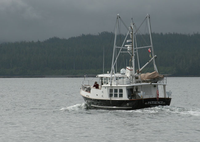
M/V PATIENCE HAILS US To our surprise and shock we hear an old familiar voice on the radio. It’s one of the boats that we cruised with during out Alaska 2002 trip. It was M/V Patience hailing us. We say “hello” and in the distance coming out of Reid Passage we can see it’s them. We watch them coming towards us heading the same way we came out, but they’re heading down Seaforth Channel to Shearwater. They’ve been cruising Alaska and are heading home. They said it was a short trip this year as they had some engagements they needed to get home for. We passed and waved to each other and Ziggy barked a big “hello” though I’m sure he hasn’t a clue who or what we were waving at. It was so great seeing them again and hearing their voices. We were so sad we missed them at Shearwater and didn’t have the opportunity to catch up and visit. Larry takes advantage on the short radio conversation to pick Bill’s brain for some anchorages. They are seasoned cruisers up here and know all the best places and all the ins and out and the trouble spots to stay away from. We said we’d hope to see them in Friday Harbor at the tail end of our journey and wished each other safe journeys home.
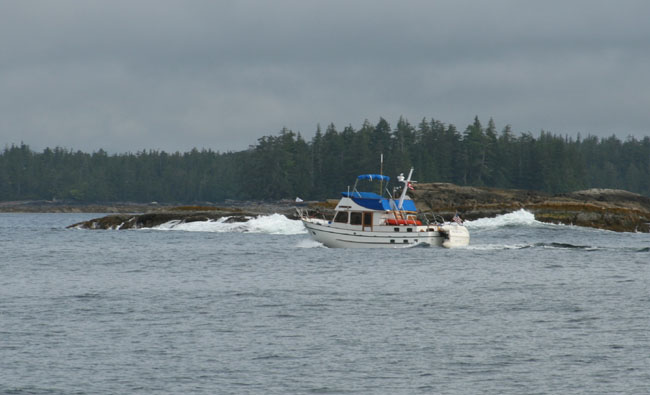
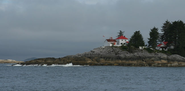
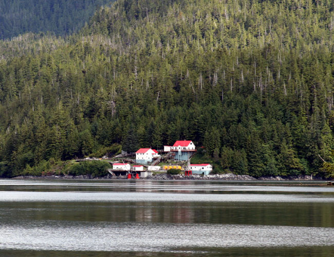
We watch as Mary One heads into Reid Passage passing some waves crashing on the nearby rocks. The sun is glistening on their boat in the midst of all this foggy haze of grey. We see Ivory light which is so beautiful. The red and white buildings stand out against the grey rocks and green foliage so bright and cheerful. Our friends John Alexander and Cheryl Fortier (www: ????) who made this trip in their 1949 Chris Craft managed to stop and visit the Ivory Light House keeper which they said was no easy task. They said he was happy to have visitors and made them cookies. As we go by I wonder how in the world they managed to stop there as it looks very rough and rocky.
MILBANKE SOUND As we head out into Milbank Sound we begin to feel the swells. They are large but far apart and not steep. It’s a bit scary to me being out here in the swells but I soon get used to it once I see the boat again handles them so well. The swells are about 6 foot tall with a period of 10 seconds which is a very smooth ride. OK, now I know what that feels like. Even though we’ve been through much rougher seas on our trip south through the canal and up the East Coast, I’m always nervous about new places thinking there is going to be some kind of weird thing we haven’t experienced. We are certainly experienced in these kinds of seas but I’m still a little nervous about these northern waters. At least we can see land and are heading towards a channel far in the distance that we will be back into the protection of the land. Reid Passage is a beautiful passage and on a clearer day it would have been a passage I’d regret not seeing again but today the magnificent tall hill tops are sadly decapitated by these grey depressing clouds. We pass a stick sticking up which is the top of a big dead head buried under the water. That is scary. That’s what you have to watch out for around here. Ziggy is a little nervous and has a worried look on his face and Larry picks him up to comfort him. Our chart plotter suddenly lost our route. Larry had to turn every off and reboot. Soon we have our course back again. Mmmm modern technology. We hear on the radio boat traffic channel that a boat that will be at Mc Ginnes Point at 10:20 AM. Her name is Radiant to the Seas. There’s also a cruise ship coming up behind us in about an hour. We can hear Prince Rupert Traffic telling him: “if you are more than one five minutes off your float plan you are to let us know.”“ He answers back: “Roger”. We’re off Cross Point now. The swells are still here but they are smooth and there isn’t a wind ripple across the smooth swelly waters. We’ve got 8 knots on our nose. All is well. I look out ahead and it looks calm and flat. There is a speck on the silvery horizon line of the ocean. It’s a red marker identifying some dangerous rocks.
There’s something very lonely about this kind of boating on these dark dreary days. The rocks on the shore are dark jet black and look jagged and unfriendly. It’s kind of nice being on the outside though as we don’t have to deal with all those rapids and timing and rocky narrow passages.
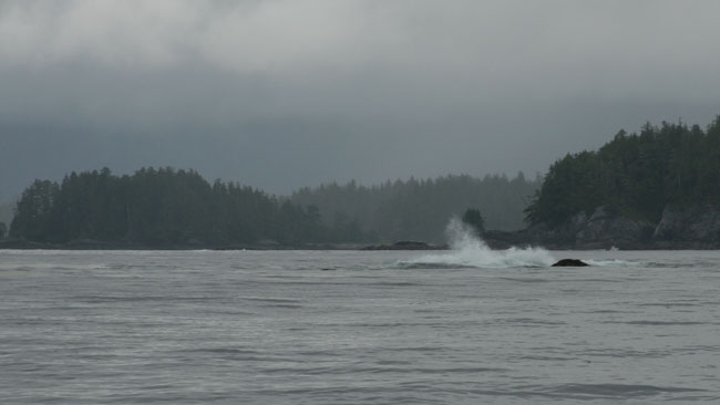
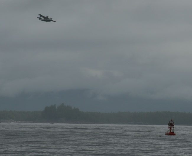
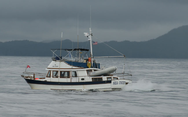
WHALE ROCK Just off Moss Passage is Vancouver Rock. It’s the strangest rock I’ve ever seen as the swells roll over it in such an odd way that it looks like a group of whales spouting and splashing. It’s right by the red buoy. I go outside to take a picture of this strange thing and a float plane appears out of the clouds and flies right over. We go by a lot of gunk in the water. Looks like a cruise ship dumped its poop. Wonder what the accepted method of disposal is on a cruise ship is up here. Ah finally a boat. We see a trawler go by in the opposite direction. It’s a Canadian vessel and its name was Sea Chief. He doesn’t wave back.
The weather seems to be opening up a little and we start to see a bit of a green tone to all this monotonous grey whiteness. The clouds are breaking up now and becoming a mixture of white and dark and very puffy. They look like balls of cotton. The shores are rocky and black. The white foamy waves contrast against them sharply as they pounding away at them, creating brilliant splashes, each one more spectacular than the next. They crash, and then disperse into huge fans of spray that shoot up into the air with such beauty and power. They hit the rocks with such power and then fling back their newly created arms spread wide as they ride up into the air, out and down, over and over again. Instead of the usual mountain images of steep forested side that come straight down to the ocean clifflike, here the mountains level out before they reach the water’s edge. They look like big giant slides. It is such beautiful scenery.
LEAVING MILBANK SOUND As we begin leaving Milbank Sound and begin our turn into the protection of the wide mouthed entrance to Finlayson Channel, we pass several low lying islands. We both admit it was some what of a relief to have gone out through Milbank Sound which allowed us to avoid all those time and energy consuming passages and narrows. It felt somehow like we were cheating or we had it easy today. We’ve passed several floating logs today. I guess the storm we had the past couple of days has washed them out of the streams and inlets. As we began to enter Finlayson Channel we hear M/V Sea Chief hailing a fishing vessel nearby. He asks him to standby as he tells them their engines have overheated. The fishing boat acknowledges and says they will stand by. A few minutes later Sea Chief comes back on the radio and says they’ve checked their intake valve and still don’t know what the problem is and would appreciate if they could stand by for a few more minutes. The fishing vessel comes back and says “No Problem, if you need some help we can send the skipper over in the skiff to check out the problem.” Sea Chief sounds relieved and says “Thank you, we’ll see if we need him.”
There’s an island in Finlayson Channel that looks like a pyramid as you approach it from Milbank Sound way. That’s where you turn to go down a narrow passage on its left side to go to Klemtu, an Indian Village. Mary One said Klemtu isn’t a good place to stay because the boats go back and forth through that channel and the wakes are terrible at the dock. The Indians though, we read, have new docks and are really trying to encourage cruisers to come there as opposed to years of what we heard of being unfriendly to boaters. It is flat as can be out here. We only have about 2 knots of wind behind us. It couldn’t’ be a better day. The visibility is clearing up as the High is approaching again. Never did hear anymore about Sea Chief, guess we are out of range. Sounds like the fishing boat will help them out though so not to worry. As we are approaching Klemtu Passage it
looks so wide but on the chart it looks so narrow. You’d almost think you
couldn’t fit looking on the chart.
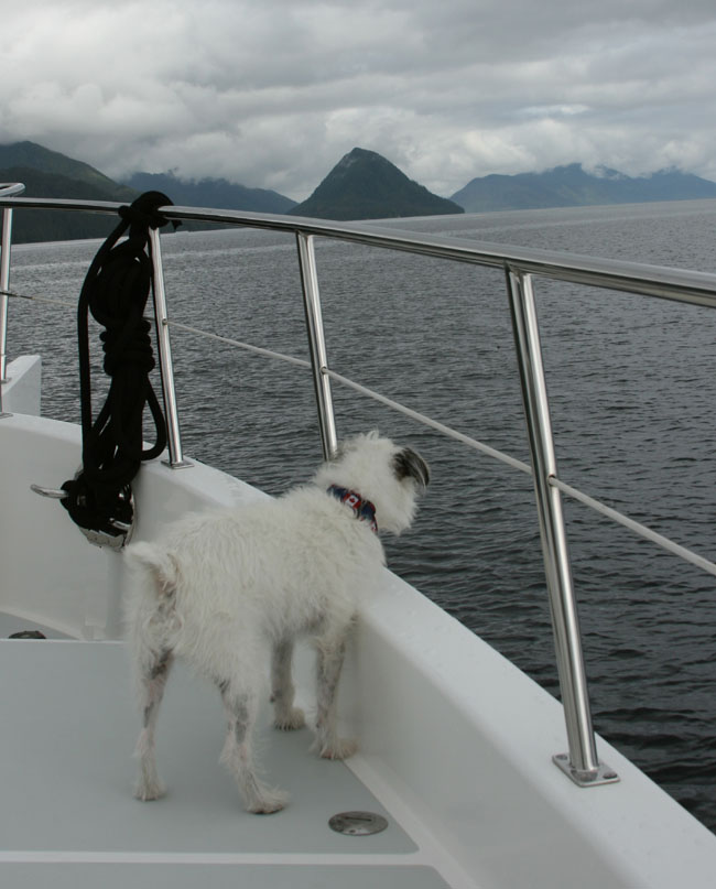
KLEMTU PASSAGE IS SO BEAUTIFUL As we’re coming through this beautiful Klemtu Passage Ziggy wants to ride out on the bow. WELCOMING DOLPHINS
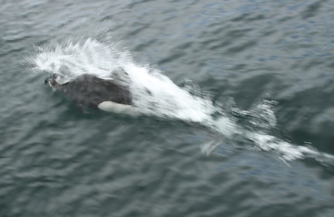
Suddenly he is barking at the water from
the bow sprit. I can see water splashing out but the sea is flat calm. I go
out on the bow with Ziggy and discover we’ve got dolphins escorting us into the
Indian village. I do my best to hold Ziggy suspended between my legs with all
fours running full motion in mid air while I try desperately to get a picture of
these beautiful welcoming dolphins.
WHITE OWL
Oh, my gosh this is soooo beautiful through here. It’s so protected and the landscape reminds me of being on a lake. I see what looks like a white owl flying over the channel as another boat slowly comes down the opposite direction. The owl flies over the passage and buzzes the boat. What is it with these Indian villages and the animals and dolphins?
INDIAN VILLAGE
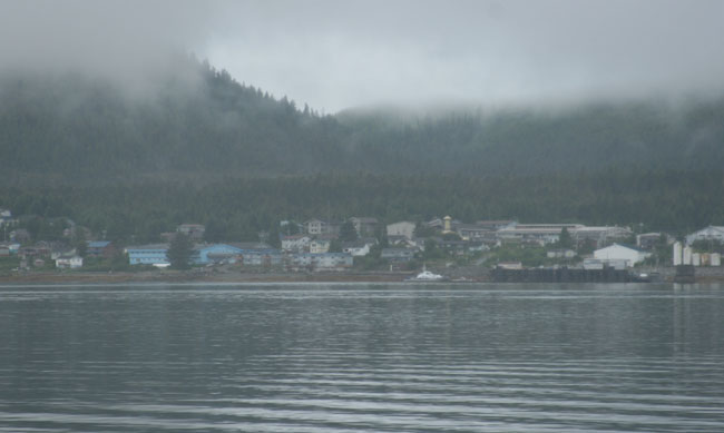
We pass the little village at the base two tall mountains. It’s nestled in the crotch of the valley and is magnificently picturesque. An eagle soars above the village. We see their new docks and two pretty big boats are docked there so doesn’t look like there is extra space today. It is exposed to boats going by that may not be considerate of their wake but it’s nothing like other places we’ve been for instance like NYC. I think we could’ve handled the wakes with no complaints. We see their beautiful new Long House out on the point and it looks so beautiful there. The Indian “calligraphy” or paintings on the face of it are clear and crisp from a long distance away. The place is so quiet, we don’t see a soul. I think this would be an interesting stop.
BOAT BLUFF LIGHT HOUSE EMAIL FROM JOHN AT BOAT BLUFF
We continue on and go through Jane Passage where Boat Bluff Light is. John Alexander said you can get Wi Fi there as you ride by so Larry checks our connection and sure enough we got our email in an instant as we went by and ironically we got an email from John!! We see a sea plane about 3 miles up ahead coming this way straight up the channel using it like a suspended road. We see lots of fish jumping out of the water and little birds scooting across the water in front of us. It is a spectacular area, well worth the passage. I’m beginning to think there really is something mystical about these Indians and the places they live. Each place we visit of theirs seems to have some unity or tie between nature and the people and the land. I can’t explain it, you just feel it. It’s mystical and beautiful and strange. I must be getting a little crazy.
M/V SEA CHIEF We hear Sea Chief again on the radio! Now he’s hailing the Prince Rupert Coast Guard. He tells them that they have been picked up by the RCMP (Royal Canadian Mounted Police) who have taken them to a cove and he just wanted to make sure before they left that he could reach the Coast Guard by radio to arrange for a tow back to Shearwater.
Well, we have our last glance at Finlayson Channel and now head up into Tolmie Channel. It hugs nicely along side Princess Royal Island on our left and over the top of us another sea plane or maybe the same one flies over us and up the channel in the opposite direction from the last one, following it like we do, flying low and turning up the channel as it does. We hear a call hailing us. It’s from Mary One. They just came out of Jackson Pass and wondered how our trip around Ivory Light and Milbank Sound was. We told them it wasn’t bad at all, that the swell were 6 foot but far apart so it was a nice cruise. They said their transit went well also. As we pass Cougar Bay and we hit the current and it drops our momentum down about two knots.
The scenery up this channel scenery is spectacular. We can see down the channel for miles past dozens of layers mountains all layed out in a perfect perspective landscape as the mountains curve softly down to the waters edge. The mountain silhouettes are only separated by different tones, shadows, sunlight and depth.
NO BOATS FOR HOURS We haven’t seen or heard any boats on the radio for hours now. Think how amazing that is to travel for hours in this modern crowded world and never see a soul. I guess that’s why we boaters like to come up here. Finally though, a white sailboat appears motoring down the channel and heads into Heikish Narrows. We’re thinking about anchoring at Khutze Bay. We read up in the cruising books about the bay. It sounds like it might be a tough anchorage as most of it is too deep and where it is shallow there may not be much swinging room. We’ve heard it’s beautiful though and are determined to go there.
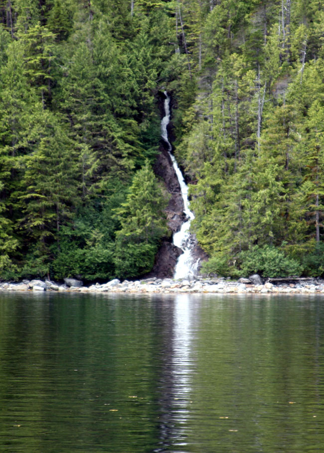
WATERFALLS We’re starting to see lots of waterfalls created by the emptying lakes tucked up high back in the nearby mountains.
We are passing a widening in Tolmie Channel by Swanson Bay. It’s another possible anchorage if Khutze is full though it looks very open to the channel. We see a tall brick chimney projecting over the tops of the forest. It and some crumbling posts left from their dock are all that remain of the old sawmill that was very important way back when there only were hand loggers in this area. This are was popular for the sole logger before the days of chain saw a A-frames as they only used axes and the steep sides of the mountains made it easier for a single logger to slide the cut trees right down into the water. The sawmill bought all their logs and cut them and readied them for towing As we are nearing the marker at Khutze Inlet. The channel up ahead is looking fogged over. The winds have picked up to 20 knots and they are rushing down the channel hitting us straight on our nose and the current is going with it, so we have two strong foes against us now. We have about 22 minutes until we reach Larry’s final waypoint just inside Khutze Cove and then we’ll be out of it. We will then edge our way around the green spit where we hopefully can find enough room to anchor and lay out the chain with enough swing room. Our other option is to go further into the cove, another 45 minutes, and try to anchor right in front of the waterfall on a small mud ledge that drops off very quickly into depths that are way beyond anchoring depth. Hope the first option works. I’m thinking if neither works we’ll have to come back out and head up the channel in the fog and go to Hartley Bay, another Indian village. Or, we could go to Bishop Hot Springs, another two hours. Maybe we could go to Butedale but everyone says it’s falling down so bad that we might not be able to find anyplace suitable at the dock. Let’s hope the first option works.
At first we thought it was pronounced Khutze Inlet (like cutzie) but its proper pronunciation is like “cutes”. It’s far from cute though it’s majestic, breathtaking, and quite colossal. There’s nothing serene, pretty or cute about this place. The guide books weren’t too encouraging about the anchoring as it sounded a bit like a challenge. The inlet is long, about five miles long and it’s about a mile just to get into the Green Spit. According to the cruising guides those are the only two anchorage locations recommended it’s too deep everywhere else.
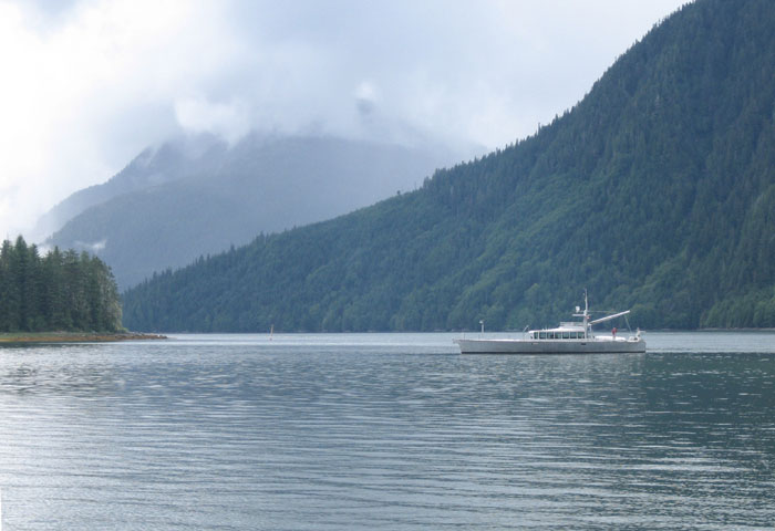
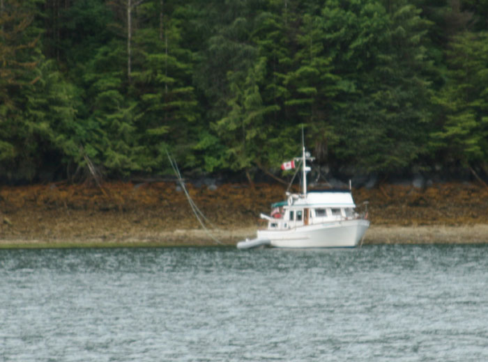
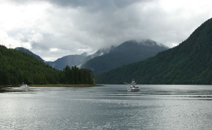
GREEN SPIT ANCHORAGE Heading to either anchorage you have to head in past the Green Spit. We headed in slowly and hugged the north side of the inlet as the Green spit stretches out across much of the inlet with a deep enough opening on the northside. You really can’t see the opening because mch of it is under water and dangerously shallow. (I guess they call it the Green Spit because it’s under the green water?) Just behind the Green Spit is the first possibility for anchoring, well except for the person that wants to anchor right in the “fairway” of Green Spit (as mentioned above). The “first possibility” is where the stream empties out in the center of a beautiful flat grassy meadow at the base of two huge mountains. (I always associate a green grassy meadow by the shore line a good chance of sighting a bear or wildlife grazing in a place like this dusk or early morning so was anxious to anchor as close to this as possible.) The only problem, there is only a small mud shelf there to anchor on left by the run off of the stream and then it drops off dramatically to deep waters too deep to anchor in. SECOND POSSIBILITY The second anchoring possibility is to head in the inlet another 5 miles to the end where there is the out fall of a large waterfall. There according to the cruising guides you have an even smaller shallow ledge to try and hook your anchor on. To do this one you have to drive your bow right up to the waterfall, drop the line and back her down hoping you’ll get a bite. If you do, the flow from the waterfall should keep you anchor hooked and keep you from turning in the tide. You will be anchored right at the falls and hear nothing but the beautiful sound of the powerful waterfall as it drowns out the sound of anything else. I’m not sure I would like. I think it might make me nervous. I like the idea of hearing was going on around me, especially what’s going on with the anchor. WE'RE TIRED AND WANT SOMETHING EASY We had a long day of cruising, about 7 hours or more, and just wanted to go for something we thought we could handle. It was going to be challenging enough to try to come close to shore and hook the anchor on a ledge by the stream. Here’s where the cruising guides are a bit confusing I thought and in some ways contradicted each other. One says don’t anchor in front of the stream. Ordinarily we thought that anchoring in front of the stream would be good as the out flow from the stream would keep your anchor in place and hooked. So if we don’t anchor by the stream in the shallow area that only left a small shelf to anchor on the right side of the stream. Another guide says anchor in the fairway of spit. To us that meant right in the opening that you have to go through to get around the shallow spit. To us that didn’t make sense because if you are anchored there aren’t you in the way of other boaters trying to come in to Khutze? So confused about the recommendations we decided we’ll study the charts and depths and when we get there we’ll see what seems right and go from there. So, we head feeling some anxiety about this next challenge. As you head in to the anchorage you don’t see the opening immediately and then you finally figure out that there is no visible opening because the green spit is under water and the entry looks mistakenly wide open. Some concerned soul though has put a rustic post sticking up marking part of it spit, I guess as a warning. I’m sure there have been many mishaps here over the years. And, of course, someone has anchored right “in the fairway” per the guide so now anyone coming in here has to carefully maneuver around him and between the shallow invisible spit. We carefully maneuver Knotty Dog around the boat anchored in the fairway and also give the end of the invisible Green Spit as much space as we can and hope the chart plotter is right on. We watch the deep sounder diligently. We slowly head in and try not to create much of a wake for the trawler parked right in the fairway, though I think he deserved a bit of one myself. Once past this obstacle we see two more boats at anchor in the area where we wanted to anchor. One by the stream on the little shelf and the other right dab in the center of everything centered off the stream (which the book for some reason said not to anchor there). We were hoping we’d be the only other boat in here so would be able to pick our spot but no such luck so we hope that we can find enough of a ledge to hook the anchor on and also have enough swing room.
Right away we notice the large aluminum sail/power boat, anchored off the mouth of the stream, is M/V Sea Horse, the custom boat built by Steve Dashew that was on the cover of Passage Maker Magazine several months ago, actually has been the written about by various boating magazines. Our friend Dave Wyman from Santa Barbara told us she was up here cruising these northern waters. He will be taking her down to Southern California in the fall. What a coincidence to see her in this anchorage. Anyway, the other boat, a trawler, was anchored to the right or West of the stream right in the recommended anchoring location. He was right in the middle of the space which left only a small space on either side of him that we weren’t sure there would be enough room for us. He also had attached a stern line to the shore. Dashew was out in the center in 83 feet smack dab in the middle of the scenic area and looking beautiful and content and also right where the cruising book said not to go. Wind Horse is a big boat and will need space for a big swing so it looked like a good spot for him.
DANG IT, WE’RE GOING TO HAVE TO DO A STERN TIE TO SHORE Dang it, we realize we’re going to have to do a stern tie also. If we don’t we’ll swing into the trawler because we have to drop the anchor so close to him. We have the rope and etc. to do the stern tie, so that’s not a problem, but in all the cruising we’ve done so far, we have amazingly escaped having to go to all the trouble. This will be our first try.
HERE’S THE PLAN We’re slowly checking the area, checking the depths and we find the small ledge where the water gets shallow to about 40 feet. So, we decided we’ll drop the anchor here and then back it down towards shore and get it hooked. Then we’ll have to quickly and miraculously get the dinghy down to then try to take the stern line to shore and miraculously get off the dinghy and wrap a rope around a tree and snug it up. What a bunch of trouble. GOOD GRIEF, if we can pull this one off we will have advanced to another level of boating that I don’t even want to know about. We were also pretty tired after a long day out and I didn’t really feel up to this impossible challenge. Of course the winds have to always pick up right when we are doing something nerve wracking. So Larry starts the Gen Set and gets the dinghy semi set up so when the big moment comes to get the dinghy down off the fly bridge (which is a two person job no matter how you look at it) we will have eliminated several preliminary steps and hopefully, please God, we can get it down quick as we have to do all this while terribly close to the other boat. The tide in here is running a good clip right now and seems to be swirling around what ever is deep down below us, (probably that steep ledge).
HERE WE GO So, we turn the boat around getting our stern facing the rocky shore (same position as the other trawler) and slowly get the nose of the boat just in front of the ledge that drops from 40 straight away to 145 feet. We begin to drop the anchor and edge the boat back to hook it in the shallow area of the ledge. We get a good hook right away but the currents are swinging us right over towards the trawler next to us. I’m trying to keep us away from the trawler with the thrusters but the current is so strong that it’s taking everything we’ve got to try to stay away from it. We keep swinging precariously close to the boat. I’m thinking I can’t leave the helm with this going on to help get the dinghy down (which requires two people) and still hold Knotty Dog off this other boat. Even if we manage to get the dinghy down, it will be hard to hold her off giving Larry enough time to get to shore and wrap the stern line around a tree on shore. This is hideous!!! We both decide this is impossible in these conditions. So up comes the anchor again. If we only had the dinghy down we might be able to do this but this trawler is set firm and is not swinging with the current so it’s making it impossible for us. REGROUP Once the anchor is up again we regroup discuss our options. There’s not enough space here for us to do this with this other boat right in the center of the small ledge that we have to hook the anchor on. Wind Horse has the primo spot right at the outlet of the spring so there’s no option there. We decide to go to the other side of the stream. After looking at the charts we think there’s a small patch of shallow shelf there to drop the anchor on. FEELING PRETTY STUPID As we come around and begin to head over to the other side of the stream (also feeling really stupid about now) we see Dashew get off his boat and into his dinghy and head out towards us. We think he must be watching the troubles we’ve been having and is coming to tell us some info about the anchorage that will help us. So as he heads towards us we slow down almost to a stop and get ready to greet him and just as he comes close to reaching us he turns his dinghy around with his back to us and starts taking pictures of his boat sitting solo within this magnificent setting. He wasn’t coming to talk to us at all. We felt kind of stupid and sped up again heading over to try the other spot hoping at some point tonight we would find an end to this. We’ve only got a small spot to anchor in over here too. We head in and nose around with the deep sounder to try to see how much space we have. The chart says there is a shelf 36 feet deep and then it steps to a shear drop off to about 145 feet. We explore the space and the bow gets closer than we lick to the shear rock face of the shore as we explore our options. The area is not exactly as charted as there is a surprise 14 foot shelf in there but we think we have enough room to get a hook on a spot. This time we’re not sure if we’ll be able to get a stern line on the shore as the shore is like a steep wall of rock but we’ll deal with that later. Maybe we can just get her hooked and have enough swinging room without messing with all that stern line crap. At least over here the boat can swing in the current without hitting another boat while we get the dinghy down and do all that stern tie crap (excuse my language).
OK, HERE WE GO AGAIN We drop the anchor on the ledge and back her down but as we continue to back her down we are just getting too close to the rock ledge and don’t feel comfortable with the whole situation. We are getting really exasperated now. ENOUGH WITH THE DAM SHELF I tell Larry, “I think on one of our tries we hooked it better out in the deeper water.” We both decided to forget this shelf anchor stuff and just drop it out in the deep water like Dashew. We’ve had enough of this dam shelf. So we pull the anchor up (still leaving some down) and move out into the deeper water, drop a *%#@ load of anchor out and suddenly we’re hooked with no problem. All that business in the cruising guides about getting hooked on the shelf, and not anchoring in front of the stream, caused nothing but grief for us. We should’ve just come in and figured it out on our own. It was such a waste of time and energy and very stressful. WE’RE SITTING PRETTY We finally anchored in water 145 deep with a great bite and had no more problems for the rest of the night. Sometimes we think we make or think things much more difficult than they really are. This is a prime example of that. Dashew was parked in an area 83 feet deep in front of the stream against what the books said and had no problem either. So much for the cruising books at Khutze Inlet. We also didn’t really expect to see 3 other boats in here. What a surprise. Anyway, we had a good solid hold the whole night though we woke up about 1:00 AM as we heard the chain rumbling below but that was because we were turning in the tide. Then early this morning I heard it turn again. I also heard Dashew leave about 4:30 AM I think it was.
NO BEARS, WOLVES OR DEER Never saw any bears or heard any wolves. Just for the heck of it and because Ziggy likes it so much, Ziggy and I did a couple wolf howls that returned back to us in a reverberating echo out of the big mountain valleys. We watched a couple eagles hanging out peering down at us from their high perches.
We could hear birds sing and distant waterfalls inside the forest hidden amongst the trees and rock. I bet it is beautiful at the head of the Khutze Inlet where the waterfall is. We saw another boat come in late evening just before and head down the inlet as there obviously wasn’t enough much space for him where we all were. He never came back out while we were there so must have had good luck with the anchoring.
|


 IVORY LIGHTHOUSE
 LONELY PASSAGE


 KLEMTU




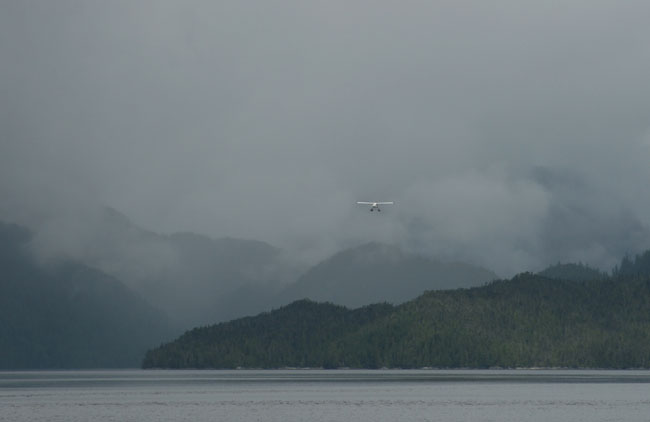 SEA PLANE FOLLOWS CHANNEL LIKE A ROAD


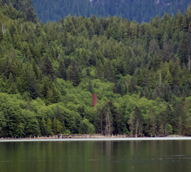 SWANSON BAY
 We
decide we’ll try to go in by the trawler and see if there is enough ledge left
for us between the trawler and the spring and not too close to Wind Horse.



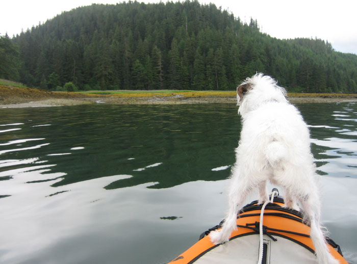 Zig
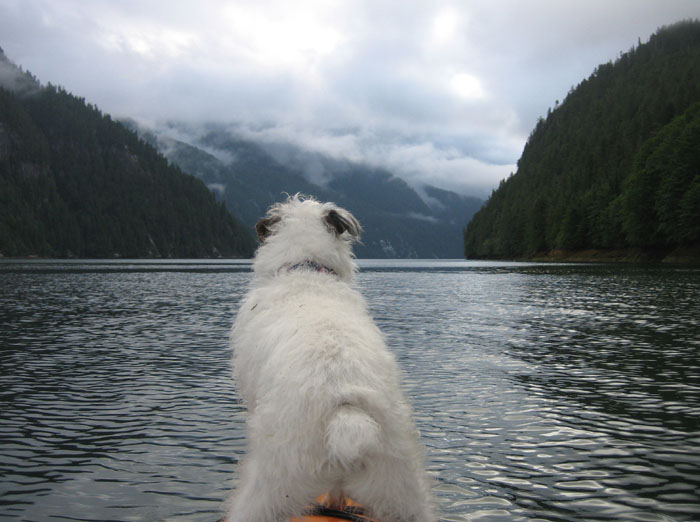
and I went to shore on the kayak three times to mess around and let Zig do some
business. I got a little nervous as he liked to go into the tall grass where I
couldn’t see him and I was afraid some wolves or cougars might snatch him up
quick if any were around. Our only predator if you could call it that were four
black loud mouthed birds that acted like a gang of rowdy teenagers, squawking
and dive bombing at Ziggy. They were especially raucous when Ziggy got on shore
which they made it perfectly clear it was their turf not his.