|
|
|
|
|
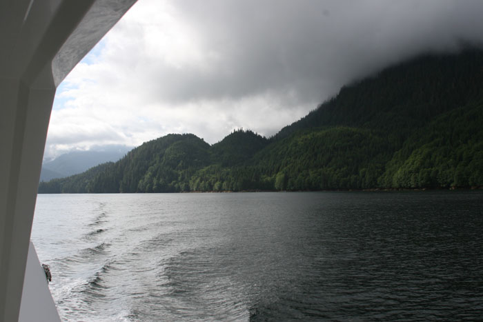
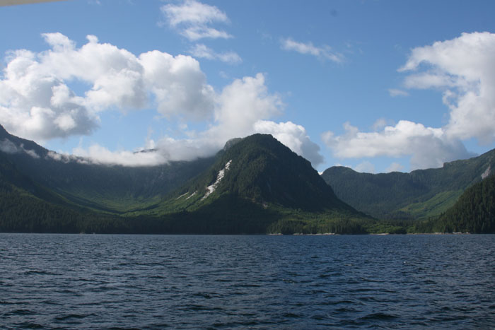
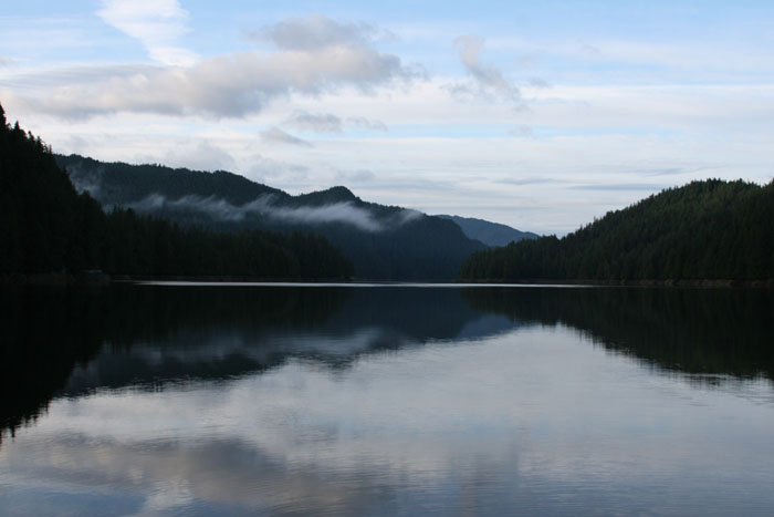
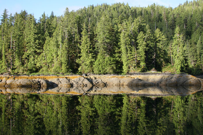
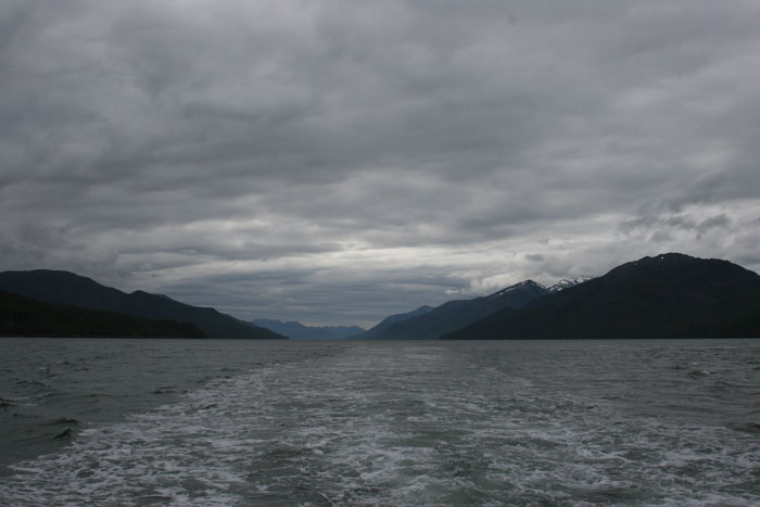
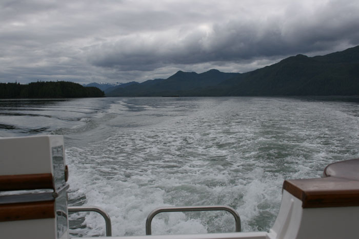
We are on our way out Khutz Inlet and soon back in the Graham Reach. The anchor came up fine, all 275 feet of it, and at mid point a big starfish came up with it too. I was on edge though as I manned the helm and watched as the depth sounder kept flipping from 145 feet deep to sometimes to between 7 – 15 feet deep. I think it was that strange little hump that we noticed when circling the ledge that we tried to anchor on yesterday. It was a mystery to us as while we were at anchor every once in awhile that shallow depth alarm would go off. Larry thinks there was something underneath the boat floating by that was alternating the reading, but what could it be? Guess we’ll never know. As we came out into the channel there are flickers of little white caps. They are very active white caps that look like a miniature swift dolphin skipping across the water. We’ve got 28 knot winds from the south which will mean on our stern much of the day. We are leaving on an ebb tide so we’ll see which way it will ebb. We have an extra low tide today, full moon and all that comes with it.
A MYSTERY TO ME It’s very calm out. Now surprisingly we
have about 15 knot winds from the north. These winds are confusing in these
waterway valleys as the mountains funnel the winds in all kinds of unexpected
directions. They can funnel down the inlets and meet up with winds coming in an
opposite direction in the main channel. Also depending on the ebb and currents,
the waters meet at these intersections and the mixture of winds and seas create
unexpected turbulence. It’s always seems like an unpredictable mystery to me. Wowa! I rush to get my camera to take a picture of a particularly beautiful inlet. The morning sun is just beginning to peak through the clouds when suddenly Larry says “Watch out. Hold on.” I turn quickly and say “What?” He turns the auto pilot dial sharply to the right and I grab something to hold on too. We turn just fast enough to miss a big knarly log that he didn’t see until the last moment. Oops, sharp turn, then sharp turn back to course.
DOLPHINS SPLASHING OFF THE BOW That starts Zig to whining. He always reacts to my voice or tensions or calmness when we are cruising. I guess he must sense something was wrong with that last quick turn we did and it did scare me for a moment. But, no, this time he hears dolphin splashing off the bow. I get my camera again but just that quickly they are gone in a flash. We’re now at a fork in the road so to speak and we make a left up Butedale Passage just south of Work Island. We’re now riding up Fraser Reach towards Butedale.
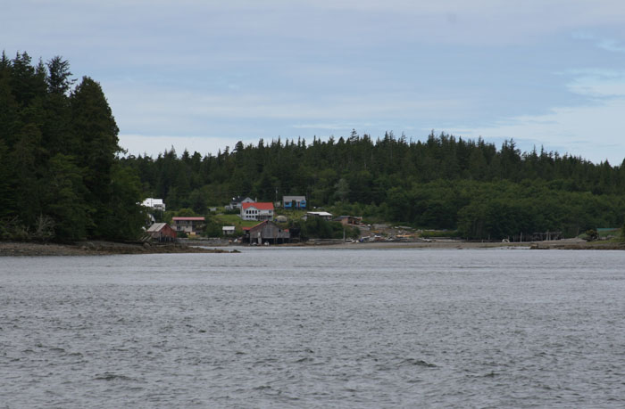
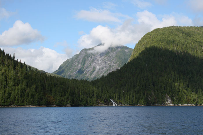
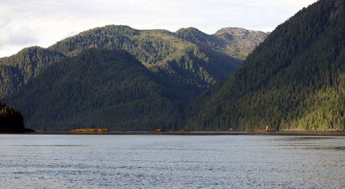
What a scenic sight Butedale is at the
opening between the steep mountains and that fabulous meandering powerful water
fall rushing down the black smooth granite slopes. The cannery has long ago
been abandoned except for a few stragglers that keep hanging on hoping they can
somehow make use of the place. It looks like there are three little boats at
the dock but most of the buildings are literally falling down into the water.
Now there’s a real ghost town for you. You can see how much has fallen down in
comparison to our Alaska 2002 trip.
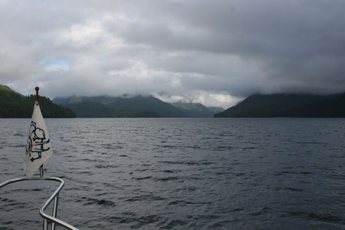
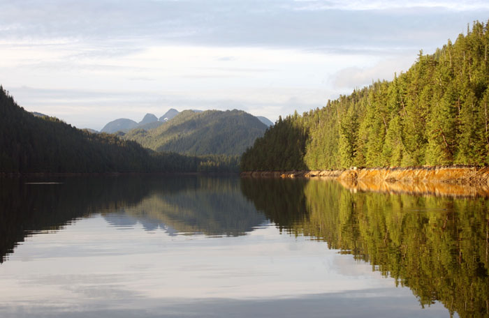
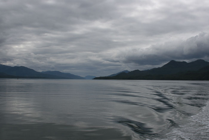
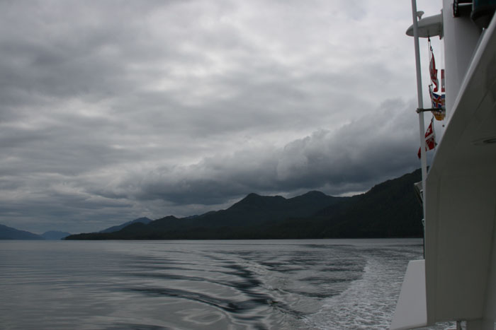
SECURITE REPORT We continue on up the channel with 15 knot winds on our nose (thought the weather forecast said the winds would be from the south and the channel is funneling stronger from the north) and fighting the current all the way. We hear the coast guard give a security report on the radio. Something about Fraser Reach and Whale Channel off of Princess Royal Island but we swear he didn’t give a channel to go to, to hear it. That’s exactly the location where we are. Larry calls Prince Rupert Coast Guard to find ask what the channel is that you switch to, to hear the report. They answered back right away and had us switch to 82 A or something like that. Prince Rupert Coast Guard said there was a buoy broken loose and floating about 3 miles south of Kingcome Point on Fraser Reach. That’s right where we’re headed. That location is just a mile or two away. We ask what channel they normally do their security reports on but then he broke up as reception in these areas between all the tall mountains is spotty at best. We kept trying to go back and forth trying to hear each other. We finally gave up and went back to Channel 16 and could hear a boater hailing us on 16. We answered back and went to 68, a non working channel. He was breaking up too but we could tell he was trying to tell us what channel to get the security reports on. We had him switch to 69 but still the reception wasn’t good. Then we could hear another boater come on and he told us you switch to the weather channels (which there are seven of them up here) to hear the security report. Anyway, we found out the info we needed and that was that the buoy came lose and we’ll have to be careful and watch for it. The funny thing was to us was that you thought you were completely along and isolated up here but when you got on the radio, suddenly you had a community answering back. Where were all these boaters? Hiding up the inlets? Out on the other side of the island we’re going by? It was kind of funny and made us chuckle. WATCHING FOR A LOSE BUOY FLOATING DOWN THE CHANNEL Thank goodness we have great weather and excellent visibility so we’ll hopefully be able to see the loose buoy with no problems. The last time we came up here (in 2002) it would’ve been another story as it was rough, windy, foggy and raining and the mixture would’ve been a serious problem to see anything. It’s amazing when you are cruising up here in these remote places. You won’t see a person for miles and miles and suddenly you get on the radio with a question and out of the blue you have help. It could be cruisers like us or fisherman or tug captains but they get back to you right away offering help and information. I love how they do that. It makes you feel good and safe. PASSING ONE WATERFALL AFTER ANOTHER We’re passing one waterfall after another as these mountains are filled with little lakes and the spring run off pours out into the channels in these beautiful waterfalls and they are beautiful. The sky is filled with puffy white clouds and blue skies are peeking through here and there allowing shining patches of sun to spot light a green hillside lightening the dark green tones. The newly exposed sky also reflects on the waters turning them from deep black to a dark bluish color. I wish my camera was doing a better job capturing the magnificent beauty here. I just got a new Canon state of the art by I think I need a college class to figure the dang thing out. I just have to try to put it on Auto and hope for the best but I have been terribly disappointed as it just hasn’t been showing the beauty of the area as it truly is. I bet those lakes hidden up in the valleys of the mountains, the source of all these waterfalls, are beautiful also. So far we haven’t seen as much clear logging as we did in the southern part of the BC Coast near the Broughton Island and areas like that. That area is really getting a butch. But I can significantly say that we’ve seen much more logging overall than in 2002.
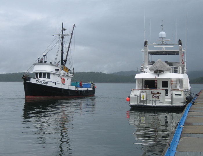
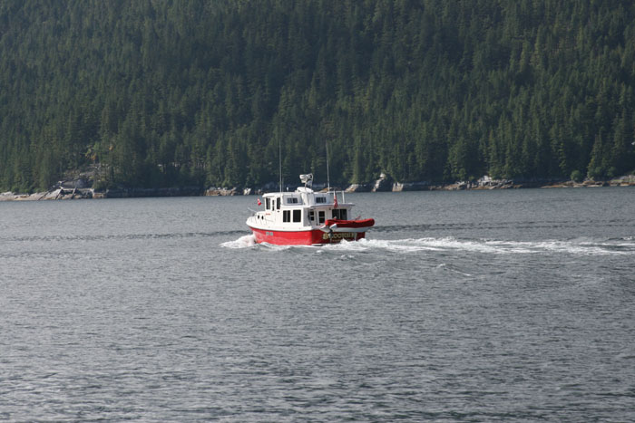
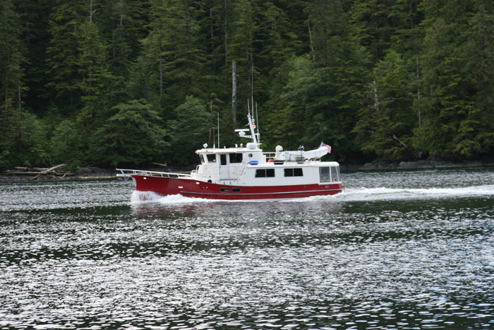
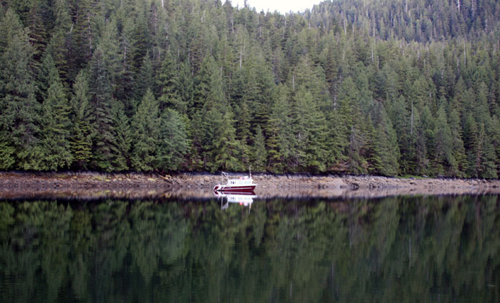
NO BUOY, JUST A RED AND WHITE NORDIC TUG We’re up to the end of Fraser Reach and just off Kingcome Point and no lose buoy that we can see. Awhile back we thought we saw it. There was what we though was a red and white can shaped thing way up the channel but it turned out to be a red and white Nordic tug. It looked like a buoy for the longest time.
THE SINKING OF THE QUEEN OF THE NORTH
Last time we came through here we had no visibility and seas were rough. Today we have about 10 knots on our bow. It’s sunny with a mixture of scattered clouds and blue skies and it’s simply amazing the sights we are seeing. This land up here is so vast and beautiful. We never did come across the loose buoy. Maybe someone thought that red and white Nordic tug really was a buoy. (Just kidding.)
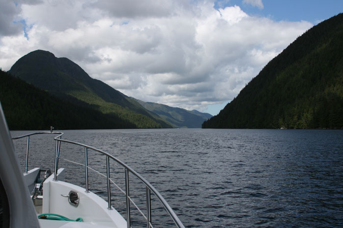
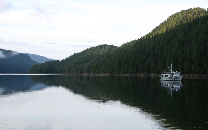
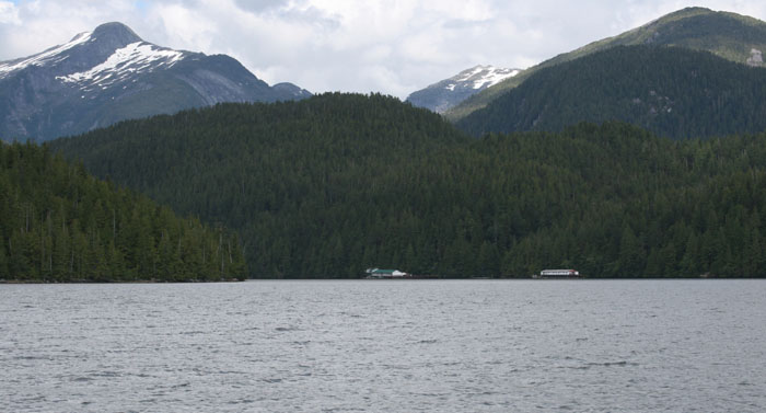
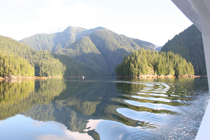
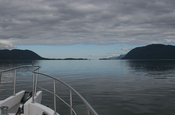
WRIGHT SOUND I go down into the galley to make some lunch. I look out the window as we pass a section before we come out into Wright Sound. There are these two gigantic mountains that shape into these two huge bowls off to our portside to the West. It’s absolutely magnificent. We didn’t see them our first trip as the weather was too bad. I go to get the camera to capture these beautiful mountains and just as I do, I notice two dolphins jump way up and out of the water by the salon window and before you know it they are gone. It was like they were jumping high out of the water and looking in. What an amazing space this Wright Sound is. It’s like an ocean unto itself. The only patch of civilization around here is Hartley Bay, the “aboriginal village” behind the little island on the NE side. It’s a dry town and has docks with power but we’ve never gone there. We see several big salmon jumping out of the water. Glad to see there still are some headed up a stream somewhere. The scenery is so wide and open. You just can’t get it all in with a camera. Its 360 degrees of amazing scenery. We passed Hartley Bay but couldn’t get a glimpse of the Indian Village. GREENVILLE CHANNEL We’re now heading up Greenville Channel. It’s probably the narrowest main channel of them all in the Inside Passage. I ask Larry about the anchorage we are heading to today. He turns to me and says this with be an easy anchorage tonight unlike the night before. He said it should be a “piece of cake” as he showed the whites of his teeth with an upward fleshy motion of his cheeks.
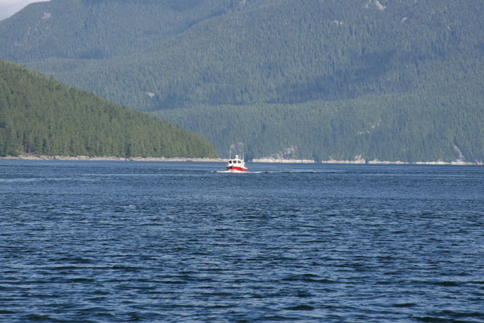
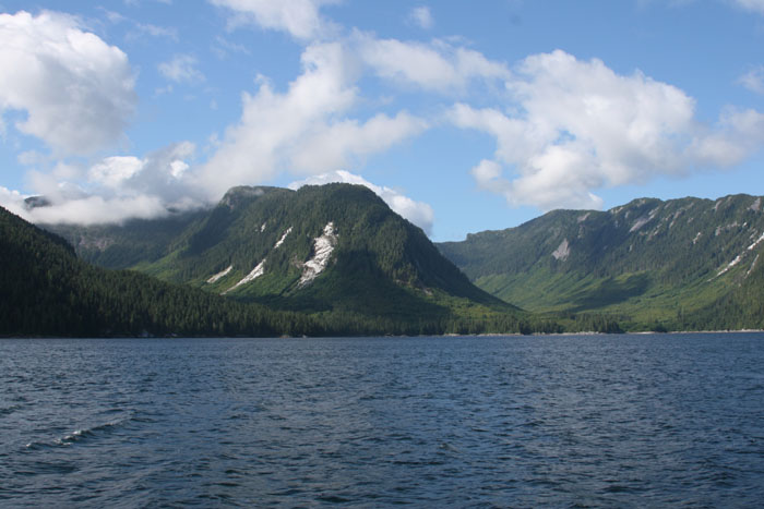
We’ve got the current with us now and we’re going 11.90 knots. That’s like flying for us. We’ve got 15-16 knots of wind on our behind which helps too. We haven’t seen but only one or two boats the whole day. Greenville Channel is pretty narrow at this point and very scenic as we can now see minute detail of the shore on each side of the channel because we are so close. I wouldn’t be surprised if we happen to see an animal’s face sticking out of the forest staring out at us. Of the three boats we saw today all three had red hulls and white cabins. What’s the deal with the colors up here? Everything looks like a buoy at the distance. We’re passing up going to Bishop Hot Springs again. We didn’t stop in our 2002 trip and not going to this time. (That’s where most boaters stop to have a good hot soak in some natural hot springs.) It’s a bit out of the way from our journey today. THINKING ABOUT OUR UPCOMING CROSSING TO QUEEN CHARLOTTE ISLANDS I told Larry I’d like to skip it and get on up the road to Prince Rupert so we can get in position for the crossing to the Queen Charlotte Islands across that dreaded Hecate Strait. I just want to get that crossing past us as safely as we can. I want to be in position to be able to wait and pick the perfect day to go and still be in time to meet our friends Joe and Fran who are flying to Queen Charlotte Islands to join us. I’ve heard so many horror stories about crossing Hecate Strait that I’m really scared and nervous about it. I know, I know…”What are you scared about?” “Your boat can do anything.” Well, I still don’t have that confidence yet. Again I’ve read too much about it and heard too many stories. MYSTERIES OF THE EBB AND FLOW These channels are strange and Greenville is no exception. We’ve been traveling with the wind on our tail and suddenly we’re in an area now and the winds are coming straight on our nose at 15 knots. The wind has completely whipped around in the opposite direction. We’re just north of Lowe Inlet now and south of Klewnuggit and the current just switched. You can see the waters changing direction as it looks like rapids with little white caps. We were running 11 knots and now we are instantly down to 8.00 knots. It is so strange. The books do say the currents split their ebb and flow in different directions at Klewnuggit. Now what’s even stranger is that we’ve, in just less than a few minutes, have gone back up to 10.10 knots. Larry say it’s could’ve been some kind of eddy or an out pouring from a stream. I did notice a small water fall but it didn’t seem but a trickle. The mysteries of these waters and winds through these inside passages always keeps you wondering and on your toes. We come across another area where the water seems squirrelly. The boat is pushed left and right. Our speed slows down again to 9.30 knots. We notice on the charts that the sides of the channel are shallow in some areas. The channel is already very narrow and with great depths so the force of the tide must be creating these strange phenomena’s. FRONT COMING We hear a security from the Coast Guard. They are warning of storm and gale force winds on the Westside of Queen Charlottes. Guess that low or front will be eventually moving our way. That’s another reason why we’re edging our way up to Prince Rupert to hang out a few days while the Front passes and take our perfect moment to cross Hecate Strait. Larry has called Prince Rupert to reserve dock space as that place can get crowded and when a storm is coming you may not be lucky enough to just come in spur of the moment and get a spot. This trip we are lucky to have a satellite phone to call to make the reservation. In 2002 you just had to take your chances. We see a bunch of flotsam across the channel and suddenly we’ve slowed down to 7.5 knots. Guess we’ve hit the switch of the ebb and flow.
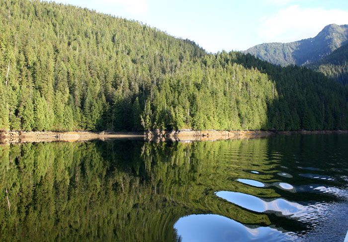
We get the kayak out and I take Zig ashore as I can tell Larry’s pretty tired. That saves him from messing around getting the dinghy down and all that goes with it. Again we are struck with the distortion of scale here at the anchorage. I kayak to the only small itsy bitsy green patch of grass that I can find for Ziggy (as all the sides of the anchorage are steep rock, straight up) and it’s a long haul to get over there. As I wait for Zig, I turn and look at the boat, and it’s as small as a peanut now. We have so much room in the anchorage but when we came in it feels so small. The space and scale is so deceptive up here. It took me forever to get to shore as I had to paddle against the current and it’s pretty strong in here surprisingly. The only grassy patch I could find is half under water with lots of black volcanic like rocks with pointed sharp barnacles on them. Poor Ziggy, I think his little paws are taking a toll with all these rough barnacle covered rocks at each anchorage. I’ve heard them described as rocks with cheese graters on them and that’s a pretty good description. Zig pokes around and we head back to settle in for the evening and enjoy the surroundings of Klewnuggit Anchorage.
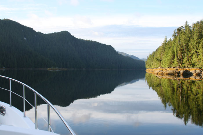
HEAD OUT AT LOW TIDE We head out early in the morning and head again up that long Greenville Channel. The winds are only about 7 knots. We’re traveling a good 9.10 knots. As we head out the wind whips around the mountains and is right on our nose. The tide is coming in as we leave. We left at low tide (extra low) as we have full moon and we can see all the shallow exposed areas that were concealed when we came in yesterday afternoon. We pass Baker Inlet. Wow, that entrance looks really narrow. There are rapids through there so you have to time you’re passage going in and out at slack tide.
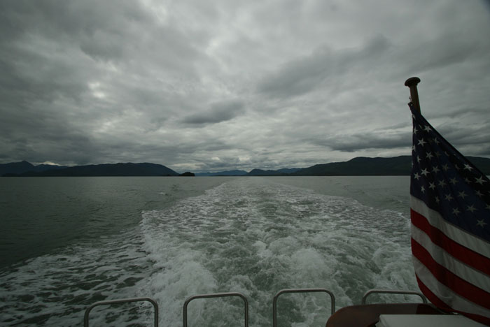
We left without taking Ziggy to shore as there’s a storm coming and heading this way. It’s due to arrive this afternoon and we’d like to get in to Prince Rupert before it gets here. It’s a five hour trip and we can see the storm heading this way behind us. Up ahead it’s sunny and bright and behind it’s dark and looks as if it’s chasing us. Weather Report July 11, Tuesday, 20006:
(Not too bad but might as well get there before it hits.) WEATHER FUNKS We pass Kumealon Inlet where John Alexander and Cheryl Fortier spent a few days weathering out a storm while they waited for good weather to go across to the Queen Charlottes. They finally couldn’t take it anymore and beat their way up to Prince Rupert for a couple days just see people again and get out of the funk that goes along with being stuck in an anchorage for days waiting out a storm. (We know exactly what that feels like.)
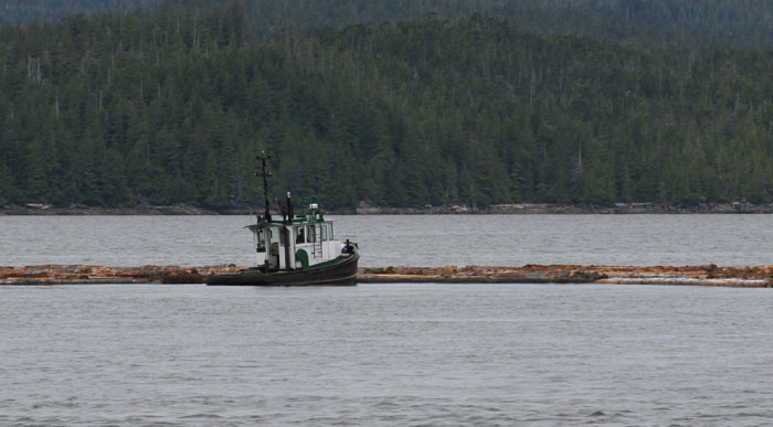
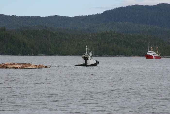
DEADHEADS AND LOGS HIDING IN THE FLOTSUM We have narrowly passed several floating logs as there are several tide lines of flotsom around here. The logs are buried with in loose forest debri and sea weed and are hidden very well. We’ve come very close to hitting some as we skim the sides of a few not seeing them until right at the last minute. Don’t know why they seem so weather logged compared to the many logs we’ve seen on this trip. They look very heavy floating deep beneath the water’s surface. We examine each one carefully with our bincoulars to make sure the small portion that is exposed isn’t a disguise of much more hidden under the surface like the way an ice burg is or that one of the little nubs isn’t a dead head.
We get a little push from Ogden Channel. That’s the Channel that we will go out in a few days to our anchorage before we head across the Hecate Strait to Queen Charlotte Islands. We both silently look down the channel and out in the direction of Hecate Strait. It’s covered in storm clouds now. We have a great deal of anticipation about that next journey for some reason. I’ve read far too much about the dangers of those waters and have a great deal of respect and fear of them. It may be the most difficult thing we will have done yet in our boating experience as I read Hecate Strait is the “fourth most dangerous body of water for boaters in the world.” Why did I have to read that somewhere? All that does is feed my scared and exagerated imagination. Well, that’s something I’ll dwell on another day I’m sure as we head north between Kennedy and Porcher Islands. Still though every once in awhile Larry or I take another look down Ogden Channel, not saying anything to each other but leaving each to his own thoughts about what’s in store for us.
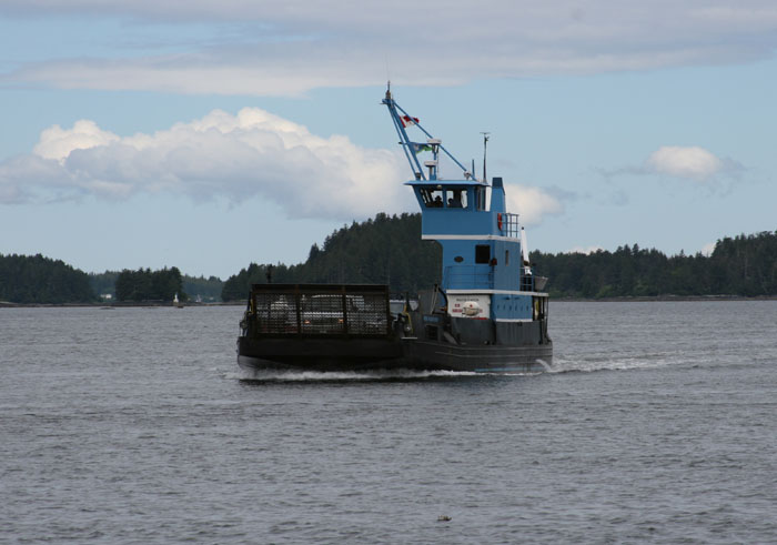
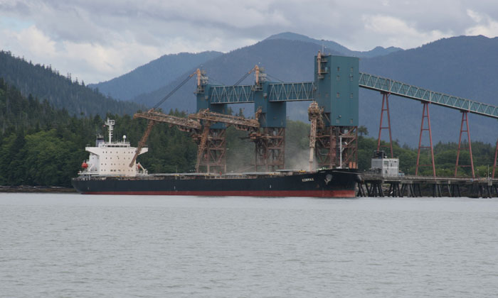
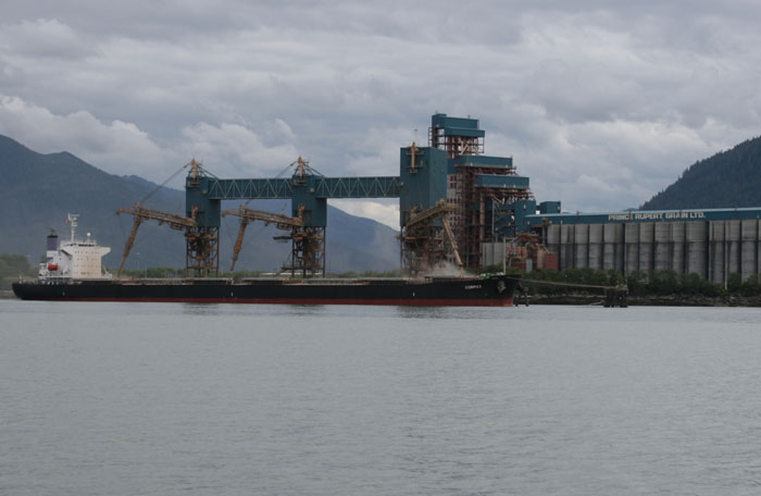
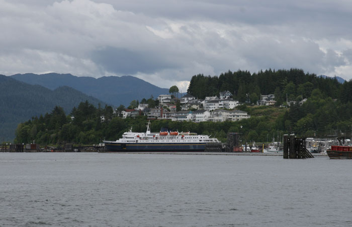
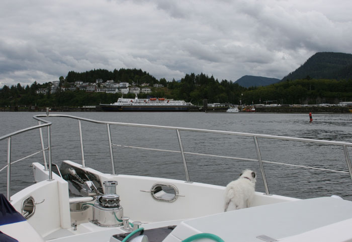
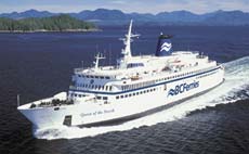
Well, no time to be distracted with wagering thoughts “we’ve got some big bad A#@% logs out here” as Larry says. I remember when we came to Prince Rupert four years ago. The waters were littered with logs that had washed out the Skeena River from a “big bad A#@% storm.” During that trip there were repeated securites on the radio from Prince Rupert Coast Guard warning about the dangerous debri. Today though, we have flat seas and the logs are pretty visible if you just pay attention and don’t let the unchallenging seas distract your attention to day dreaming. THAT DEPTH AND SCALE THING IS DECEIVING The little islands ahead are just black little bumps, silhouettes of themselves, just little black moles on the horizon. They look lost in a smoky grey haze. We see the outline of a tug and the large load he is pulling. There are so many little islands in our view ahead in that it’s hard visually to determine how far away he is from us. It’s that depth and scale thing that happens up here. It’s hard to clearly see where our path is going in relation to his between all the islands in the distance. We look at the radar to confirm his position and direction even though we see him clearly. MEMORIES OF A BIG MONSTER This same passage, when we came through in 2002, was very intimidating as we had the most enormous freighter coming up behind us. This freighter, in our mind, seemed bigger than the mountains surrounding us, so huge he blocked view of anything else. We were like a small little mouse skirting to the side of the channel, looking for safety, a hole to run into, hoping that he saw us, as he powered down the channel at a good 30 knots just swallowing the place up like nobody’s business. Larry hailed him on the radio, the shipping channel, just to make sure he saw us. A very nice voice came back and said he saw us and will pass us on our starboard side and “have a nice day”. I can’t quite describe the feeling of hailing such a big mountain of power on our small radio and to actually get a response back, and such a friendly response. You wondered how somethig so big could even think we were important enough to answer back. He could just sqwash us like a bug and no one would know the difference. Once he passed us, we tried to follow in his path, as we were missing our paper chart for this area to just outside Prince Rupert. We were no match though for his 30 knots and he disappeared out into the greyness of Chatham sound. DÉJÀ VU WITH A STRANGE MISSING CHART Well again, coincidently, again this trip we are missing the same chart. It’s like déjà vu. We don’t have the paper charts past Kennedy Island and all the way to Rupert again. There must be some glitch in Larry’s mind about this area. What are the odds of that coincidence happening two times in a row? We don’t need them though as Larry has the electronic charts but I always like to double check as we go and the paper charts allow you to see the bigger picture. So again I’ll be in the dark so to speak. CHEWING THE FAT We discuss whether to go through a cluster of islands ahead or around the easy way, but longer way and decide to go through to save some time. The water is strangely flat and quiet. It is eerie like the calm before the storm. We pass another huge log with a whole party of seagulls sitting on it looking like they were just chewing the fat. They sure take advantage of these floating logs. They look like an easy going bunch. You wonder what they are talking about. We’ve been watching a dark spot ahead for a few minutes now wondering if it was some black can marking something. We finally figure out it is a huge tree stump as big as a marker traveling down the channel with the current. Wow, that one could do some damage. MUCH LIKE AN AIR TRAFFIC CONTROLLER Prince Rupert is a major port for Canada and we constantly monitor channel 11 to see what the shipping and commercial traffic is doing. You’d be amazed to hear what goes on as there is a lot of traffic to listen to. It is a non stop chatter of ships reporting and checking in: who they are, where they are, where they are going, where they are coming from and what time they will pass a certain point or arrive at port. All this is coordinated with Prince Rupert Traffic Control so that all their passages can be safe. The traffic includes big freighters coming to get pulp and wheat and all the cruise ships (big and small), tugs and ferrie(s), etc. (I think there is only one ferry now since the Queen of the North sadly went down.) It’s amazing to listen to how they monitor all these ships. All report in their position and expected arrival time at the next way point. They are required to report in at designated locations all up and down the coast. The locations are actually marked on the paper charts and I presume the same on the electronic charts. The controller acknowledges and reports positions of other ships in relation to them. It’s very similar to an air traffic controller. It is very helpful to cruisers like us to listen in so we know what’s coming ahead and behind so we can stay out of their way.
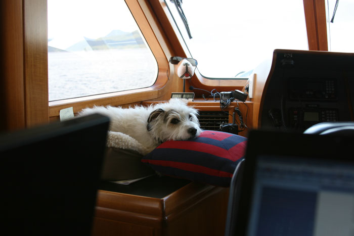
WIDE OPEN PRAIRIE OF SEA This is a strange view as we come out the channel and into Chatam Sound because instead of mountainous valleys you look off into an empty horizon dotted only by a few low lying bumps of a couple of islands and then nothing beyond. For weeks now we have been surrounded and protected by tall mountains as we journied up the Inside Passage. Now cruisers like us are open to the unpredictable elements of the great Pacific Ocean. The sky opens up to a wide patch of blue and some billowy white scattered clouds that will soon be covered with darkeness as this rainy Front races this way. ARE THESE BIRDS SMARTER THAN WE ARE? We pass by another long log with a bunch of crony seagulls lazing around on it, just picken’ at their feathers, and scratchen’ and talken’. Some are all puffy and sleeping and suddenly wake up as we disturb their morning nap. They all stop what they are doing to give us a glance and watch us as we go by. I wonder if they are talking amongst themselves about the coming storm and where they are going to hole up. You know the birds always sense a storm ahead of time and come into land for protection. How do they know? I think sometimes these animals are smarter than we are. A BIT CHILLY We’re running with the current at 10.30 knots. It’s a nice little push. Our arrival time says two hours. That will put us in there at at Prince Rupert at 12:30PM. It’s a pretty chilly ride today. We’ve been turning the heater on and off as we get too hot, then get sleepy, so turn it off, then get cold. We keep changing clothes to get the right mix. Wool socks are a necessity for me and add to that some nice warm slippers. If I can keep my feet warm everything else seems to follow but I also have my windbreaker on, some felt lined pants on and a turtle neck with a hooded sweat shirt and I’m good to go. Wait a minute its summer for God Sake! Our friends back home are probably sunning themselves on the beach and here we are bundled up. No complaints though. Anyway, that combination of clothes is pretty norm for these days of cruising up here. We had each a huge egg salad sandwich on some delicious homemade bread, made by an Indian woman (oops, Aboriginal person) in Bella Bella. I had way too many eggs and now that we will be near a grocery store I wanted to use them up while we had the opportunity to get fresh ones. Now we both feel like stuffed eggs. I hear some munching sounds and look down. Zig’s bed is under Larry’s helm seat and he’s munching on his bone totally relaxed and enjoying himself. I watch the electronic charts now with Larry as we have some islands to meander through and it always helps to have another person for perspective. PROVISIONING I’m not nearly so panicked about supplies on this trip as I had been when we first came up here or when we left for our journey south. I met someone on the NW Explorers Grand Banks Charter back in Shearwater. We were talking about provisioning and she said she couldn’t find much info on it, like books and such, and said she thought she did a pretty good job for their trip. I’m thinking to myself that was provisioning for only 7 or 9 days, the real test and challenge is provisioning for a few months. It was much harder the first time we came up here as there weren’t as many places to get supplies as there are now and we left early before a lot of places were open. Unless you want to have to try and provision at everystop you make, (which is impossible) and not knowing what will be there and consider the difficulty and labor sometimes of hauling it back to the boat all the time, I think it’s better to get the most of it done, stored, and inventoried before you leave on your journey and then just pick up whatever kind of fresh stuff you can find and sometimes scavage on the way. And if there is anything that you may have forgotten or for some unplanned reason ran out of you can try to pick it up along the way. To me then the search is mostly for things like eggs, milk, vegetables, bread, fruit and any special things that you come across that is local, like bumble berry pie, cinamon buns, fresh fish, etc. There are so many tricks to provisioning, like keeping things fresh in the salty air, packaging, menu planning, healthy issues, inventorying (so you can remember where the heck you stashed it), etc. etc. I think we’ve got the system down pretty well now. THE FRONT IS DARK AND THE SEAS ARE LIGHT It’s a strange day, no boat traffic on the radio, no freighters, cruise ships, ferries, no other cruisers, no little sports fishers, nothing. We are it, well except for one sailboat coming in from what looks like Chatham Sounds. We can see the large wheat mill just before Prince Rupert and the tall mountain that looks like one gigantic slide that swoops down to it. We can see the line of the Front ahead of us now. It has finally pulled the covers of clouds right up and over our heads. That straight dark line of clouds has been racing behind us all morning and now has caught up and getting ahead though the winds haven’t started yet. The waters are a much lighter shade of green now as the silt that comes out of the Skeena River mixes the sand and mud with the sea water and creates a lighter color than what we’ve been used to for weeks now. It lightens the whole environment up amazingly. When the seas are dark the world feels dark. When the seas are light it looks like the Carribean.
Off to our left towards Queen Charlotte Islands we can see a bundle of thick boistrous clouds. SLOW ANTICIPATION OF CIVILIZATION It’s a slow haul into Prince Rupert. It seems like you see it for so long before you finally get there. I think it’s the anticipation of civilization again. The thoughts of lattes and cappucinos, grocery store, restaurants, shops, and mostly people. We look off to our left beyond the islands to Hecate Strait and the clouds way off in the distance hovering over where I imagine Queen Charlotte Islands to be, look like cottage cheese, like little mini explosions. I tell Larry and he laughs because he knows I’m worried about going over there in the next few days. You can see Prince Rupert for such a long time before you get there. Are we ever going to get there? I feel like a kid, asking dad how many more minutes.
We finally enter the harbor channel
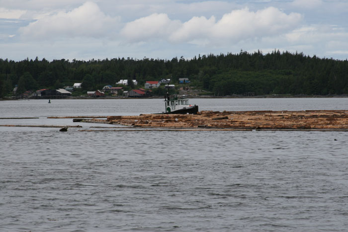
following a seiner. As we finally come inside the harbor, the seiner ahead of
us slows down to a crawl because there are two mini tugs ahead of him pushing a
log load right through the center of the harbor. A Canadian Coast Guard cutter
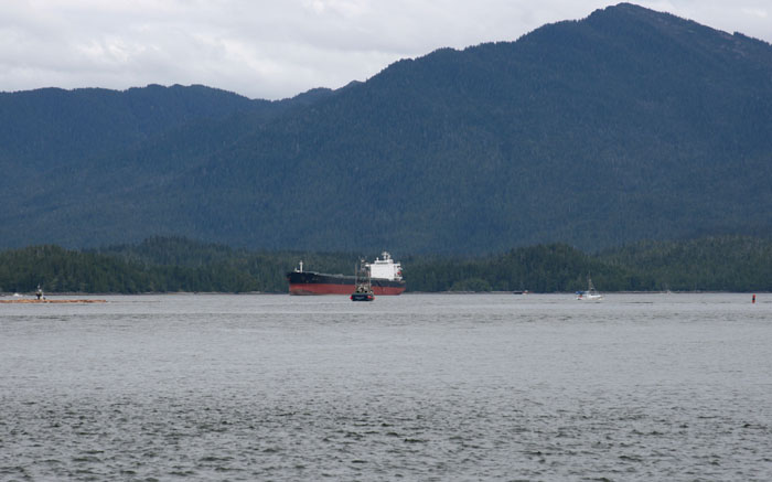
is hovering close by watching and there is a huge freighter anchored down the
way. There are several other fishing boats and crab boats going by, criss
crossing in front of us and around the log tow. Off to our port is a small
local ferry boat transporting a couple cars and trucks. Suddenly we are in a
busy environment. We slowly go by the log tow, not wanting to create wakes to shake free any of the logs the little tugs were so carefully herding around the harbor. SLAPPED BACK TO CIVILIZATION We finally are within view of Prince Rupert Yacht Club. Larry hails them on the radio and they tell us to tie up on the outer dock. As we come, in the current is running very strong and the winds of course have now picked up from the Front. We do our best to get her tied to the dock. Several people come to help as the wind and current were blowing us right off the dock, even with the thrusters working hard.
The dock hand said to be sure and put a lot of fenders on the outside of the boat as the fishing boats come in and out of the docks by us and it is not uncommon for them hit the side of the boat there! What? He must be kidding but he’s not.... Then he said the weather report is predicting 70 knot winds later so be sure and tie the boat as securely as we can. Once I heard those I could barely function finishing tying the lines. I kept saying: What???
70 knot winds!!!!!
|
|||||||||||||||||||||||||||||||||||||||||||||||||||||||||||||||||||||||||||||||||||||||||||||||||||||||||||||||||||||||||||||||||||||||||||||||||||||||||||||||||||||||||||||||||||||||||||||||||||||||||


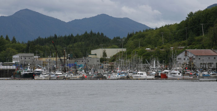
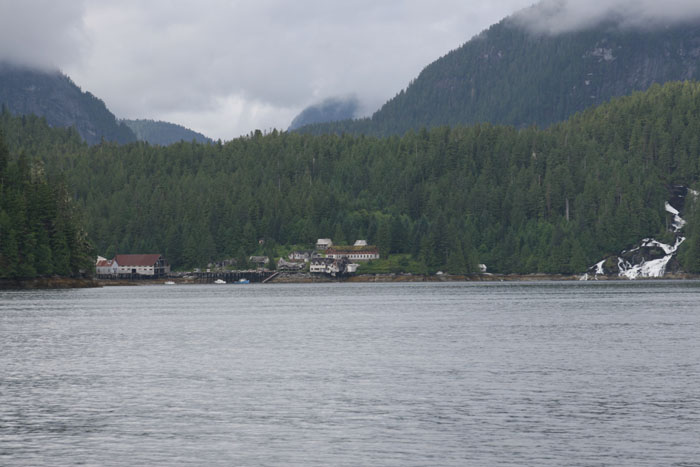 CRUMBLING RUINS OF BUTEDALE
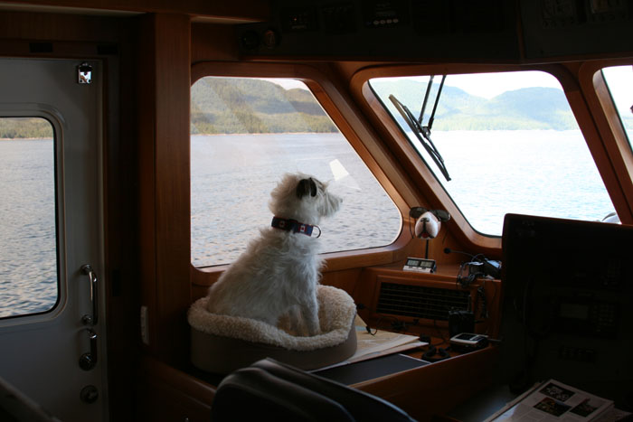
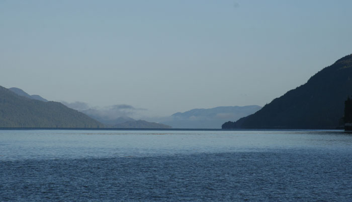
 We’re entering Wright Sound now which is
wide and open. Several large bodies of water all meet here and with the right
conditions, or I should say, the wrong conditions, this can be a rough spot.
This is also the area where the Queen of the North, the huge BC
Ferry, went down March 22. We’re looking at the chart and discussing options
of what might have happened. We don’t have a clue except that it must have been
negligence but don’t know for sure. It happened in the middle of the night
around midnight I think and everyone was rescued except for two people. I’m not
sure what would have happened to the people on the boat if it had not happened
where it had. We read later:
We’re entering Wright Sound now which is
wide and open. Several large bodies of water all meet here and with the right
conditions, or I should say, the wrong conditions, this can be a rough spot.
This is also the area where the Queen of the North, the huge BC
Ferry, went down March 22. We’re looking at the chart and discussing options
of what might have happened. We don’t have a clue except that it must have been
negligence but don’t know for sure. It happened in the middle of the night
around midnight I think and everyone was rescued except for two people. I’m not
sure what would have happened to the people on the boat if it had not happened
where it had. We read later: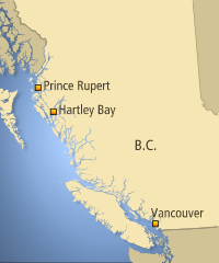 It’s really quite an amazing story to have
all those people rescued up here literally the middle of nowhere.
It’s really quite an amazing story to have
all those people rescued up here literally the middle of nowhere. 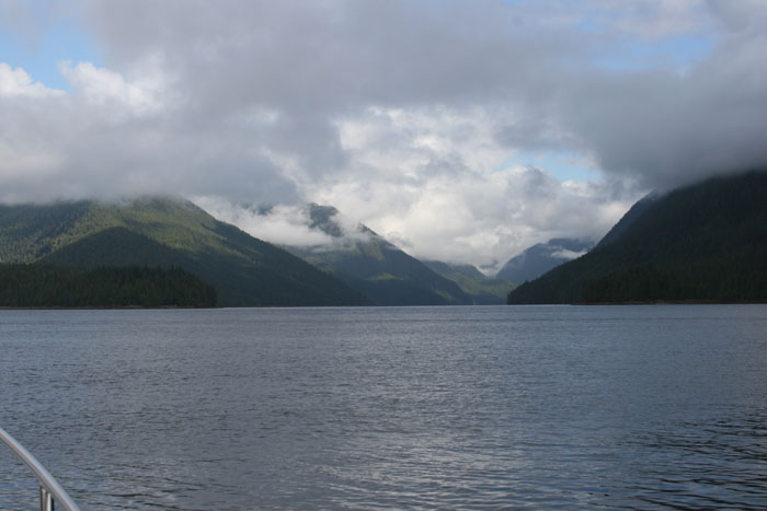
 “FOURTH
MOST DANGEROUS WATERS IN THE WORLD FOR BOATERS”
“FOURTH
MOST DANGEROUS WATERS IN THE WORLD FOR BOATERS” “SOME
BIG BAD A#@% LOGS OUT HERE!”
“SOME
BIG BAD A#@% LOGS OUT HERE!”