![]()
![]()
![]()
![]()
![]()
![]()
![]()
![]()
![]()
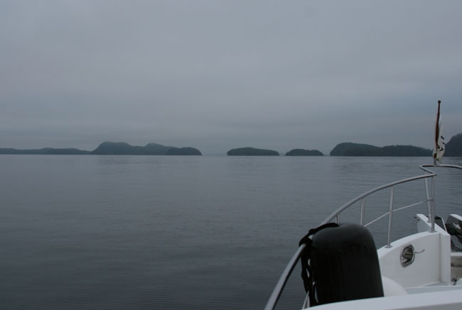
CROSSING QUEEN CHARLOTTE SOUND
|
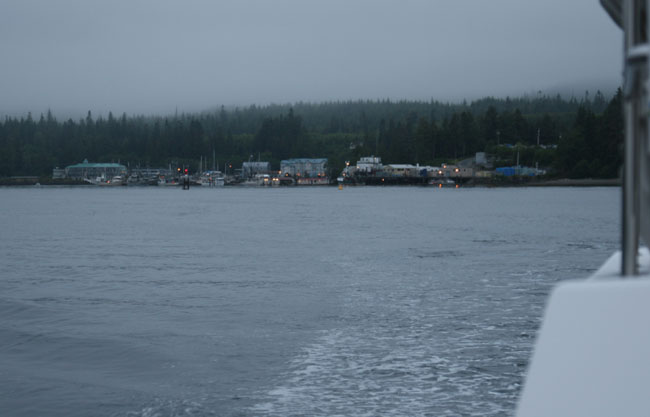
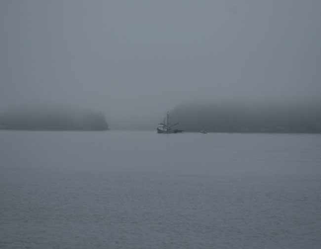
We left Port Hardy at 5:30 AM, winds are 5 knots out of the northwest (at least they are out of the Port Hardy entrance). It’s foggy out but we have good visibility probably 3-4 miles. You’d think we were late risers as all the sports fishermen we already busy at the docks and it was barely sunrise. The big fish packer we saw yesterday at the entrance of the channel coming in was at the dock across from the harbor. I think I heard him come in last night as the whole marina was vibrating. The bright yellow pilot boat just came back in from a night’s work. Maybe they escort the cruise ships up and down the channel?
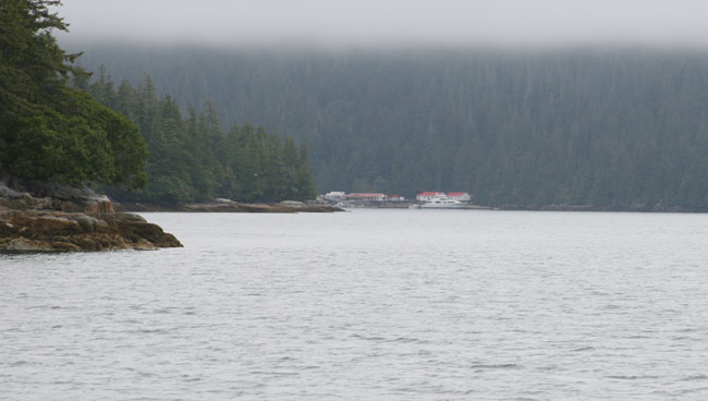
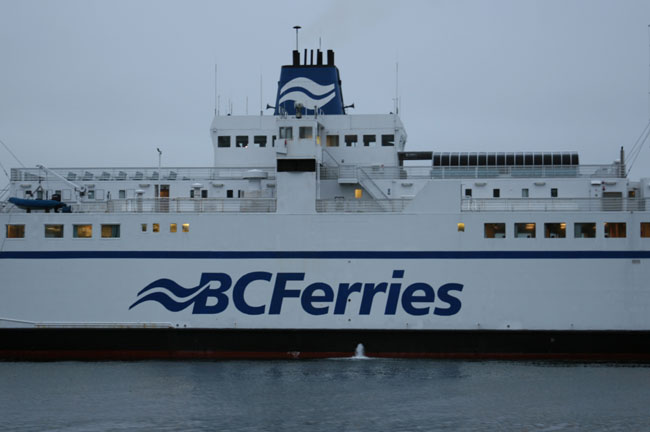
As I’m stowing away the lines and fenders I can here Larry on the radio. He hailed Comox Coast Guard to double check what channel the BC Ferries monitor. Comox CG says “71”. I look ahead and see why he’s double checking the channel as straight in front of us, sitting across the channel, is a big BC Ferry. The ferry doesn’t answer Larry’s hail. He’s just sitting there like a sleeping whale. We happen to notice that there is a ferry landing on shore over to our starboard side and another ferry is there either unloading or loading. Now it’s crystal clear the ferry in the channel is obviously waiting for that ferry to leave the dock. So now we understand and just go around him as he’s not going anywhere until that ferry leaves the dock. Guess we need another cup of coffee to wake up.
|
 |
|
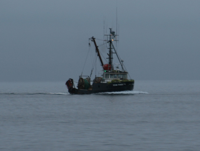
We can barely see the Gordon Islands ahead. They are just grey nubs on a light grey horizon. Off to our starboard is a black hulled seiner coming in from a night’s work. His running lights are are burning those the grey mist. |
 |
|
WEATHER FORECAST FOR QUEEN CHARLOTTE SOUND: Issued 4:00 AM, July 3, 2006 for the period ending 4 AM Tuesday with an outlook for the following 24 hours. WEST SEA OTTER (buoy) Synopsis: A broad ridge of high pressure will remain west of the Queen Charlotte Islands. Moderate to strong northwest winds prevail over most of British Columbia coastal waters. Over Inner South Coast waters strong to gale force westerlies in Juan de Fuca will make their way into southern Georgia strait as light to moderate south easterlies this morning while light to moderate northwesterlys persist in Georgia strait. Winds will ease in Juan de Fuca this morning then rise again this evening.
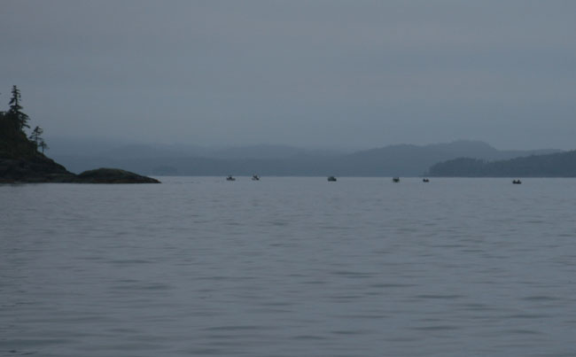
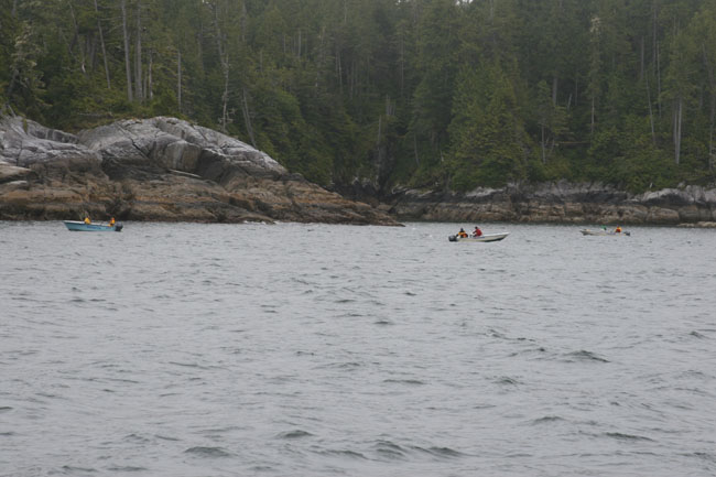
Forecast: Winds northwesterly 10 to 20 knots. Cloudy periods. Fog banks. Seas near one meter. Outlook. Moderate northwesterlys. I purposely didn’t read any of our cruising books last night as they always scare the crap-olas out of me. I’ll read them later just for fun. I’m a much braver person without their helpful information. We can see the little sports fishing boats at the tip of the northern entrance to Port Hardy called Duval Pt. They sure are catching some fish around here. Two of the guys at the fish cleaning table said they live in Campbell River but come up here because this is where the fish are.
|
 |
|
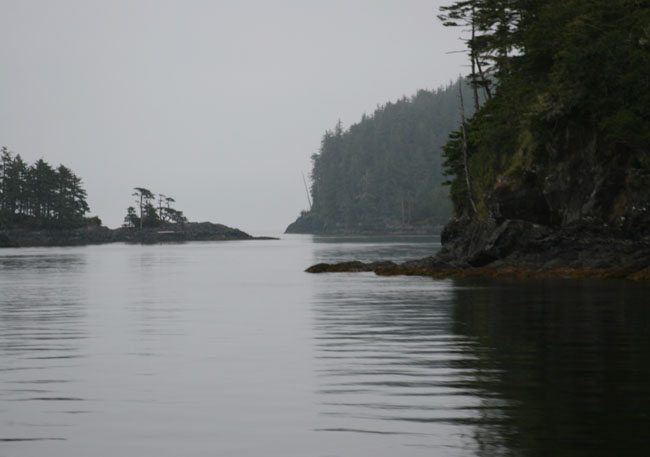
GORDON ISLANDS
We’re going to weave our way through the islands between the Gordon Islands and Bell Island. The fog is hovering over us like a thick soft down blanket. It’s just nipping off the tops of the low lying Gordon Islands. Larry’s looking at the islands through his binoculars. I ask him if he’s worried about something. He said “No, it’s just that I can’t see the hole where we are going to go through.” I said, “We probably won’t see it until we get right up into them because of the angle of our approach”. We have good visibility so it’s not like we’re coming through here in fog and can’t see our way except by the radar and chart.
This is so different coming across here alone. It’s dark and depressing. Ah, oh, our first glitch. It looks like they have a fish farm right where we wanted to go through. We can’t tell exactly until we get there but it looks like its stretched right across the opening. We check the paper charts and surprisingly they show the fish farm stations atg the islands we just didn’t notice it before. We change our route to go just to the right of Heard I. Wait, actually it’s a mistake. We mistakenly chart plotted our way, not on our intended path, but an island or two south of where we intended on going. So we make a quick change on the chart plotter and adjust our heading. Don’t know how we did that. Oh well, figured it out quickly and fixed the problem. Good thing.
|
 |
|
SAME PATH
Surprisingly we are taking the same path we took the first time we crossed the Sound four years ago. We still had our old paper charts where I hand marked our route in pencil and without planning it larry has plotted the same exact coordinates. Guess there aren’t a lot of options. The islands are so beautiful here. Again my first impression is that they take on the effect of a misty oriental water color. Sometimes the little islands look like a cluster of giant bonsai arrangements. The fur trees are craggy and it seems they barely have enough soil to cling to the rocky landscape. Their roots are exposed as they search for a crack and soil to dig into. The tops of the rocky mounds are covered in a beautiful soft green ground cover. You can tell the shoreline of the islands withstands some gruely weather as they are rugged, ragged and windswept.
|
 |
|
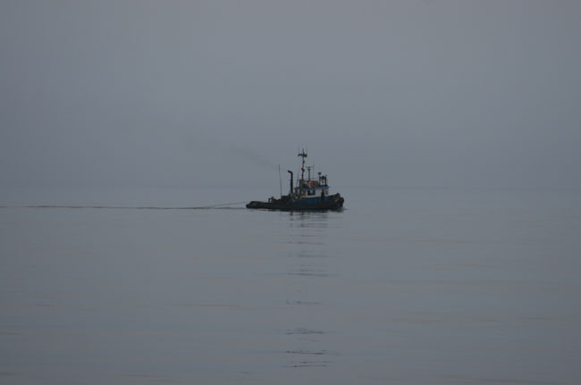
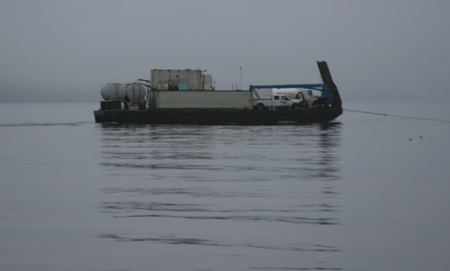
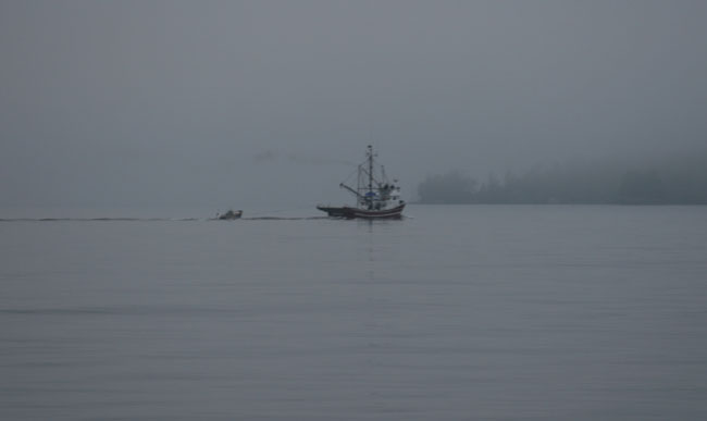
6:20 AM: We pass through the opening by Heard I. We see a several small sports fishers and one big fishing boat. I can see a tug ahead. He may be pulling a log tow as we see nothing vertically massive behind him. As we come out through the opening of the islands you begin to feel the swells of the Pacific. They don’t feel like much but you can feel them, big and massive underneath like something monstrous quiet and sleeping. The fishing boat is heading out from the islands too, looks like the same direction but ahead of us. We make out another tug pulling a barge in the fog ahead. Wow, this is getting nerve wracking as the fog is getting thicker up ahead. I can see the channel marker but think we’re going to have some significant fog. Guess that’s better than wind.
|
|
|
We’re approaching Bolivar Passage and will be making a turn to go up the left side of the islands of Walker Group. Once there we will officially head into Queen Charlotte Sound. The fishing boat is heading off in a more southerly direction through Shelter Passage as we turn north through Bolivar Passage.
BOAT TROUBLE
We hear a guy call the coast guard saying he has broken down in Christie Passage. That’s just a few islands over from where we just went through at the Gordon Island Group. His boat’s name is Lollie. He sounds so lack-si-day-sic-al about his breakdown. He said he’s “not in danger just broken down, in the fog, in the channel.” The Coast Guard it seems to us is somewhat humoring him and doesn’t sound too willing to go out and perform Tow Service duties but we’re just reading between the lines. The Coast Guard warns him that the ferry will be coming through the channel in a while so they should call the ferry on channel 71 to let them know their position, location and circumstances. The Coast Guard also asks if they have someone they can call in Port Hardy to come pick them up. He answers back that he can’t find the number. This guy sounds like a goof ball. The Coast Guard does an announcement on 16 notifying all vessels to watch out for him and to assist in a tow if possible.
It feels really chilly out. Larry says its 50 degrees outside.
I’m looking at my paper charts and we are going through this same area as we did the first trip and amazingly within 13 minutes of the first trip and on the same course. We’re just coming out of the Bolivar Passage at 6:55 AM. It’s still flat calm with a slight swell that is beginning to rock us. We have maybe 5 knot of wind off our nose. We can no longer see any islands, just the whiteness of the fog. Our only reference now is the chart plotter and radar to show us if a fishing boat, tug, ferry, cruise ship, or other cruiser like us is out here.
|
 |
|
FOG AND MARKS ON THE RADAR
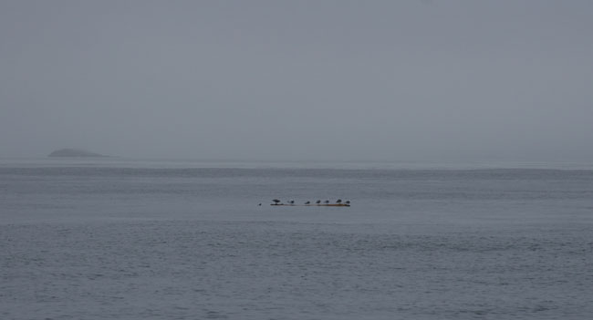
7:15 AM: We spot a couple marks on the radar. One turns out to be the fishing boat that went through Shelter Passage who is now coming behind us off our starboard quarter. We’ve got another boat about 3 miles on our starboard bow but can’t see it yet because of the fog. The waters are amazingly flat. It’s just silent whiteness out here. The only thing else out here are these little birds that sit in the water and look at you from a distance. Sometimes they look like a deadhead and then they suddenly disappear and dive down under the water leaving only a small ripple. The wind is only 2 knots. It’s amazing how calm it is for our crossing.
RIPPLE PASSAGE
We are now crossing what is called Ripple Passage and there barely is a ripple but you can feel the power of the sea beneath you playing games with the swells, just reminding you of how powerful it can be if it wants to.
|
 |
|
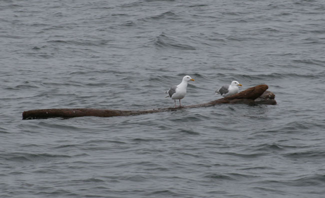
7:30 AM: We’re coming up to Storm Islands but we can’t visually see them. The sky seems to be getting dark like we might have some rain shortly. We see a log up ahead floating in the middle of this white nothingess and it is packed with birds just hanging out on it. We’re going to get a little patch of wind up here as the flat smooth sheen is turning into a patchwork of texture, ripples I guess, thence the name.
Ziggy is doing pretty good but has a worried look on his face. I have him sitting here beside me on the pilot house settee. I’ve been following the charts and he is nestled on my sweat shirt beside me. He worksthe sweat shirt up into a nest like pile with his paws and then snuggles in making part of it like a coverlet over him. I think he feels safe and warm within it. Larry is getting cold and has turned on our little electric heater that is conveniently perched under the helm seat warming him up. I for some reason am just fine. I’m usually the cold one but I keep opening the door and taking pictures and I guess with all the movement I’m warm but letting the cold air which makes Larry cold.
|
|
|
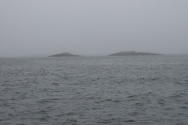
STORM ISLANDS We’re approaching Storm Islands. I wonder about the name. I look on the chart to see what’s on the mainland. I see Slingsby Channel and think if the weather was really bad you could head up that channel depending on the direction of the winds, etc. and saw an area that you might be able to anchor in and to my surprise it was called Anchor Islands so others must have used it before. Another cove is called Skull Cove. Don’t like the sound of that. Wonder how it got that name.
Guess I was wrong about the wind picking up by Ripple Passage as we have none whatsoever. Our bowsprit flag is limp as could be. So far so good.
7:50 AM: We’re starting to get some short waves, quick periods. Still no wind though. We finally get a glimpse of the Storm Islands. They have no trees, just rocks with what looks like white guano on them. They aren’t very friendly looking which explains the name and the sudden increase in waves and swells that we are starting to feel.
Whoops, I have been misfiguring the wind. It’s actually coming from behind us about 5 knots and the swells are coming on our nose. They are short and about 3-4 feet now but we are handling them fine. We have about 8 miles to go until we reach Cape Caution and then we will make a turn which will put these swells right on our portside beam.
|
 |
IT’S LUMPY, WITH TWO BANGS OF THE BULBULOUS BOW
8:10 AM: We see our first little boat coming this way. It’s creepy looking out here. No sight of land just a lumpy sea everywhere. The waves are increasing in height, maybe 3-5 feet but no white caps. OK, spoke too soon, there are the first two big bangs of the bulbulous bow. This may be a rough ride yet as we head to Cape Caution. Yuk. Sometimes this is when you would like to have some more speed as we slowly trod along not knowing how much the seas will build and precious time goes by to let the sea build while we keep what seems a very unworried pace.
MISSED CAPE CAUTION
Well, we passed Cape Caution and the sea calmed down a bit. I missed it completely as I got preoccupied writing a poem. Oh well. Maybe that’s a good thing.
Barometer: 1020
Water Temp: 59
Air Temp: 52.7 degrees
|
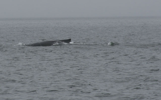
THAT SHE BLOWS!
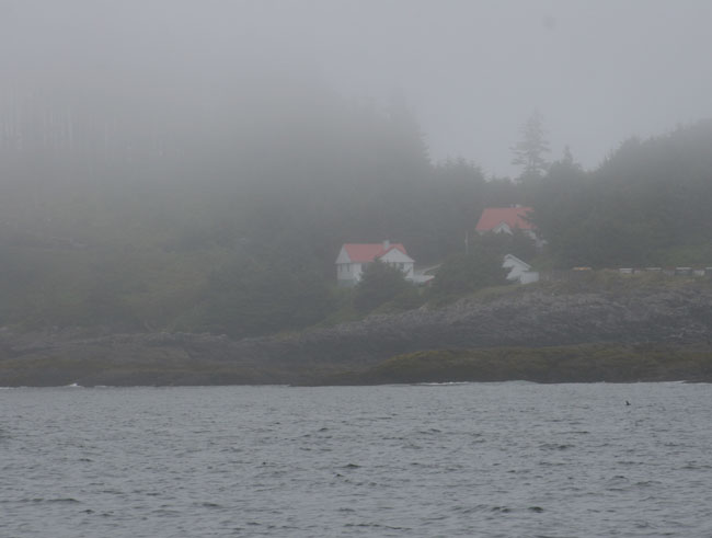
Thar She Blows! It’s our first grey whale sighting off Egg Island Light. He’s too far off in the distance to see much, just the blows. Egg Island is shrouded in fog but I think I got a picture of her showing through a thin veil of fog. We’re heading up South Passage now and crossing Smith Sound.
That She Blows again!!! Number two hump back just off Table Island. No pictures though as its too dang cold out.
|
|
|
RIVER’S INLET
11:00 AM: We’re almost to Duncaby Landing. We made it across the Sound safely and without bad seas. Thank you, thank you to the higher powers for a safe trip. We’re heading up River’s Inlet. There are several little fishing skiffs out on the point by Sharbau I. We also see a large Coast Guard cutter anchored nearby the fishermen. We’re going to make our turn just before Bull Is. to head into Duncaby. We were going to go to Dawson’s Landing but a couple at the docks in Port Hardy said it was awful and that we should definitely go to Duncaby. They said Duncaby is all new and has a great restaurant with a really good chef. We just can’t believe it has changed so much from what we experienced 4 years ago but have decided to go back and see what it’s like. (See Alaska 2002 log)
WIPED OUT
As we made the turn into River’s Inlet, I got so tired. I think all the stress of anticipating the crossing really tired me out. It was really a non eventful day. I don’t know why I let those cruising books get me worked up so much. We’re heading in through the maze of little rocky islands to Duncaby. Little fishing boats are everywhere.
We come around the bend and down the way we saw the welcoming sight of Duncaby Landing.
|
|