|
|
|
ICW From Georgetown to Littleriver, SC
We suddenly loose our charts as the computer
screen went suddenly blank. We called Ocean Bear whose turn it was to follow us
and told them the problem and they said they’d stand by until we found out what
the problem was. We had been having problems with the computer since the day we
left Santa Barbara. Sometimes the screen would just go blank and we would
reboot it and things came back but this was the worse yet. Larry thought it had
something to do with the inverter. So he monkey’d around below for about
fifteen minutes and got things going again but it was troublesome to have these
kinds of problems not knowing when they might occur.
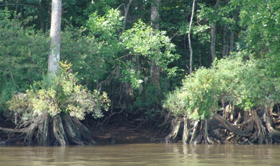
We continued along, admiring the new
landscape. The cypress trees create have interesting exposed roots that sink
into the water at the river’s edge. We notice too that the water is beginning
to take on a different color, much like coffee or tea, which is said to come
from the tannin of the cypress trees. It is said that your boat will acquire a
tea colored mustache from traversing these waters. We pass several large
plantation style homes and large plains that look like rice fields. We see many
manmade straight canals jutting out from the ICW that were in days past used for
the harvesting and transporting of the indigo, rice and logging that made this
area grand.
We pass the canal that leads to Brookgreen Gardens plantation home. I would love to have had time to go see that. The only part of the plantation building structure that remains now is the kitchen and the walled off creek landing. The remnants of the old gardens are still there with their large oaks and boxwood hedges.
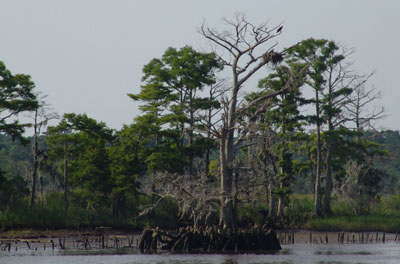
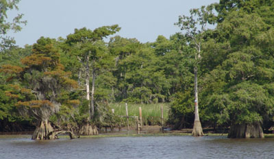
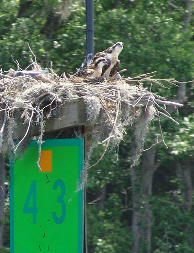
Many of these huge moss covered cypresses, with
their gnarled exposed roots anchoring these structures in the mud, have huge
nests cradled in the top limbs. Many of the birds resemble eagles but are more
likely osprey.
As we enter deeper and deeper into this wilderness area, we come across various isolated marinas for boaters making this trip up the ICW. They usually consist of a fuel dock and a restaurant. This area is filled with picturesque creeks and areas to anchor and explore but we did not have time this trip.
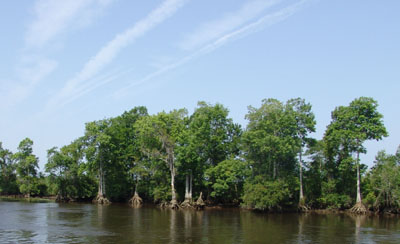
As we near the Bucksport area at mile 370 we
are warned to watch for flotsam or debris in the water. It can be bundles
of twigs or big dead heads. We saw plenty. This was a lush area, no
more views out into endless plains of salt marsh we were forested in on each
side. Bucksport used to be a timbering area in the old days. They
would ship out huge quantities of pine and cypress to Bucksport, Maine to the
shipbuilding yards.
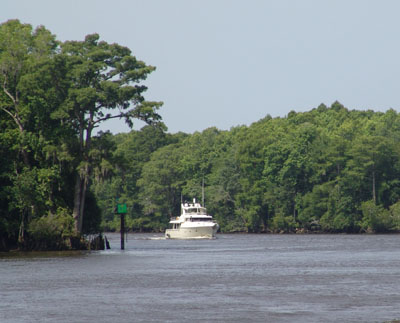
As we pass a few of these marinas, mostly designed for boats 30 feet in length or less, we now start to new something new on the ICW, water skiers and little flat funny looking river boats with awnings that go up and down much like on a convertible car.
We are still watching for floating logs and tree stumps but have been lucky so far.
THE ROCK PILE
26 Miles south of Little River is a stretch of
the ICW that is known as the Pine Island Cut or The Rock Pile. It’s not marked
on the charts but everyone knows about it. The cruising guide calls this “the
most worrisome segment of the whole ICW trip”! It’s a stretch that has been cut
by man and the sides are high and in a constant state of erosion which creates
lots of dangerous debris that falls into the channel making it difficult and
dangerous for boaters coming through this area. You
are advised to stay mid channel if at all possible at all times and monitor the
radio for any opposing traffic. One section is even more dangerous as it cuts
through solid rock and the sides are ragged and unforgiving unlike the soft muck
we’ve been used to.
LITTLE RIVER
Little River was our destination of choice today because it put us at a good location for the next leg that would take us out to sea to Cape Fear. Little River is located directly at the Little River Inlet right on the border of North and South Carolina. The Inlet is supposed to be dredged regularly and is one of few inlet that is safe in this neck of the country. The ICW north of here has a bad reputation for being shallow and dangerous and with our drafts Ocean Bear and Knotty Dog (6 feet from the waterline) we felt it necessary to go out to the ocean again and we both were looking forward to it. We stayed two days in Little River to rest and get ready for the next leg. I didn’t see much of Little River except the boat and the dock as I accidentally flipped my big kitchen butcher knife and it did a nose dive right into my foot and nothing stopped it but the two bones between my big and second toe. I was unable to walk for the next two days.
It was a busy thoroughfare where we were docked right on the ICW. Boats were constantly going by in both directions. Many would forget to go slow and would create wakes. Now I understand the importance of those No Wake Zones. My highlight of the stay was getting up early one morning as the sun rose and seeing a small crab boat going by checking his traps. He must have left so early that his small son was still asleep on the bow of the boat. NOW ON TO BALD HEAD
|
 We
left this morning at a reasonable time coming out of Sampit River and heading
north up Waccamaw River. The scenery is suddenly much different than what we
had been used to for the last many miles of the journey. We begin to see large
cypress trees lining the shores.
We
left this morning at a reasonable time coming out of Sampit River and heading
north up Waccamaw River. The scenery is suddenly much different than what we
had been used to for the last many miles of the journey. We begin to see large
cypress trees lining the shores. 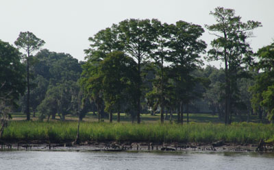
 As we continue on, it’s just past noon as we
approach the Socastee Swing Bridge. It’s a small swing bridge with a vertical
clearance of 11 feet so we will need an opening and it only opens 15 minutes and
45 minutes past the hour. We call ahead to let the bridge know we’re almost
going to make it in time for his opening. He answers in his southern drawl,
“Keep a comin’ Cap’n, I’ll hole ‘er op ‘n fer ya”. We put on a little
speed and he did hold it for us. We gave him a big wave and thanked him for
holding it for us on the radio as we went through.
As we continue on, it’s just past noon as we
approach the Socastee Swing Bridge. It’s a small swing bridge with a vertical
clearance of 11 feet so we will need an opening and it only opens 15 minutes and
45 minutes past the hour. We call ahead to let the bridge know we’re almost
going to make it in time for his opening. He answers in his southern drawl,
“Keep a comin’ Cap’n, I’ll hole ‘er op ‘n fer ya”. We put on a little
speed and he did hold it for us. We gave him a big wave and thanked him for
holding it for us on the radio as we went through. 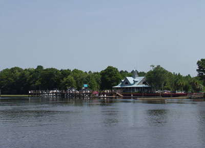 As we get closer to Little River Area it is
becoming more populated and we have to watch our wakes. Many little cottages
have the typical docks and some have their little day boats raised above the
water. We pass many docks decorated with comical corny chotsky most making jest
at trying to get you to slow down and create a non wake zone. We begin to pass
golf courses and all sorts of development. They’ve really over developed this
area, so much so that the edges of the banks are eroding. We even saw a gondola
or overhead tramway carrying golfers from one side of the river to the other to
golf. We passed another huge structure that looked like something from outer
space. Larry said he thought it was something like a waypoint navigation system
for airplanes but wasn’t sure. It was a huge round disc thing and very strange.
As we get closer to Little River Area it is
becoming more populated and we have to watch our wakes. Many little cottages
have the typical docks and some have their little day boats raised above the
water. We pass many docks decorated with comical corny chotsky most making jest
at trying to get you to slow down and create a non wake zone. We begin to pass
golf courses and all sorts of development. They’ve really over developed this
area, so much so that the edges of the banks are eroding. We even saw a gondola
or overhead tramway carrying golfers from one side of the river to the other to
golf. We passed another huge structure that looked like something from outer
space. Larry said he thought it was something like a waypoint navigation system
for airplanes but wasn’t sure. It was a huge round disc thing and very strange.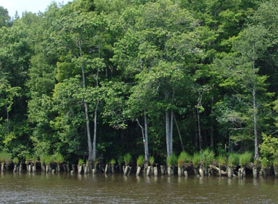
 We had no problems going through The
Rock PIle except for trying to pass one small sailboat that was going way to
slow to stay in the center of the channel and did not answer their as we heard
boaters ahead and behind trying to hail them to move over or to notify them of
their intent to pass. As we made our pass, we noticed they were from France and
maybe that’s why we had no answer.
We had no problems going through The
Rock PIle except for trying to pass one small sailboat that was going way to
slow to stay in the center of the channel and did not answer their as we heard
boaters ahead and behind trying to hail them to move over or to notify them of
their intent to pass. As we made our pass, we noticed they were from France and
maybe that’s why we had no answer.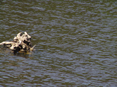
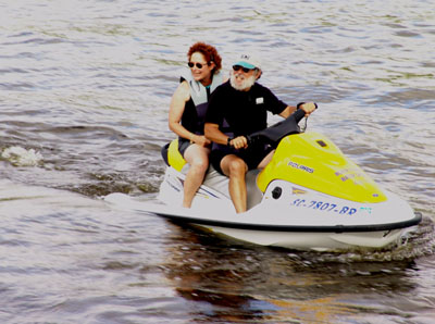 Joanna and Steve made the most of it and
decided to rent a jet ski and explored the area. They looked great on the jet
ski and said they had a good time. Joann graciously invited us to a home cooked
meal on their boat because of my infirmity which was greatly appreciated.
Joanna and Steve made the most of it and
decided to rent a jet ski and explored the area. They looked great on the jet
ski and said they had a good time. Joann graciously invited us to a home cooked
meal on their boat because of my infirmity which was greatly appreciated.