|
|
|||||||||||||||||||||||||||
The Last 100 miles ( Coinjock & Atlantic Yacht Basin)
We left early that morning, at 7:30 as we had a long day ahead to Coinjock. It was Ocean Bear’s turn to lead so they left before us and headed out the channel. We followed out into the Pungo River from Bellhaven and by 8:30 we were headed into the narrow channel the makes the land cut of the ICW into Alligator River/Pungo River Canal. At the entrance to this cut the markers again switched to green on the right!
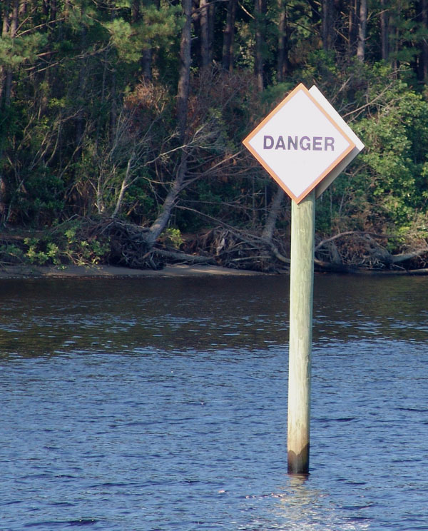
It is advisable for all boaters during this stretch to monitor the radio for any tugs or even pleasure boats as this stretch is famous for floating or submerged debris. By listening to the radio you can get a heads up on dangerous obstacles before it’s too late.
That was the case today. We heard boaters warning each other about a small
submerged dead head, barely visible, but huge under the water and dangerously in
the middle of the channel. It would be a deadly blow for some of those small
fast power boats that were racing down the straight.
At one point on the stretch, in the distance a head, we could see two boats coming straight at us. The canal is barely wide enough for two boats to pass. We assumed one was trying to pass the other. We noticed by the large wakes behind them that they were both going a good pace. We became more and more anxious as it became clear that one of the boats wasn’t really passing but that they both were racing each other. We were getting ready to hail them on the radio as they were getting closer and we began to wonder if they even knew we were there. It was like two kids drag racing. Finally at the last minute the boat on the opposing lane pulled behind the other just as they both raced by leaving huge wakes that we road up and down like a roller coaster. They waved as they went by as if nothing was unusual.
About midway through the stretch we passed Fairfield Canal. This canal is an offshoot to Lake Mattamuskeet Wildlife Refuge. This area is popular to bird watchers as this is a stop off point for the migratory birds between March and November. Huge flocks of them stop here on their journey. Of course, it is also popular to hunters as this is big birding country as evidenced by the many duck blinds we see along the way. ALLIGATOR RIVER Double Click small photos to enlarge
We finally left the narrow cut and dumped into the wide Alligator River. It was a wide stretch but not deep so we very carefully kept within our course and followed the markers. There were a couple of doglegged turns that were supposedly marked by quick flashing lights according to the cruising guide but we did not see them. I was amazed that we still had names like Alligator River and Cypress Swamp. It definitely looked swampy on these shore lines. Are there really alligators here? Guess so. We saw so many duck blinds now, some built out quite a ways in the water. They seemed so silly to me. I really couldn’t imagine someone uncomfortable crouched inside indefinitely waiting until a flock birds would fly by so they could take a pot shot. Maybe they don’t mind crouching there as the area is remote and so beautiful. In fact this whole trip through North Carolina is worth coming back to. It would be fun to spend more time exploring this wilderness and observing the abundance of wildlife. There are remote forgotten areas to explore like Buffalo City, just five miles up stream from the ICW. It was written to have “a turning basin and decaying old town wharf, no longer useful as the town was wiped out by cholera years ago.” Interesting off the beaten path places, like ghost towns in the west, worth searching out for tales of the past.
About
mid way up the Alligator River is the Alligator River Bridge. We were lucky
today as the winds were minimal. If the winds are stronger than 35 knots, the
bridge tender may not open the bridge. So you had better have an alternate plan
to take shelter in case this happens. This is the last bit of protected stretch
before we cross the Abermarle Sound which opens again to the Outer Banks. It’s
an area that again can be hazardous depending on the conditions as there is no
protection from the winds from the Outer Banks.
As we leave Alligator River and head across Abermarle Sound, we read confusing instructions in the guide:
“the entrance to Alligator River has been remarked with a series of four green, lighted markers: “AR 1”, “3”, “5” and “7”. New day beacon “6” is just north of the shoal (the old “6” was lighted) and the red mark at the shoal is now quick flashing ”8” The white danger beacon is still in place on the shoal. New red “10” (fl. 2.5 sec) is where the chart shows a six-second light, and a four-second red “12” is where “10” used to be”. Goood grief! I just put a question mark in the book and ignored all that. We did just fine.
We crossed Abermarle Sound keeping close watch on our course though we had safe depths on each side. About 30 miles off to our right were the Outer Banks, Kitty Hawk, and places like Kill Devil Hills. Maybe we’ll come back some day and explore the Outer Banks. Somehow we hated to pass them by. We wondered what they would be like. There is so much to see here. In the opposite direction just to our North East is where the Dismal Swamp dumps into the sound. DISMAL SWAMP
I would love to see it for it’s scenery and history. On the border between Virginia and North Carolina is the Halfway House Hotel which was famous in the early 1800’s for a place to be married, dueling and provided a haven for the unlawful. Edgar Allen Poe stayed there while he wrote “The Raven” according to the cruising guide. Jane Adam’s Floating Theatre followed this route and was the inspiration for “Showboat”. It just sounds like a lot of fun and another unique experience. Well, someday maybe but today we’re headed for Coinjock up the ICW on the Virginia Cut. VIRGINIA CUT
We left the Abermarle Sound and images of what the Dismal Swamp must be like
and entered the Virginia Cut. We finally entered into the protected waters of
North Carolina Cut nearing our destination for the day.
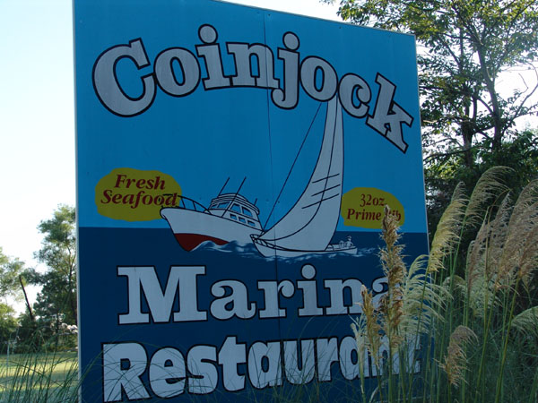
We were anxious to get to Coinjock as the write up about it’s restaurant was a draw. The guys especially kept talking about their famous 32 ounce steak that they were going to order that evening. I on the other hand was getting anxious as it said to check the current before tying up at Coinjock. It advised checking the strength of the current as you pass under a nearby bridge and see how the water travels around the pilings. It also warns to check the current before untying at the dock as you leave too. The currents in the stretch are all wind driven and as we had perfect weather conditions the whole day we tied up safely with no problems.
COINJOCK
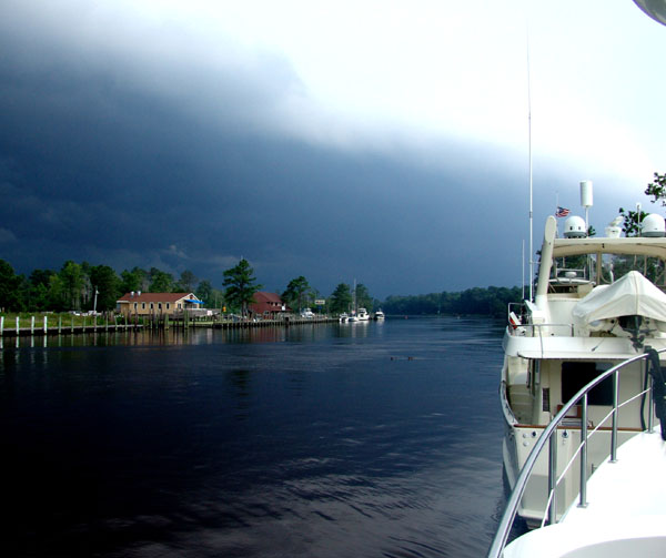
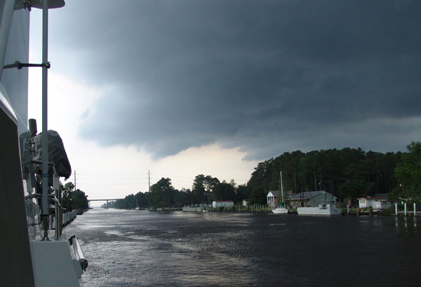
It wasn’t long before our perfect weather turned and the winds picked up and the sky got dark and black. A huge ferocious squall came through filled with 30 + knot winds, lightening and crackling thunder and a downpour that came in buckets. I guess we were just lucky we got there when we did. We ran to the restaurant through the downpour and got ourselves a nice cozy booth. The restaurant was packed with not just boaters but people from the surrounding area. It was true they did have a 32 ounce steak and we saw people ordering it and the steaks were so large they were bigger than their plates. I guess we chickened out and ordered something sensible. We had another great evening with Joann and Steve as we watched the storm outside. We were cozy and safe.
COINJOCK TO AYB
We left the next morning about 9:00. I took Knotty Dog off the dock for the first time. We had no current and it was easy. Ocean Bear followed right behind. It was our turn to lead today, our last day together. We entered Coinjock Bay and again we were lucky with the weather and winds as we had none of the problems that some can have coming through this stretch. Currituck Sound is unique in that it has what they call “picket fence markers”. The sound opens up into a wide open area. The dredged channel is lined and protected by a long row of submerged pilings. You are advised to give them a wide berth as a wind coming down on your beam can suddenly without warning push on to them. It was a long and monotonous channel. We had to keep checking our stern to make sure we weren’t edging off onto the piles. It was about five miles of this. We were also amazed to see the shoreline heavily settled with cottages and the surrounding waters were filled, absolutely filled, with crab pots. We watched the crabbers as they worked the sound moving back and forth over the water, careful to keep their track so they would not to miss any of their pots. Double Click small photos to enlarge
We finally crossed this stretch and entered a land cut again. It was the North Land River. It was about 11:30. We meandered our way up the snaking river. We were traveling a few knots faster than Ocean Bear and without knowing it had gained a bit in distance and they were out of sight. As we approached North Landing Swing Bridge we realized that we would arrive in time to make their scheduled opening at 12:00 but Ocean Bear was too far behind so they would have to catch the 12:30 opening. We thanked the bridge tender and loved to hear his Virginia accent as he asked where our home port was. As we headed up the river we noticed several off shoots, the cruising guide calls them “side sloughs” and “bypassed bends of the river”. They were as wide as the channel we were traveling and would sometimes loop immediately back into the channel. They were eerie as we noticed that they were filled with sunken ships. It was strange to see the decaying remnants of these boats just barely sticking out of the water, just enough to make you wonder. We thought that perhaps they were boats that had seeked shelter here from the many hurricanes that threaten the area and they were unlucky and never made it out. We found out later that they were just a dumping ground for old wrecks. FINAL DESTINATION, GREAT BRIDGE It wasn’t long before we saw Great Bridge ahead of us and this meant we were at the end of this leg of our journey as the Atlantic Yacht Basin is just south of Great Bridge. Great Bridge is just south of The Great Bridge lock, the one and only lock on the ICW. The lock is on mile marker 11.3 from the official start of the ICW. This lock separates the ICW from fresh water to salt water and makes the Atlantic Yacht Basin a great place to store or winter the boat as it sets in fresh water and is very protected.
We hailed the yard and they gave us our docking location which was on their
outer dock that lined the ICW. We tied Knotty Dog up and just as we were
doing our final tie ups, Ocean Bear came in and docked in front of us. We
both had completed this leg of our journey together and would now make
arrangements for maintenance items to be taken care of and some n
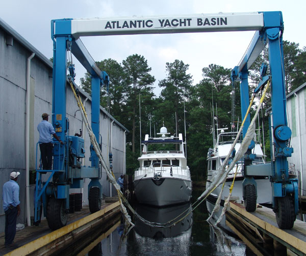
ATLANTIC YACHT BASIN
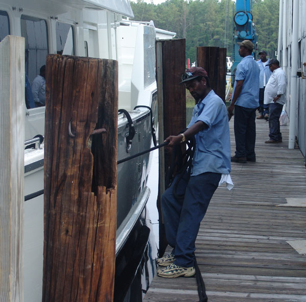
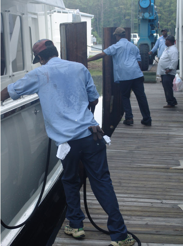
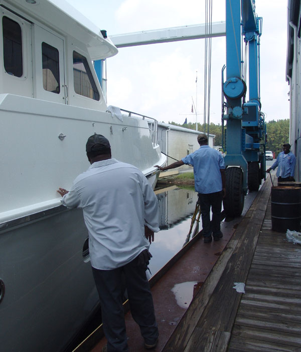
Ocean Bear and Knotty Dog were again hunkered up to a snug dock after a long journey. This time though, we were both waiting for needed attention whether it be routine maintenance or other more urgent issues. We arrived on a Thursday and the manager of the yard was gone on vacation until the following week so neither one of us could get anything significant done on that Friday nor any idea of a schedule for service the following week.
It is a pleasant place to be stuck. We are on the end of the long ICW channel just south of Great Bridge and the locks that separate the ICW from fresh and salt water. Just on the other side of the locks, the ICW has just 12 more short miles until it pours out into the Chesapeake. It was amazing to think that we had traveled 1236 miles up the ICW from Key West, not including the trip from Santa Barbara, CA to reach this stopping point. We actually made it. Who would’ve ever thought? Once we get some rest, repairs and maintenance done, we plan to cruise the rest of the summer in the Chesapeake and then return here to bed Knotty Dog for the winter.
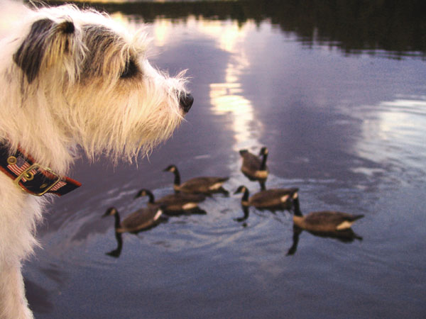
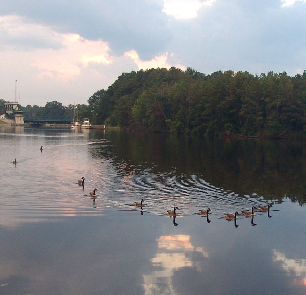
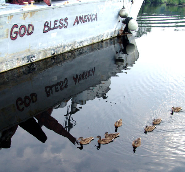
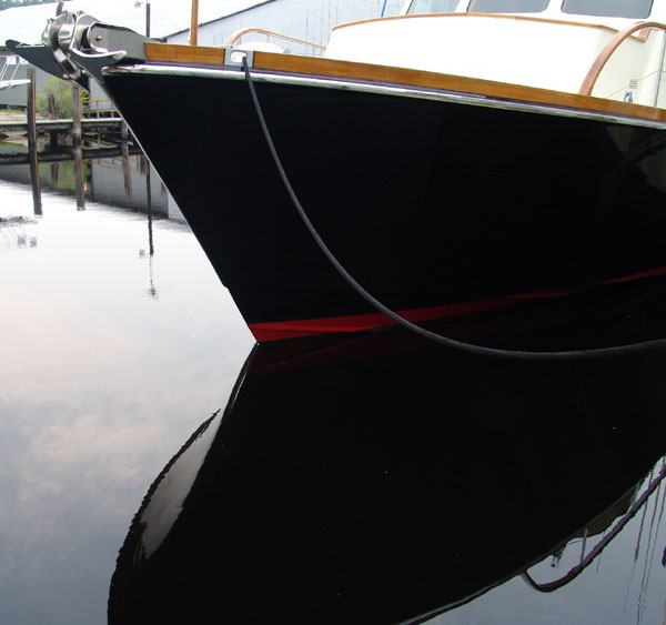
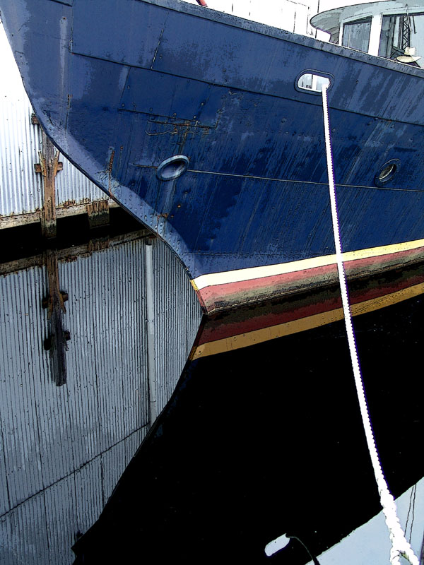
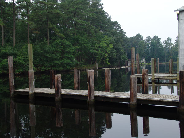
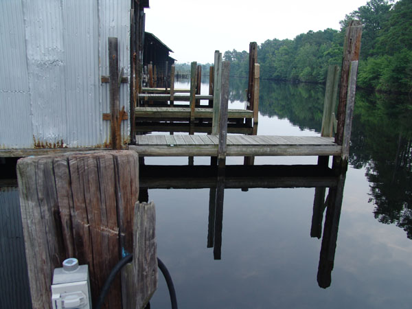
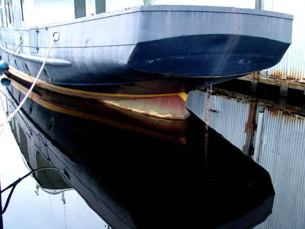
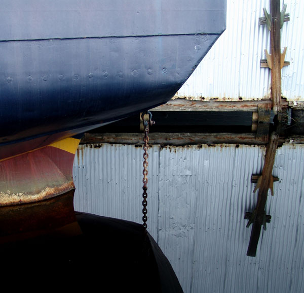
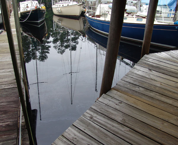
Even though it is an old boat yard, there is something beautiful about the place. The water is black as ink. The brackish waters provided mysterious perfect reflections. Every day at dusk, the ducks, like clockwork swim down the channel stopping at each boat looking for some handouts. Their parade usually occurred before or just after the afternoon downpour. Every hour on the hour, the Great Bridge would open and it was a constant changing landscape as boats made their way up and down the channel going to destinations unknown. Other than that it was a peaceful, pleasant place to be stuck.
Double Click small photos to enlarge
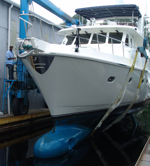
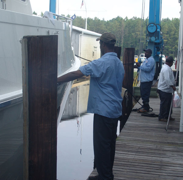
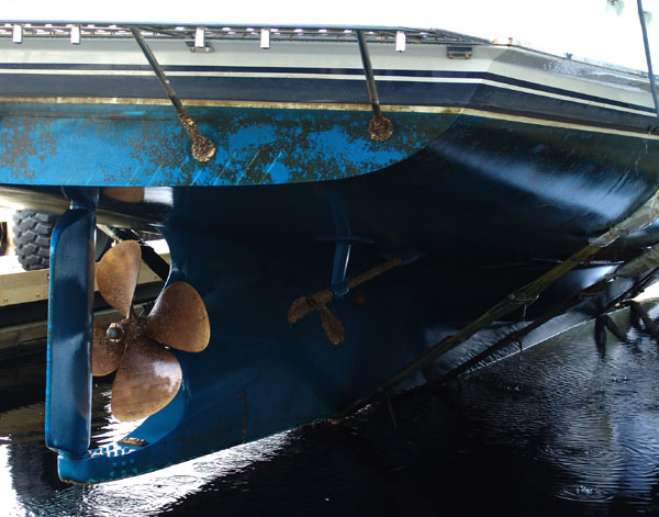
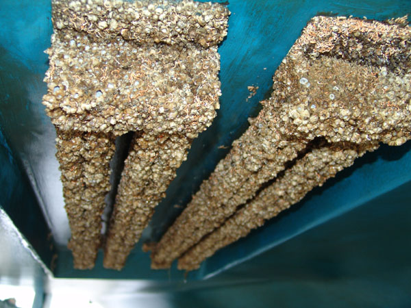
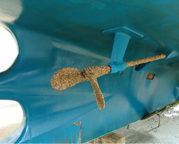
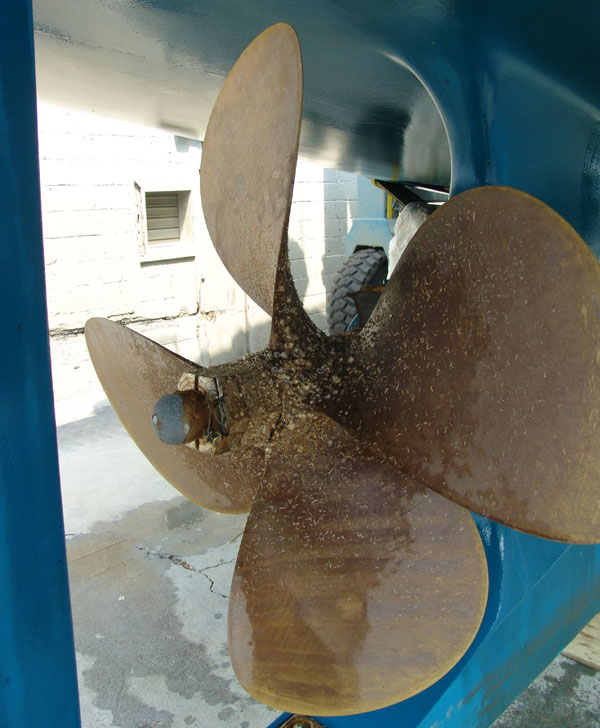
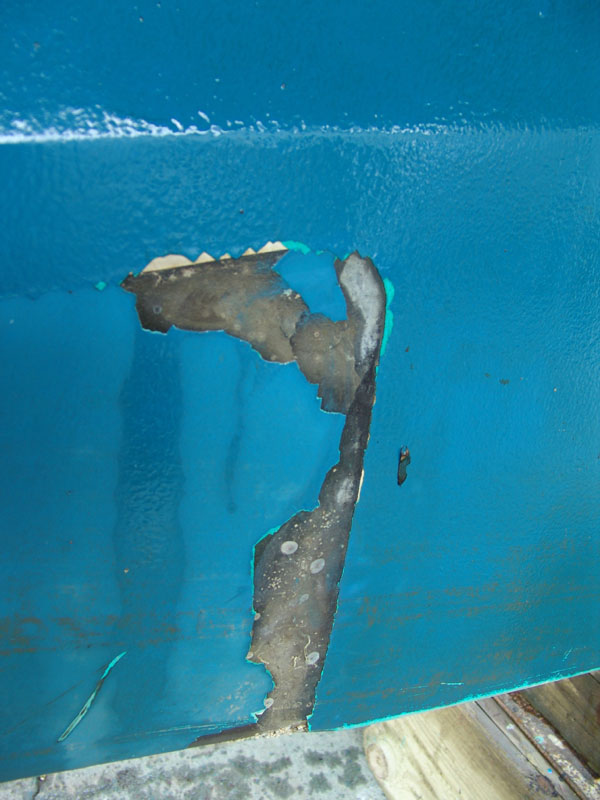
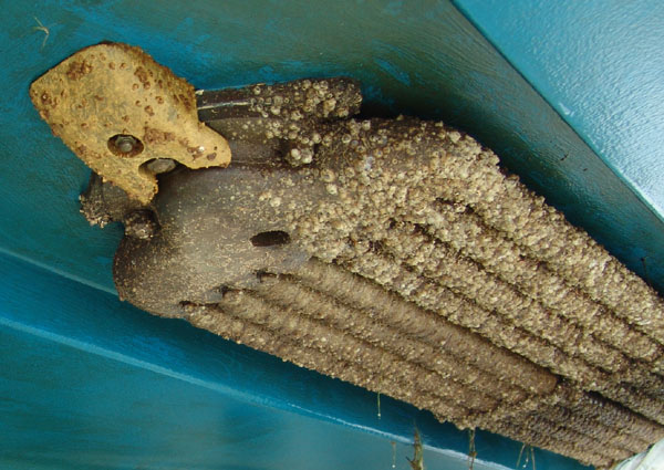
We all took advantage of this time to get our fix at the nearby mall. None of us had been able to go shopping for about 6 weeks and actually, much longer for Larry and I considering the whole trip we’d been on since January. We rented a car and made numerous trips to the mall for the silliest of excuses. They mostly consisted of trips to Target, Starbucks, Office Depot and lots of chain restaurants. Actually this place, like all other metropolis areas, is filled with the same chain stores and eateries that are so familiar to us no matter where we live. We could very well have been in any city as they all look the same. We must have tried every restaurant around the mall area. We dragged Joann and Steve to several dinners at different Mexican restaurants, none of which were any good. We were so homesick for Mexican food it was terrible. We kept telling them that this is really not what Mexican food was all about and promised that if they came for a visit to California we’d show them some good Mexican food. I can’t believe how silly I got when I saw several Drive-In Fast food joints with service to your car like in the old days. Some even brought the food on roller skates! It was like the movie American Graffiti all over again. I couldn’t wait until we could try one out. It was called Sonic. My first disappointment was when they brought the food as there was no tray to set the food on by hanging it on the window outside the like in the old days. To our surprise, the waitress just immediately handed everything in to us as fast as she could. We were scrambling to keep up with her as we tried to find places to perch our drinks and food in this unfamiliar rental car. Nothing came with ketchup, mustard or salt either. She said that all those items had to be ordered specifically when you placed your order on the push button intercom. I guess we looked shocked and so she begrudgingly said she’d make an extra trip and bring us what we needed. She returned with the condiments and straws when she brought the credit card slip to sign which by then, we had eaten everything. I was amazed that we could even pay by credit card. Guess I’ve been on the boat too long. Another big thing that we noticed around here is ice cream is everywhere. There are a million ice cream stores and everyone is either at the ice cream parlor or the fast food drive in. People don’t seem to worry about getting fat around here. It didn’t matter how fat the people are, they were still out eating ice cream and we did it too. The temptation was too strong and you could eat without guilt because everyone else was doing it. It was great! Everything was fried, deep fried, or going to be fried. There was no healthy food to be found. We took advantage of it much to our dismay a few weeks later as the pounds piled on! Monday rolled around before we knew it and all was business again. Ocean Bear was hauled out and got new paint on the bottom plus attention to several maintenance issues such as the bow thrusters that caused them problems at the dock in Beaufort, SC and their satellite TV. We got the Knotty Dog hauled out too to see what condition the bottom was in. We were anxious to see if there was any damage after we went aground in Honduras. The bottom looked pretty good but the warm waters of the Caribbean provided a good breeding ground for the barnacles as they were overtaking the boat. The crew at AYB put her up on the rack and for three days scraped and scraped until they finally got the barnacles off. Once they were satisfied, they did a little touch up paint on a few areas that needed it on the bottom. We were happy to find no damage from going aground which was good and reconfirmed again what a solid safe boat this is. We stayed in the boat while she was hauled and high up in the air on the rack which was quite an experience. Larry managed to get the water hose hooked up so we could have running water and air conditioning. We put a tall ladder up to the swim step and hiked up and down that ladder to get in and out of the boat. It was a weird place to be but worked. We had to leave one of the doors open just wide enough to bring the water hose through to hook up in the engine room and one night when we left for dinner, Ziggy managed to leverage that door open wide enough for him to escape and jump off the boat. We really don’t understand how he jumped off the boat without hurting himself as it must have been 20 feet off the ground. When we returned that night, he was gone. In the pitch dark we started searching the boat yard and Larry finally found him locked up in the customer lounge. The next day, one of the workmen said he saw Zig running around the yard and he put him in there. What a scare that was. After that, everyone in the yard knew who Ziggy was. We were very happy with the service we received at AYB and felt good about our choice to use them for winter storage for Knotty Dog. Once the bottom was dry, they put Knotty Dog in the water and we began to make plans again to leave. Our first stretch would be to finish the last 12 miles of the ICW and then explore the Chesapeake for the summer.
|
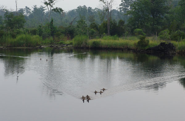
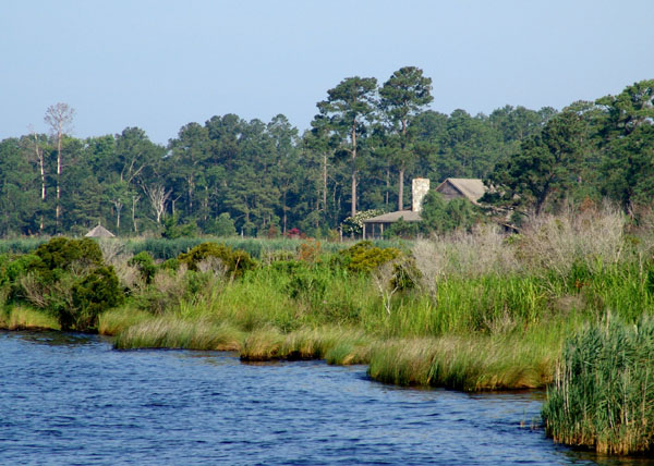
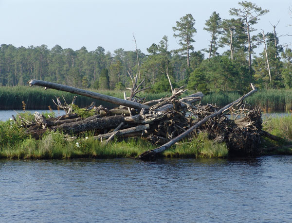
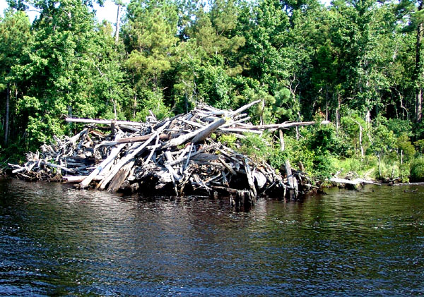
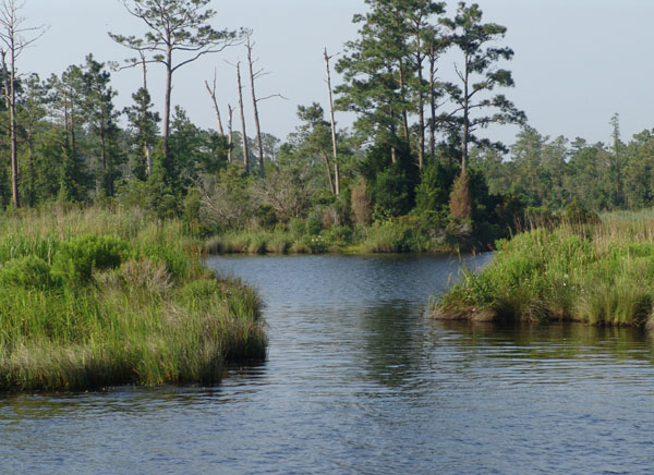
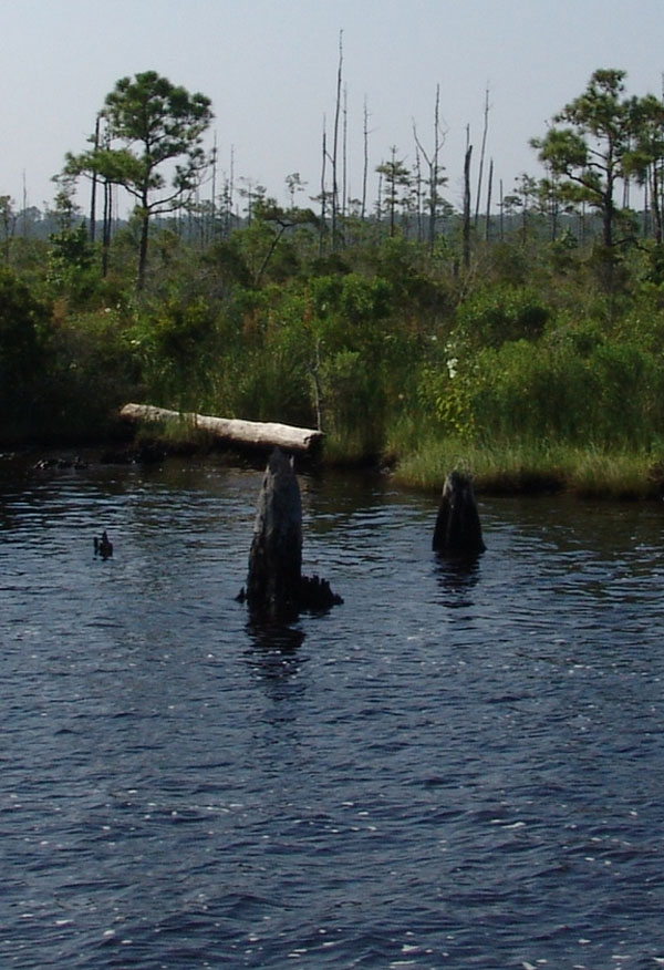
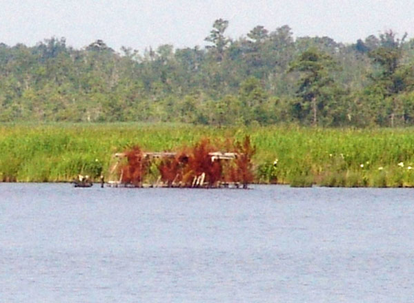
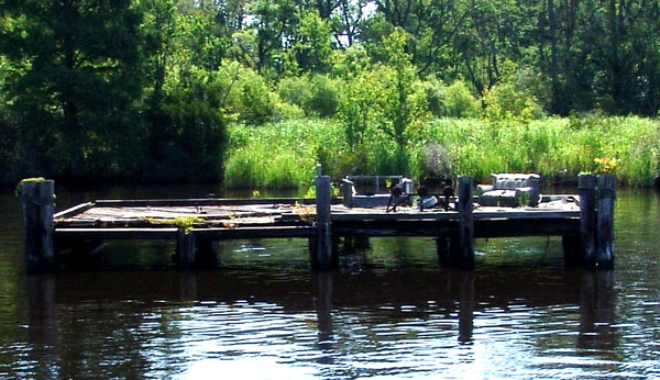
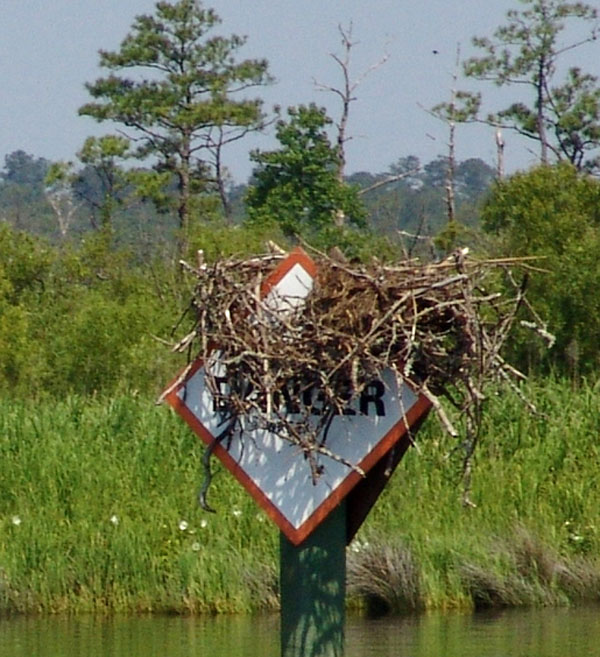
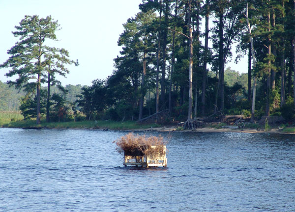 It was beautiful country with marsh lands and trees and large stumps of trees
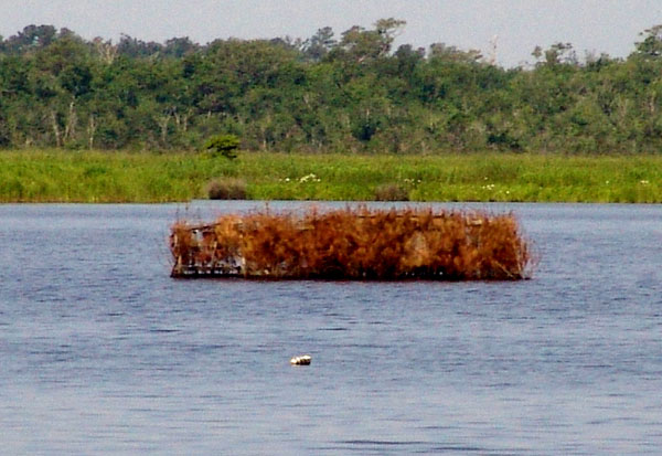
exposed on the shoreline. We began to see strange structures in the water.
They were boxes on platforms made of wooden slats and then covered with dead
branches that were strapped to the slats. We finally figured out that they were
duck blinds. They were everywhere. As I mentioned in Bellhaven it was the
start of seeing ducks on this journey. We were now in duck hunting country.
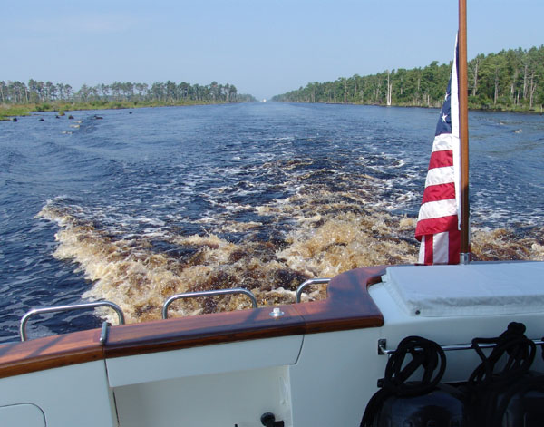
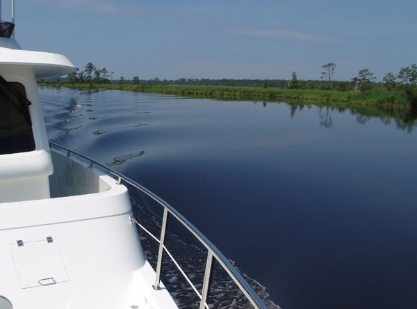
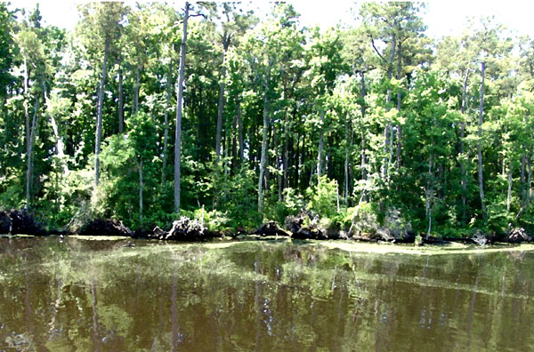
Most of the leg of this day was some 25+ miles through a narrow man-made
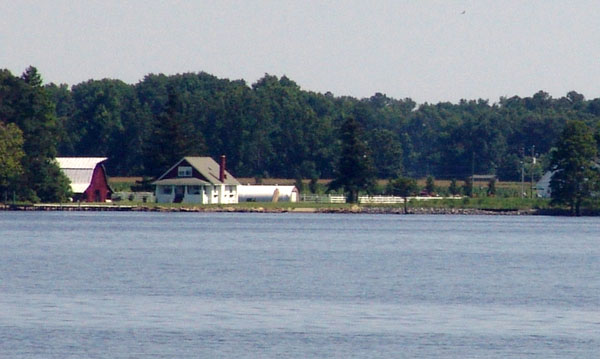
straight cut. It was beautiful though and isolated. Occasionally we’d pass a
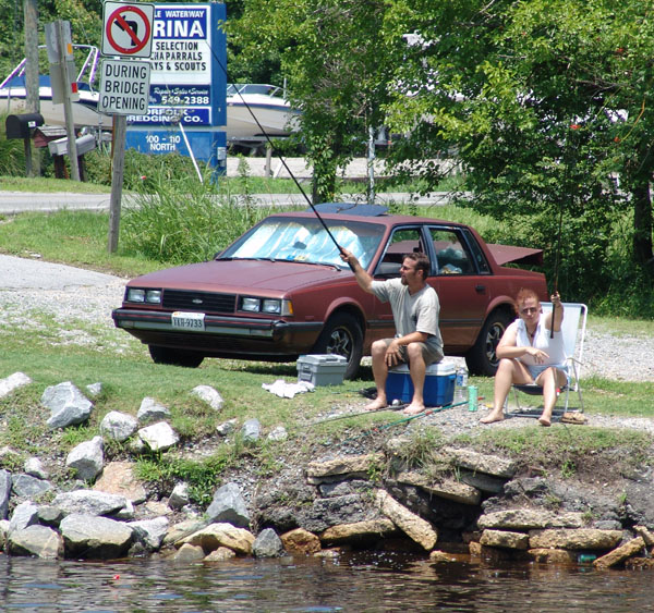
house lodged in the foliage or see a sign for a marina or prop repair and tow
service. The water was black and inky and the wake behind us was not the white
waves we normally make but a brownish, tea like wake.
It was beautiful country with marsh lands and trees and large stumps of trees
exposed on the shoreline. We began to see strange structures in the water.
They were boxes on platforms made of wooden slats and then covered with dead
branches that were strapped to the slats. We finally figured out that they were
duck blinds. They were everywhere. As I mentioned in Bellhaven it was the
start of seeing ducks on this journey. We were now in duck hunting country.
Most of the leg of this day was some 25+ miles through a narrow man-made
straight cut. It was beautiful though and isolated. Occasionally we’d pass a
house lodged in the foliage or see a sign for a marina or prop repair and tow
service. The water was black and inky and the wake behind us was not the white
waves we normally make but a brownish, tea like wake.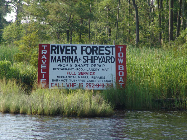
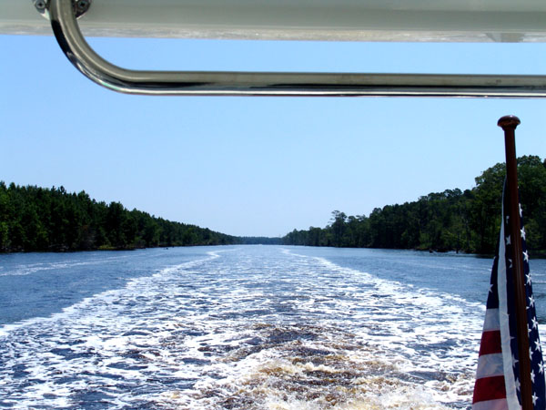
 Midway
up the narrow channel we heard a lot of boat chatter on a radio station that
both Ocean Bear and Knotty Dog we using to talk to each other. It sounded like
several boats traveling together talking back and forth. One boat was the lead
boat and seemed to be giving instructions to the others on how to follow him and
what to do. It become annoying after awhile because it was non stop, so at one
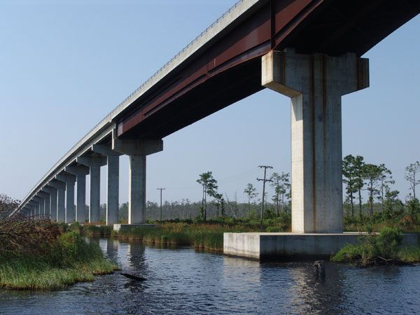
point we decided to switch to another channel that had less traffic. I was
taking some pictures of a bridge we just went under and happened to notice a
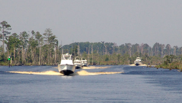
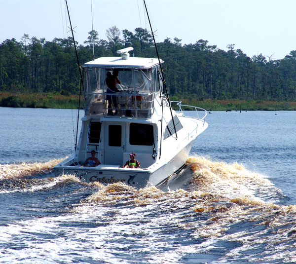
boat behind us in the distance. Soon, I could make out two boats behind us.
They were probably 1/3 mile and gaining on us. As they got within a ¼ mile of
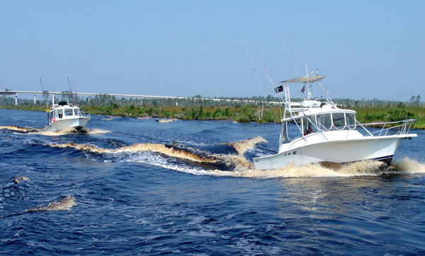
I could see it was several boats, racing this way, much faster than we were
going. We called ahead to warn Ocean Bear and to prepare for a serious of wakes
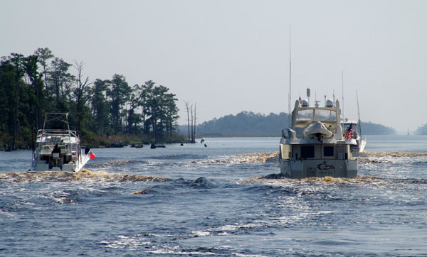
when they go by. We all prepared for the passing. They didn’t slow down, but
just raced past, one right after the other. Not only were they rocking our
boats wildly but they were creating damaging wakes to the sides of the narrow
channel. These boaters are very inconsiderate and create serious damage to the
banks, eroding them away and loosening debris that’s becomes a hazard and
sometimes submerged danger to boaters. They were oblivious to us and
everything else as they went by. We realized that these were the boaters that
were on the same channel that we were on before. We
decided to go back and monitor their channel again since they were ahead of us.
They surely would report on anything to each other that we might want to know
about. Sure enough it wasn’t long before we heard them being warned by another
boater of a huge submerged log.
Midway
up the narrow channel we heard a lot of boat chatter on a radio station that
both Ocean Bear and Knotty Dog we using to talk to each other. It sounded like
several boats traveling together talking back and forth. One boat was the lead
boat and seemed to be giving instructions to the others on how to follow him and
what to do. It become annoying after awhile because it was non stop, so at one
point we decided to switch to another channel that had less traffic. I was
taking some pictures of a bridge we just went under and happened to notice a
boat behind us in the distance. Soon, I could make out two boats behind us.
They were probably 1/3 mile and gaining on us. As they got within a ¼ mile of
I could see it was several boats, racing this way, much faster than we were
going. We called ahead to warn Ocean Bear and to prepare for a serious of wakes
when they go by. We all prepared for the passing. They didn’t slow down, but
just raced past, one right after the other. Not only were they rocking our
boats wildly but they were creating damaging wakes to the sides of the narrow
channel. These boaters are very inconsiderate and create serious damage to the
banks, eroding them away and loosening debris that’s becomes a hazard and
sometimes submerged danger to boaters. They were oblivious to us and
everything else as they went by. We realized that these were the boaters that
were on the same channel that we were on before. We
decided to go back and monitor their channel again since they were ahead of us.
They surely would report on anything to each other that we might want to know
about. Sure enough it wasn’t long before we heard them being warned by another
boater of a huge submerged log. 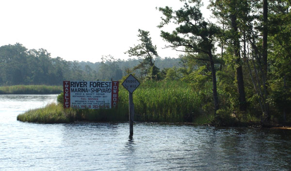
 Someday it would be fun to come back with a different boat that is shallower
and smaller and explore the 82 miles of the Dismal Swamp. We of course had to
take what they call the Virginia Cut on the ICW north which is supposed to be
dredge by the Corps of Engineers to 12 feet and as we have all learned that is
not always the case. The Dismal Swamp on the other hand is a shallow 6 feet and
at times of low water even shallower. The Dismal Swamp starts at Mile 7 of
the ICW up near Norfolk area and ends at this point where we are today. The
construction was started in 1793 of which George Washington was part of the
conceptual planning. The canal took 12 long years of slave labor to complete.
It was a valuable asset in colonial times for shipping. It even became a
battle stand during the Civil War when the confederates fought the Yankees
preventing them from blowing up a vital section making it unusable. It was
restored and put to use again in the 19th century to move goods back
and forth from Norfolk to inland Virginia and remote areas of North Carolina.
In the 20th century though its commercial importance withered and it
became neglected. Now it is used only by recreational boaters and the locals
work very hard to keep it open.
Someday it would be fun to come back with a different boat that is shallower
and smaller and explore the 82 miles of the Dismal Swamp. We of course had to
take what they call the Virginia Cut on the ICW north which is supposed to be
dredge by the Corps of Engineers to 12 feet and as we have all learned that is
not always the case. The Dismal Swamp on the other hand is a shallow 6 feet and
at times of low water even shallower. The Dismal Swamp starts at Mile 7 of
the ICW up near Norfolk area and ends at this point where we are today. The
construction was started in 1793 of which George Washington was part of the
conceptual planning. The canal took 12 long years of slave labor to complete.
It was a valuable asset in colonial times for shipping. It even became a
battle stand during the Civil War when the confederates fought the Yankees
preventing them from blowing up a vital section making it unusable. It was
restored and put to use again in the 19th century to move goods back
and forth from Norfolk to inland Virginia and remote areas of North Carolina.
In the 20th century though its commercial importance withered and it
became neglected. Now it is used only by recreational boaters and the locals
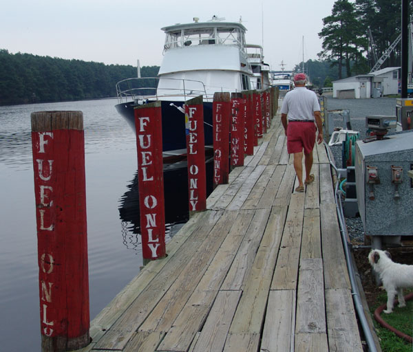
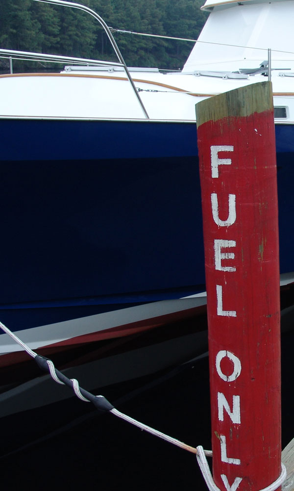
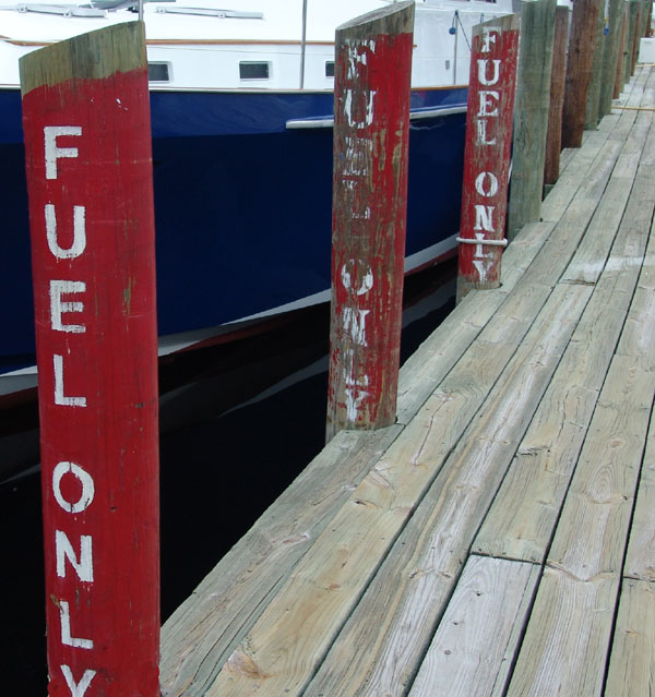
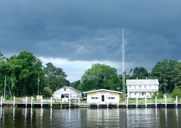
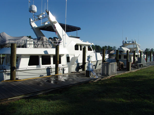
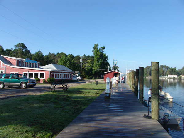
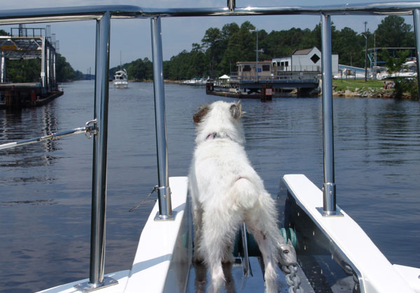
work very hard to keep it open.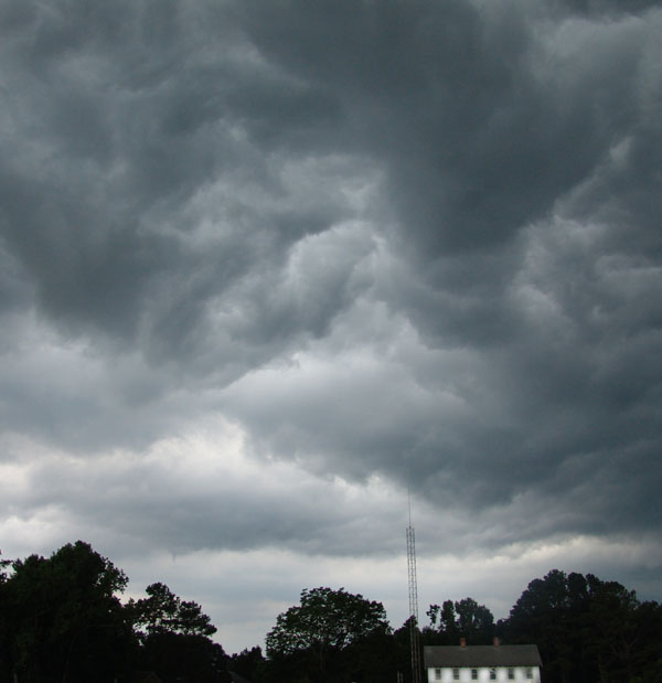 Coinjock was named by the Indians for the local berries. It was a funny
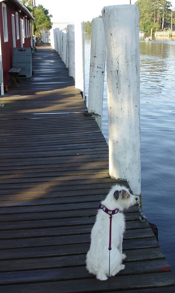
place. There were two long docks on each side of the cut. You tied up on the
side and there was nothing more there than a restaurant, fuel dock and a small
marina store. The docks were old and wooden. The buildings were old and
painted red with white trim and it reminded me of a summer camp. It was late in
the day when we got there. As soon as we got settled we planned to meet in the
restaurant a few yards down the dock for dinner.
Coinjock was named by the Indians for the local berries. It was a funny
place. There were two long docks on each side of the cut. You tied up on the
side and there was nothing more there than a restaurant, fuel dock and a small
marina store. The docks were old and wooden. The buildings were old and
painted red with white trim and it reminded me of a summer camp. It was late in
the day when we got there. As soon as we got settled we planned to meet in the
restaurant a few yards down the dock for dinner.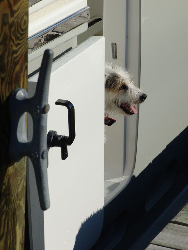 We couldn’t believe that this was our last stop before we reached Atlantic
Yacht Basin and pretty much ends our trip up the ICW. We will stay for a couple
weeks to get some rest and needed work done on the boat. Joann and Steve will
be leaving us at that point heading north to their home port. Our partial
journey was nearing an end and we realized that soon we would be missing these
new friends.
We couldn’t believe that this was our last stop before we reached Atlantic
Yacht Basin and pretty much ends our trip up the ICW. We will stay for a couple
weeks to get some rest and needed work done on the boat. Joann and Steve will
be leaving us at that point heading north to their home port. Our partial
journey was nearing an end and we realized that soon we would be missing these
new friends.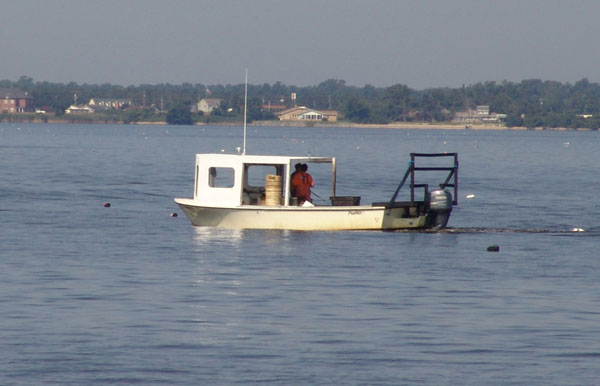
 eeded
rest for us.
eeded
rest for us. 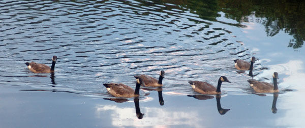 It is quiet and peaceful here and any traffic
that goes by on the ICW goes very slow as it is a strict “no wake zone”. The
view to opposite side of the channel from where we are docked is a lush forest
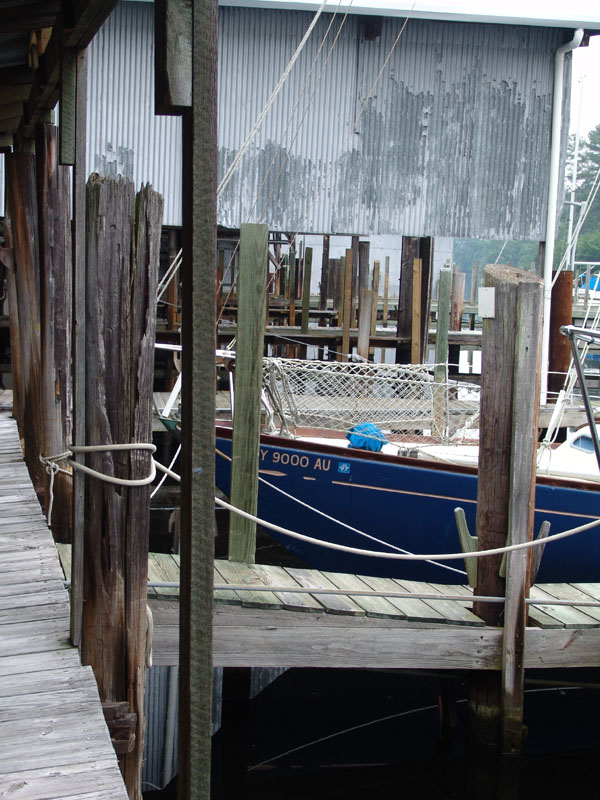
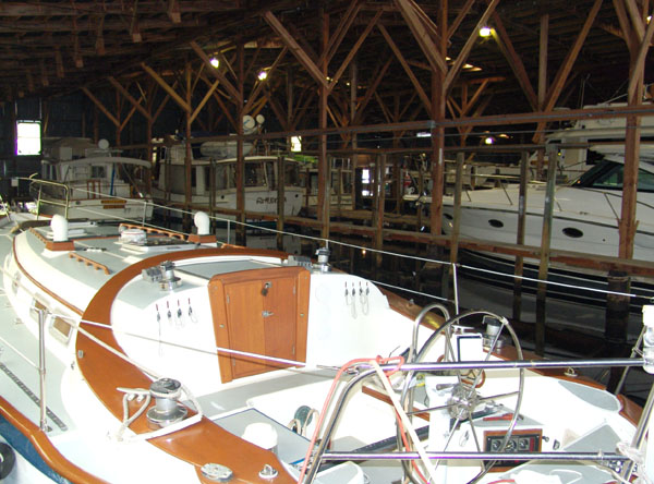
and the other side is surrounded by forest and wet lands. There are several old
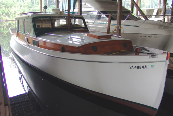
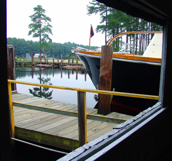
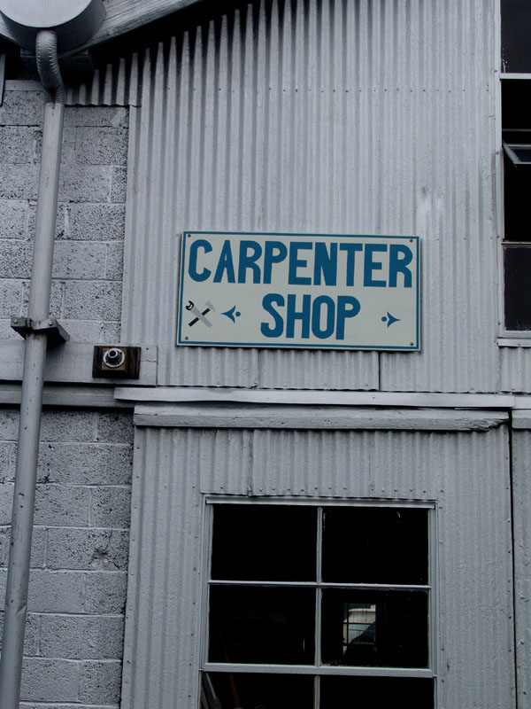
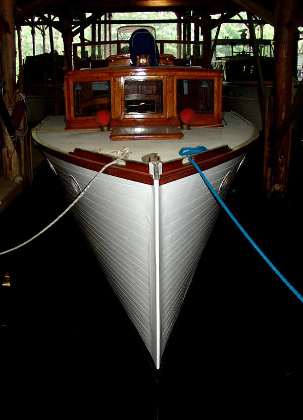
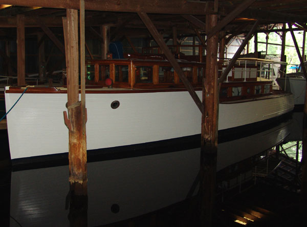
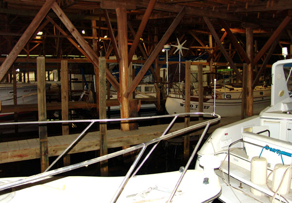
storage warehouses filled with floating boats providing covered protection.
There must be hundreds of boats. Our dock is wooden and old and the center
bowed down a bit with age and use over the years. After all, this place dates
back to 1936. There is plenty of area for Ziggy to run around with no leash as
there really are not many people around at this time to bother about him.
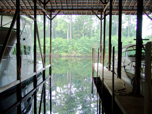
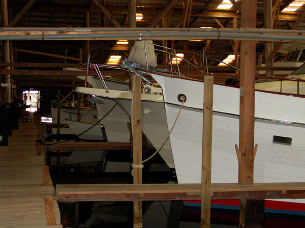
It is quiet and peaceful here and any traffic
that goes by on the ICW goes very slow as it is a strict “no wake zone”. The
view to opposite side of the channel from where we are docked is a lush forest
and the other side is surrounded by forest and wet lands. There are several old
storage warehouses filled with floating boats providing covered protection.
There must be hundreds of boats. Our dock is wooden and old and the center
bowed down a bit with age and use over the years. After all, this place dates
back to 1936. There is plenty of area for Ziggy to run around with no leash as
there really are not many people around at this time to bother about him.